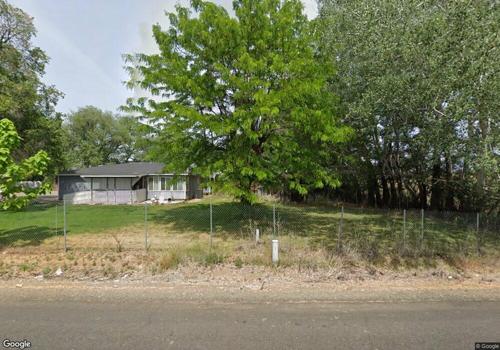
4711 Branch Rd Wapato, WA 98951
Estimated Value: $375,000 - $498,000
3
Beds
2
Baths
1,864
Sq Ft
$226/Sq Ft
Est. Value
About This Home
This home is located at 4711 Branch Rd, Wapato, WA 98951 and is currently estimated at $420,993, approximately $225 per square foot. 4711 Branch Rd is a home located in Yakima County with nearby schools including Camas Elementary School, Adams Elementary School, and Satus Elementary School.
Ownership History
Date
Name
Owned For
Owner Type
Purchase Details
Closed on
Oct 2, 2003
Sold by
Bommersbach Eugene P and Bommersbach Janice J
Bought by
Granberry Christopher D and Granberry Mary M
Current Estimated Value
Home Financials for this Owner
Home Financials are based on the most recent Mortgage that was taken out on this home.
Original Mortgage
$132,850
Outstanding Balance
$62,038
Interest Rate
6.22%
Mortgage Type
Purchase Money Mortgage
Estimated Equity
$358,955
Create a Home Valuation Report for This Property
The Home Valuation Report is an in-depth analysis detailing your home's value as well as a comparison with similar homes in the area
Home Values in the Area
Average Home Value in this Area
Purchase History
| Date | Buyer | Sale Price | Title Company |
|---|---|---|---|
| Granberry Christopher D | $137,000 | Yakima Title Company |
Source: Public Records
Mortgage History
| Date | Status | Borrower | Loan Amount |
|---|---|---|---|
| Open | Granberry Christopher D | $132,850 |
Source: Public Records
Tax History Compared to Growth
Tax History
| Year | Tax Paid | Tax Assessment Tax Assessment Total Assessment is a certain percentage of the fair market value that is determined by local assessors to be the total taxable value of land and additions on the property. | Land | Improvement |
|---|---|---|---|---|
| 2025 | $3,719 | $371,700 | $124,500 | $247,200 |
| 2023 | $2,672 | $248,800 | $74,000 | $174,800 |
| 2022 | $2,407 | $229,500 | $70,900 | $158,600 |
| 2021 | $2,239 | $209,800 | $68,600 | $141,200 |
| 2019 | $1,801 | $159,300 | $60,200 | $99,100 |
| 2018 | $1,831 | $148,800 | $50,500 | $98,300 |
| 2017 | $1,709 | $147,400 | $50,500 | $96,900 |
| 2016 | $1,658 | $146,500 | $50,500 | $96,000 |
| 2015 | $1,658 | $143,400 | $50,500 | $92,900 |
| 2014 | $1,658 | $142,200 | $50,500 | $91,700 |
| 2013 | $1,658 | $142,200 | $50,500 | $91,700 |
Source: Public Records
Map
Nearby Homes
- NKA McDonald Rd
- NKA Knights Lane Campbell Rd
- nka Lateral A Prgrssve Rd Rd
- 1423 Progressive Rd
- NKA Campbell Rd
- NNA Fort Rd Unit Fort Rd/Lateral B Rd
- nka W Rd
- 41 Washington St
- 91 Batali St
- NKA Fort Rd
- 0 McDonald Rd
- 91 W Pioneer St
- 703 S Naches Ave
- 604 W 4th St
- NKA Branch Rd
- 2284 Ashue Rd
- 260 Truck Garden Ln
- NKA Progressive Rd
- 213 W C St
- 115 E Elizabeth St
- 4651 Branch Rd
- 4731 Branch Rd
- 7561 Lateral A Rd
- 7671 Lateral A Rd
- 7491 Lateral A Rd
- 4861 Branch Rd
- 7580 Lateral A Rd
- 7550 Lateral A Rd
- 7462 Lateral A Rd
- 5001 Branch Rd
- 6510 Ashue Rd
- 3981 Branch Rd
- 3961 Branch Rd
- 5760 Ashue Rd
- 5361 Branch Rd
- 5900 Ashue Rd
- 5381 Branch Rd
- 5810 Ashue Rd
- 3841 Branch Rd Unit Lot 1
- 3841 Branch Rd