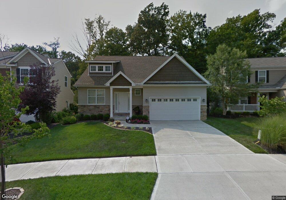
4713 Hassman Ct Cincinnati, OH 45223
Northside NeighborhoodEstimated Value: $384,000 - $420,000
3
Beds
3
Baths
2,264
Sq Ft
$177/Sq Ft
Est. Value
About This Home
This home is located at 4713 Hassman Ct, Cincinnati, OH 45223 and is currently estimated at $400,373, approximately $176 per square foot. 4713 Hassman Ct is a home with nearby schools including Chase Elementary School, Robert A. Taft Information Technology High School, and Western Hills High School.
Ownership History
Date
Name
Owned For
Owner Type
Purchase Details
Closed on
Sep 9, 2010
Sold by
Rockford Woods Development Of Cincinnati
Bought by
Folz Michael H
Current Estimated Value
Home Financials for this Owner
Home Financials are based on the most recent Mortgage that was taken out on this home.
Original Mortgage
$180,000
Outstanding Balance
$127,833
Interest Rate
5.99%
Mortgage Type
Unknown
Estimated Equity
$272,540
Create a Home Valuation Report for This Property
The Home Valuation Report is an in-depth analysis detailing your home's value as well as a comparison with similar homes in the area
Home Values in the Area
Average Home Value in this Area
Purchase History
| Date | Buyer | Sale Price | Title Company |
|---|---|---|---|
| Folz Michael H | $36,000 | Attorney |
Source: Public Records
Mortgage History
| Date | Status | Borrower | Loan Amount |
|---|---|---|---|
| Open | Folz Michael H | $180,000 |
Source: Public Records
Tax History Compared to Growth
Tax History
| Year | Tax Paid | Tax Assessment Tax Assessment Total Assessment is a certain percentage of the fair market value that is determined by local assessors to be the total taxable value of land and additions on the property. | Land | Improvement |
|---|---|---|---|---|
| 2024 | $870 | $119,560 | $14,350 | $105,210 |
| 2023 | $924 | $119,560 | $14,350 | $105,210 |
| 2022 | $856 | $89,093 | $11,939 | $77,154 |
| 2021 | $837 | $89,093 | $11,939 | $77,154 |
| 2020 | $839 | $89,093 | $11,939 | $77,154 |
| 2019 | $1,010 | $85,666 | $11,480 | $74,186 |
| 2018 | $1,011 | $85,666 | $11,480 | $74,186 |
| 2017 | $973 | $85,666 | $11,480 | $74,186 |
| 2016 | $995 | $80,416 | $11,592 | $68,824 |
| 2015 | $889 | $80,416 | $11,592 | $68,824 |
| 2014 | $894 | $80,416 | $11,592 | $68,824 |
| 2013 | $868 | $85,642 | $12,600 | $73,042 |
Source: Public Records
Map
Nearby Homes
- 4706 Hassman Ct
- 4667 Hamilton Ave
- 4571 Janet St
- 4636 Ashtree Dr
- 4568 Hamilton Ave
- 1595 Thompson Heights Ave
- 1723 Monterey Ct
- 4556 Hamilton Ave
- 1542 Glen Parker Ave
- 4574 Kirby Ave
- 5300 Hamilton Ave
- 1645 Glen Parker Ave
- 4688 Kirby Ave
- 1649 Glen Parker Ave
- 4524 Innes Ave
- 1722 Glen Parker Ave
- 4348 Kirby Ave
- 4344 Kirby Ave
- 2088 Raeburn Dr
- 4339 Kirby Ave
- 4715 Hassman Ct
- 4711 Hassman Ct
- 4717 Hassman Ct
- 4709 Hassman Ct
- 4710 Hassman Ct
- 4712 Hassman Ct
- 4719 Hassman Ct
- 4707 Hassman Ct
- 4708 Hassman Ct
- 4721 Hassman Ct
- 4705 Hassman Ct
- 4990 High Hollow Ln
- 4986 High Hollow Ln
- 4723 Hassman Ct
- 4702 Hassman Ct
- 4703 Hassman Ct
- 4989 High Hollow Ln
- 4994 High Hollow Ln
- 4700 Hassman Ct
- 4725 Hassman Ct