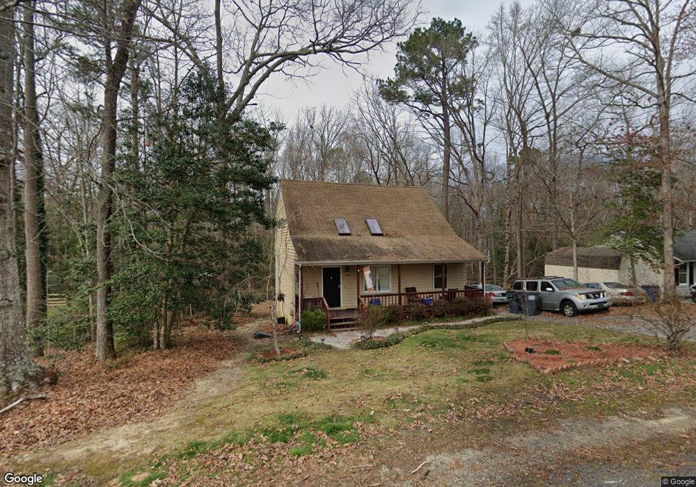
4724 Bexwood Dr Chesterfield, VA 23832
Estimated Value: $314,000 - $337,000
3
Beds
2
Baths
1,344
Sq Ft
$240/Sq Ft
Est. Value
About This Home
This home is located at 4724 Bexwood Dr, Chesterfield, VA 23832 and is currently estimated at $322,433, approximately $239 per square foot. 4724 Bexwood Dr is a home located in Chesterfield County with nearby schools including Thelma Crenshaw Elementary School, Bailey Bridge Middle School, and Manchester High.
Ownership History
Date
Name
Owned For
Owner Type
Purchase Details
Closed on
Nov 14, 2017
Sold by
Hunt Robert D and Ellet Jenifer
Bought by
Ellet Jenifer
Current Estimated Value
Create a Home Valuation Report for This Property
The Home Valuation Report is an in-depth analysis detailing your home's value as well as a comparison with similar homes in the area
Home Values in the Area
Average Home Value in this Area
Purchase History
| Date | Buyer | Sale Price | Title Company |
|---|---|---|---|
| Ellet Jenifer | -- | None Available |
Source: Public Records
Tax History Compared to Growth
Tax History
| Year | Tax Paid | Tax Assessment Tax Assessment Total Assessment is a certain percentage of the fair market value that is determined by local assessors to be the total taxable value of land and additions on the property. | Land | Improvement |
|---|---|---|---|---|
| 2025 | $2,440 | $271,300 | $60,000 | $211,300 |
| 2024 | $2,440 | $256,700 | $52,000 | $204,700 |
| 2023 | $2,222 | $244,200 | $49,000 | $195,200 |
| 2022 | $2,062 | $224,100 | $47,000 | $177,100 |
| 2021 | $1,963 | $199,700 | $45,000 | $154,700 |
| 2020 | $1,748 | $184,000 | $45,000 | $139,000 |
| 2019 | $1,681 | $176,900 | $42,000 | $134,900 |
| 2018 | $1,583 | $166,300 | $42,000 | $124,300 |
| 2017 | $1,536 | $154,800 | $42,000 | $112,800 |
| 2016 | $1,404 | $146,300 | $42,000 | $104,300 |
| 2015 | $1,339 | $136,900 | $42,000 | $94,900 |
| 2014 | $1,315 | $134,400 | $42,000 | $92,400 |
Source: Public Records
Map
Nearby Homes
- 10810 Ridgerun Rd
- 4519 Bexwood Dr
- 5101 Blossomwood Cir
- 11261 Sunfield Dr
- 10524 Genlou Rd
- 5124 Rollingway Rd
- 10508 Rollingway Ct
- 10927 Decoy Ln
- 11425 Brandenburg Dr
- 4112 Stigall Dr
- 10836 Genito Square Dr
- 10339 Qualla Trace Dr
- 10718 Genlou Rd
- 10332 Qualla Trace Dr
- 10556 Braden Woods Ct
- Stanley Plan at Lawson Mill
- Drexel Plan at Lawson Mill
- Caldwell Plan at Lawson Mill
- Ellerbe Plan at Lawson Mill
- Avery Plan at Lawson Mill
- 4718 Bexwood Dr
- 4723 Bexwood Dr
- 4712 Bexwood Dr
- 4736 Brookridge Rd
- 4742 Brookridge Rd
- 11002 Sunfield Dr
- 4718 Brookridge Rd
- 4706 Bexwood Dr
- 11004 Sunfield Dr
- 4711 Bexwood Dr
- 4712 Brookridge Rd
- 4748 Brookridge Rd
- 4700 Bexwood Dr
- 4723 Brookridge Rd
- 11000 Sunfield Dr
- 4706 Brookridge Rd
- 4705 Bexwood Dr
- 4731 Brookridge Rd
- 4737 Brookridge Rd
- 4754 Brookridge Rd