Estimated Value: $212,000 - $258,000
2
Beds
2
Baths
1,272
Sq Ft
$185/Sq Ft
Est. Value
About This Home
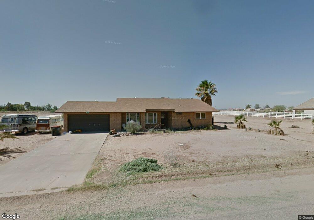
This home is located at 4739 E Pinto Dr, Eloy, AZ 85131 and is currently estimated at $234,791, approximately $184 per square foot. 4739 E Pinto Dr is a home located in Pinal County with nearby schools including Picacho Elementary School and Santa Cruz Valley Union High School.
Ownership History
Date
Name
Owned For
Owner Type
Purchase Details
Closed on
Jan 28, 2022
Sold by
Tyler Losey Austin
Bought by
Vermeuelen Margaret
Current Estimated Value
Purchase Details
Closed on
Apr 24, 2012
Sold by
Losey Austin Tyler
Bought by
Vermeulen Margaret Maria and Losey Austin
Purchase Details
Closed on
Apr 18, 2012
Sold by
Losey Dale Ann and Losey Larry George
Bought by
Losey Austin Tyler
Purchase Details
Closed on
Nov 10, 2008
Sold by
Vermeulen Margaret M
Bought by
Losey Austin T
Home Financials for this Owner
Home Financials are based on the most recent Mortgage that was taken out on this home.
Original Mortgage
$77,140
Interest Rate
6.07%
Mortgage Type
FHA
Create a Home Valuation Report for This Property
The Home Valuation Report is an in-depth analysis detailing your home's value as well as a comparison with similar homes in the area
Home Values in the Area
Average Home Value in this Area
Purchase History
| Date | Buyer | Sale Price | Title Company |
|---|---|---|---|
| Vermeuelen Margaret | -- | None Listed On Document | |
| Vermeulen Margaret Maria | -- | None Available | |
| Losey Austin Tyler | -- | None Available | |
| Losey Austin T | -- | Title Security Agency Of Pin | |
| Losey Austin T | $95,000 | Title Security Agency Of Pin |
Source: Public Records
Mortgage History
| Date | Status | Borrower | Loan Amount |
|---|---|---|---|
| Previous Owner | Losey Austin T | $77,140 |
Source: Public Records
Tax History
| Year | Tax Paid | Tax Assessment Tax Assessment Total Assessment is a certain percentage of the fair market value that is determined by local assessors to be the total taxable value of land and additions on the property. | Land | Improvement |
|---|---|---|---|---|
| 2025 | $834 | $13,877 | -- | -- |
| 2024 | $810 | $12,478 | -- | -- |
| 2023 | $841 | $10,162 | $1,400 | $8,762 |
| 2022 | $810 | $6,798 | $1,100 | $5,698 |
| 2021 | $823 | $6,911 | $0 | $0 |
| 2020 | $815 | $6,363 | $0 | $0 |
| 2019 | $786 | $5,640 | $0 | $0 |
| 2018 | $693 | $4,225 | $0 | $0 |
| 2017 | $699 | $4,431 | $0 | $0 |
| 2016 | $715 | $4,460 | $1,000 | $3,460 |
Source: Public Records
Map
Nearby Homes
- 4433 E Pinto Dr
- 4527 E Colt Dr
- 4121 E Appaloosa Dr Unit 172
- 4780 E Mustang Dr Unit 2
- 6280 N La Palma Rd
- 3250 E Alsdorf Rd
- 203 E 12th St
- 116 E 12th St
- 120 E Alsdorf Rd Unit 39
- 1500 E Arica Rd
- 109 E 12th St Unit 12
- 0 E Alsdorf Rd Unit 11061247
- 0 E Alsdorf Rd Unit 11224866
- 414 E 5th St
- 800 N Sunshine Blvd
- 6001 N Sunshine Blvd
- 0 E 8th St Unit 10
- 503 N Sunshine Blvd Unit 2
- 108 E 8th St Unit 17
- 413 E 3rd St
- 4556 E Pinto Dr Unit 109
- 4708 E Pinto Dr
- 4679 E Pinto Dr
- 4709 E Pinto Dr Unit 143
- 4801 E Pinto Dr
- 4678 E Pinto Dr
- 4649 E Pinto Dr
- 4831 E Pinto Dr
- 4831 E Pinto Dr Unit 2
- 4738 E Pinto Dr Unit 103
- 4648 E Pinto Dr
- 4768 E Pinto Dr Unit 102
- 4619 E Pinto Dr
- 4830 E Pinto Dr
- 0 S Highway 87 -- Unit '-' 5657544
- 0 S Highway 87 -- Unit '-' 5538123
- 0 S 87 Hwy Unit 8 6596299
- 0 S Highway 87 -- Unit 32 6230378
- 0 S Highway 87 -- Unit 6206052
- 0 S 87 Hwy Unit 5766977
Your Personal Tour Guide
Ask me questions while you tour the home.