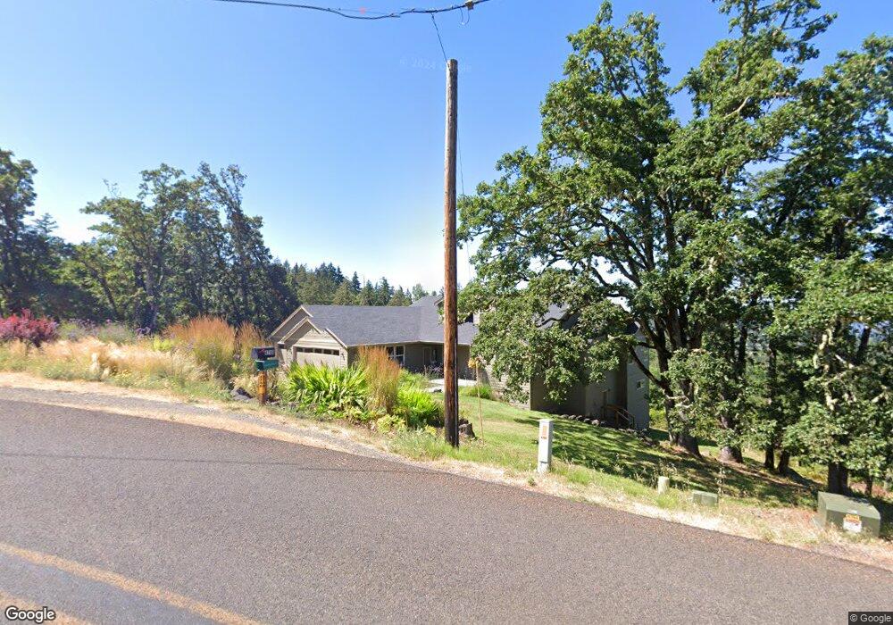
4748 Blanton Rd Eugene, OR 97405
Estimated Value: $723,000 - $1,135,014
4
Beds
3
Baths
2,600
Sq Ft
$353/Sq Ft
Est. Value
About This Home
This home is located at 4748 Blanton Rd, Eugene, OR 97405 and is currently estimated at $917,504, approximately $352 per square foot. 4748 Blanton Rd is a home with nearby schools including Adams Elementary School, Arts And Technology Academy At Jefferson, and Churchill High School.
Ownership History
Date
Name
Owned For
Owner Type
Purchase Details
Closed on
Oct 11, 2023
Sold by
Delf Gregory D and Delf Corlies R
Bought by
Delf Revocable Trust and Delf
Current Estimated Value
Purchase Details
Closed on
Oct 1, 2009
Sold by
Farwell James E
Bought by
Delf Gregory D and Delf Corlies R
Purchase Details
Closed on
Dec 5, 2007
Sold by
Eec Holding Llc
Bought by
Delf Gregory D and Delf Corlies R
Purchase Details
Closed on
Oct 11, 2007
Sold by
Jaros R Derek and Jaros Dianne F
Bought by
Eec Holding Llc
Purchase Details
Closed on
Oct 27, 2006
Sold by
Brink Mark W and Brink Kellie J
Bought by
Jaros R Derek and Jaros Dianne F
Create a Home Valuation Report for This Property
The Home Valuation Report is an in-depth analysis detailing your home's value as well as a comparison with similar homes in the area
Purchase History
| Date | Buyer | Sale Price | Title Company |
|---|---|---|---|
| Delf Revocable Trust | -- | None Listed On Document | |
| Delf Gregory D | -- | None Available | |
| Delf Gregory D | -- | None Available | |
| Eec Holding Llc | $339,500 | Cascade Title Co | |
| Jaros R Derek | $250,000 | Cascade Title Co |
Source: Public Records
Tax History
| Year | Tax Paid | Tax Assessment Tax Assessment Total Assessment is a certain percentage of the fair market value that is determined by local assessors to be the total taxable value of land and additions on the property. | Land | Improvement |
|---|---|---|---|---|
| 2025 | $6,597 | $483,150 | -- | -- |
| 2024 | $6,553 | $469,078 | -- | -- |
| 2023 | $6,553 | $455,416 | $0 | $0 |
| 2022 | $6,245 | $442,152 | $0 | $0 |
| 2021 | $5,755 | $429,274 | $0 | $0 |
| 2020 | $5,841 | $416,771 | $0 | $0 |
| 2019 | $5,628 | $404,633 | $0 | $0 |
| 2018 | $5,204 | $381,406 | $0 | $0 |
| 2017 | $5,003 | $381,406 | $0 | $0 |
| 2016 | $4,867 | $370,297 | $0 | $0 |
| 2015 | $4,754 | $359,512 | $0 | $0 |
| 2014 | $3,139 | $234,440 | $0 | $0 |
Source: Public Records
Map
Nearby Homes
- 0 W 40th Ave Unit 3 639571582
- 4040 Southpointe Dr
- 784 Brookside Dr
- 0 Pine View Ct Unit 758820410
- 653 Brookside Dr
- 806 Sundance St
- 3854 Monroe St
- 418 Stonewood Dr Unit 418
- 422 Stonewood Dr Unit 422
- 223 Trailside Loop Unit 223
- 2030 W 34th Ave
- 0 Lorane Hwy Unit 1-3-5-A
- 151 Treehill Loop Unit 151
- 152 Treehill Loop Unit 152
- 278 Rockridge Ct
- 143 Treehill Loop Unit 143
- 86134 Lorane Hwy
- 2191 Lorane Hwy
- 453 Dellwood Dr
- 126 Treehill Loop Unit 126
- 0 Blanton Rd
- 4828 Blanton Rd
- 4695 Blanton Rd
- 4850 Blanton Rd
- 4393 Blanton Heights Rd
- 4870 Blanton Rd
- 4875 Blanton Rd
- 4355 Blanton Heights Rd
- 4375 Blanton Heights Rd
- 4325 Blanton Heights Rd
- 4660 Blanton Rd
- 4450 Blanton Heights Rd
- 4400 Blanton Heights Rd
- 4490 Blanton Heights Rd
- 4350 Blanton Heights Rd
- 4903 Blanton Rd
- 4398 Blanton Heights Rd
- 4970 W 44th Ave
- 4975 Blanton Rd
- 4980 Blanton Rd
Your Personal Tour Guide
Ask me questions while you tour the home.