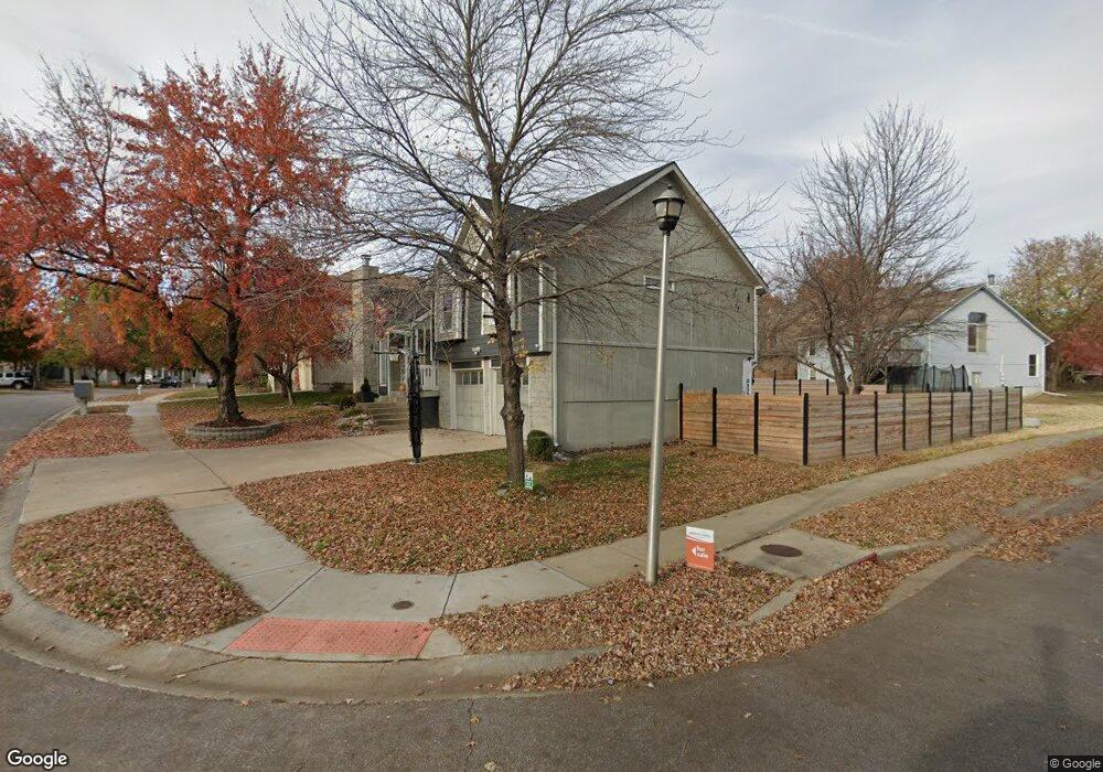
4751 Brockway St Shawnee, KS 66226
Estimated Value: $356,000 - $380,000
3
Beds
2
Baths
1,489
Sq Ft
$245/Sq Ft
Est. Value
About This Home
This home is located at 4751 Brockway St, Shawnee, KS 66226 and is currently estimated at $365,402, approximately $245 per square foot. 4751 Brockway St is a home located in Johnson County with nearby schools including Riverview Elementary School, Mill Creek Middle School, and Mill Valley High School.
Ownership History
Date
Name
Owned For
Owner Type
Purchase Details
Closed on
Feb 23, 2009
Sold by
Corlis Bryan T and Corlis Susan D
Bought by
Torres Antonio G Martinez
Current Estimated Value
Home Financials for this Owner
Home Financials are based on the most recent Mortgage that was taken out on this home.
Original Mortgage
$176,739
Outstanding Balance
$111,125
Interest Rate
4.92%
Mortgage Type
FHA
Estimated Equity
$254,277
Create a Home Valuation Report for This Property
The Home Valuation Report is an in-depth analysis detailing your home's value as well as a comparison with similar homes in the area
Home Values in the Area
Average Home Value in this Area
Purchase History
| Date | Buyer | Sale Price | Title Company |
|---|---|---|---|
| Torres Antonio G Martinez | -- | Chicago Title Ins Co Olathe |
Source: Public Records
Mortgage History
| Date | Status | Borrower | Loan Amount |
|---|---|---|---|
| Open | Torres Antonio G Martinez | $176,739 |
Source: Public Records
Tax History Compared to Growth
Tax History
| Year | Tax Paid | Tax Assessment Tax Assessment Total Assessment is a certain percentage of the fair market value that is determined by local assessors to be the total taxable value of land and additions on the property. | Land | Improvement |
|---|---|---|---|---|
| 2024 | $4,138 | $35,811 | $6,553 | $29,258 |
| 2023 | $4,231 | $36,030 | $6,553 | $29,477 |
| 2022 | $4,045 | $33,741 | $6,233 | $27,508 |
| 2021 | $3,602 | $28,796 | $5,668 | $23,128 |
| 2020 | $3,340 | $26,451 | $4,934 | $21,517 |
| 2019 | $3,279 | $25,587 | $4,487 | $21,100 |
| 2018 | $3,037 | $23,471 | $4,487 | $18,984 |
| 2017 | $3,011 | $22,701 | $3,775 | $18,926 |
| 2016 | $2,819 | $20,987 | $3,775 | $17,212 |
| 2015 | $2,764 | $20,309 | $3,775 | $16,534 |
| 2013 | -- | $19,837 | $3,775 | $16,062 |
Source: Public Records
Map
Nearby Homes
- 22014 W 47th Terrace
- 4707 Noreston St
- 22014 W 51st St
- 5005 Hilltop Dr
- 5116 Payne St
- 4713 Lone Elm
- 21525 W 51st St
- 4638 Aminda St
- 21408 W 50th St
- 22115 W 51st Terrace
- 22625 W 49th St
- 22611 W 46th Terrace
- 22714 W 49th St
- 21222 W 48th St
- 5206 Round Prairie St
- 4754 Lakecrest Dr
- 21804 W 52nd Terrace
- 9307 Aminda St
- 9303 Aminda St
- 9313 Aminda St
- 4747 Brockway St
- 4750 Payne St
- 4743 Brockway St
- 4746 Payne St
- 22012 W 48th St
- 22005 W 48th St
- 0 Brockway St Unit 2039130
- 22001 W 48th St
- 4742 Payne St
- 4739 Brockway St
- 4746 Brockway St
- 21907 W 48th St
- 22013 W 48th St
- 22016 W 48th St
- 4742 Brockway St
- 4738 Payne St
- 4735 Brockway St
- 4749 Payne St
- 4738 Brockway St
- 22017 W 48th St