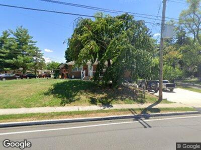
4751 Mount Alverno Rd Cincinnati, OH 45238
Delhi Hills NeighborhoodEstimated Value: $184,000 - $218,811
3
Beds
2
Baths
1,218
Sq Ft
$170/Sq Ft
Est. Value
About This Home
This home is located at 4751 Mount Alverno Rd, Cincinnati, OH 45238 and is currently estimated at $206,703, approximately $169 per square foot. 4751 Mount Alverno Rd is a home located in Hamilton County with nearby schools including Delshire Elementary School, Delhi Middle School, and Oak Hills High School.
Ownership History
Date
Name
Owned For
Owner Type
Purchase Details
Closed on
Apr 7, 2006
Sold by
Zukor Theodore G
Bought by
Tenhundfeld Nicole L
Current Estimated Value
Home Financials for this Owner
Home Financials are based on the most recent Mortgage that was taken out on this home.
Original Mortgage
$80,000
Outstanding Balance
$47,790
Interest Rate
6.48%
Mortgage Type
Fannie Mae Freddie Mac
Estimated Equity
$157,887
Purchase Details
Closed on
Feb 29, 1996
Sold by
Tanner Maxine Gregory and Simmons Lorine Gregory
Bought by
Zukor Theodore G
Home Financials for this Owner
Home Financials are based on the most recent Mortgage that was taken out on this home.
Original Mortgage
$53,000
Interest Rate
7.06%
Create a Home Valuation Report for This Property
The Home Valuation Report is an in-depth analysis detailing your home's value as well as a comparison with similar homes in the area
Home Values in the Area
Average Home Value in this Area
Purchase History
| Date | Buyer | Sale Price | Title Company |
|---|---|---|---|
| Tenhundfeld Nicole L | $116,000 | None Available | |
| Zukor Theodore G | $80,000 | -- |
Source: Public Records
Mortgage History
| Date | Status | Borrower | Loan Amount |
|---|---|---|---|
| Open | Tenhundfeld Nicole L | $80,000 | |
| Previous Owner | Zukor Theodore G | $50,500 | |
| Previous Owner | Zukor Theodore G | $53,000 |
Source: Public Records
Tax History Compared to Growth
Tax History
| Year | Tax Paid | Tax Assessment Tax Assessment Total Assessment is a certain percentage of the fair market value that is determined by local assessors to be the total taxable value of land and additions on the property. | Land | Improvement |
|---|---|---|---|---|
| 2024 | $2,943 | $50,789 | $7,424 | $43,365 |
| 2023 | $2,952 | $50,789 | $7,424 | $43,365 |
| 2022 | $2,111 | $32,281 | $7,238 | $25,043 |
| 2021 | $2,067 | $32,281 | $7,238 | $25,043 |
| 2020 | $2,097 | $32,281 | $7,238 | $25,043 |
| 2019 | $1,912 | $26,461 | $5,933 | $20,528 |
| 2018 | $1,914 | $26,461 | $5,933 | $20,528 |
| 2017 | $1,728 | $26,461 | $5,933 | $20,528 |
| 2016 | $1,990 | $30,534 | $6,783 | $23,751 |
| 2015 | $1,992 | $30,534 | $6,783 | $23,751 |
| 2014 | $1,994 | $30,534 | $6,783 | $23,751 |
| 2013 | $1,915 | $31,157 | $6,923 | $24,234 |
Source: Public Records
Map
Nearby Homes
- 5061 Grosse Pointe Ln
- 5060 Grosse Pointe Ln
- 349 Halidonhill Ln
- 163 Pedretti Ave
- 407 Elm St
- 4878 Delhi Pike
- 5054 Clarevalley Dr
- 4308 Copperfield Ln
- 433 Wilke Dr
- 4949 Riverwatch Dr
- 4223 Champdale Ln
- 305 Parktrail Ln
- 5110 Old Oak Trail
- 4205 Glenhaven Rd
- 494 Greenwell Ave
- 4975 Donlar Ave
- 5324 Orangelawn Dr
- 288 Kinsman Ct
- 357 Marbill Ln
- 551 Greenwell Ave
- 4751 Mount Alverno Rd
- 293 Ihle Dr
- 4725 Mount Alverno Rd
- 289 Ihle Dr
- 4750 Mount Alverno Rd
- 4781 Mount Alverno Rd
- 4750 Mt Alverno
- 4772 Mount Alverno Rd
- 287 Ihle Dr
- 4798 Mount Alverno Rd
- 294 Jupiter Dr
- 4738 Mount Alverno Rd
- 4715 Mount Alverno Rd
- 292 Ihle Dr
- 283 Ihle Dr
- 4703 Mount Alverno Rd
- 288 Jupiter Dr
- 4784 Mount Alverno Rd
- 288 Ihle Dr
- 281 Ihle Dr