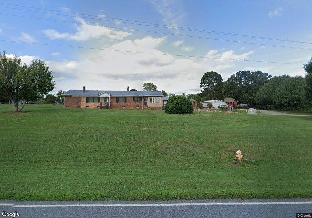
4760 Rifle Range Rd Conover, NC 28613
Estimated Value: $340,000 - $531,000
3
Beds
2
Baths
2,360
Sq Ft
$192/Sq Ft
Est. Value
About This Home
This home is located at 4760 Rifle Range Rd, Conover, NC 28613 and is currently estimated at $451,954, approximately $191 per square foot. 4760 Rifle Range Rd is a home located in Catawba County with nearby schools including Lyle Creek Elementary School, River Bend Middle School, and Bunker Hill High School.
Ownership History
Date
Name
Owned For
Owner Type
Purchase Details
Closed on
Jul 10, 2009
Sold by
Swink Nora L and Swink David C
Bought by
Swink Nora L
Current Estimated Value
Home Financials for this Owner
Home Financials are based on the most recent Mortgage that was taken out on this home.
Original Mortgage
$117,500
Interest Rate
5.27%
Mortgage Type
New Conventional
Purchase Details
Closed on
Sep 4, 2001
Create a Home Valuation Report for This Property
The Home Valuation Report is an in-depth analysis detailing your home's value as well as a comparison with similar homes in the area
Home Values in the Area
Average Home Value in this Area
Purchase History
| Date | Buyer | Sale Price | Title Company |
|---|---|---|---|
| Swink Nora L | -- | None Available | |
| Swink Nora L | -- | None Available | |
| -- | $125,000 | -- |
Source: Public Records
Mortgage History
| Date | Status | Borrower | Loan Amount |
|---|---|---|---|
| Closed | Swink Nora L | $117,500 |
Source: Public Records
Tax History Compared to Growth
Tax History
| Year | Tax Paid | Tax Assessment Tax Assessment Total Assessment is a certain percentage of the fair market value that is determined by local assessors to be the total taxable value of land and additions on the property. | Land | Improvement |
|---|---|---|---|---|
| 2025 | $2,242 | $429,000 | $43,900 | $385,100 |
| 2024 | $2,242 | $429,000 | $43,900 | $385,100 |
| 2023 | $2,156 | $218,800 | $43,900 | $174,900 |
| 2022 | $1,521 | $218,800 | $43,900 | $174,900 |
| 2021 | $1,521 | $218,800 | $43,900 | $174,900 |
| 2020 | $1,521 | $218,800 | $43,900 | $174,900 |
| 2019 | $1,521 | $218,800 | $0 | $0 |
| 2018 | $1,332 | $191,700 | $43,500 | $148,200 |
| 2017 | $1,332 | $0 | $0 | $0 |
| 2016 | $1,332 | $0 | $0 | $0 |
| 2015 | $1,393 | $191,720 | $43,500 | $148,220 |
| 2014 | $1,393 | $232,200 | $47,200 | $185,000 |
Source: Public Records
Map
Nearby Homes
- 4645 Rifle Range Rd
- 4874 Stone Dr Unit 125
- 4858 Water Wheel Dr
- 1371 Millrace Dr
- 4932 Sandstone Dr
- 1246 Houston Mill Rd
- 5260 Rifle Range Rd
- 5309 Hall St
- 5429 Buddy St Unit LOT 3
- 4687 Ransom Dr
- 5217 Canterbury Dr
- 4073 Lee Cline Rd
- 1862 Green Leaf Ct
- 3951 Springs Rd
- 4120 Village Blvd NW
- 3677 Charles St NW
- 3671 Charles St NW
- 3665 Charles St NW
- Aria Plan at Cline Village
- Hanover Plan at Cline Village
- 4766 Rifle Range Rd
- 4755 Rifle Range Rd
- 4770 Powder Horne Ln
- 4752 Rifle Range Rd
- 4763 Rifle Range Rd
- 4776 Rifle Range Rd
- 4786 Rifle Range Rd
- 4762 Powder Horne Ln
- 4728 Musket Way
- 4736 Musket Way
- 4787 Rifle Range Rd
- 4752 Musket Way
- 4750 Powder Horne Ln
- 4766 Musket Way
- 1145 Opal Creek Dr
- 1133 Opal Creek Dr
- 4738 Powder Horne Ln
- 4734 Rifle Range Rd
- 1169 Opal Creek Dr
- 4778 Musket Way