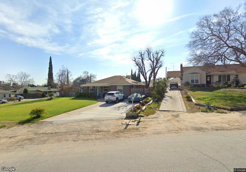
477 Chestnut Ave Bakersfield, CA 93305
College Heights NeighborhoodEstimated Value: $283,204 - $350,000
3
Beds
1
Bath
1,339
Sq Ft
$235/Sq Ft
Est. Value
About This Home
This home is located at 477 Chestnut Ave, Bakersfield, CA 93305 and is currently estimated at $315,051, approximately $235 per square foot. 477 Chestnut Ave is a home located in Kern County with nearby schools including Myra A. Noble Elementary School, Washington Middle School, and East Bakersfield High School.
Ownership History
Date
Name
Owned For
Owner Type
Purchase Details
Closed on
Apr 10, 1997
Sold by
Hud
Bought by
Torres Fred G
Current Estimated Value
Home Financials for this Owner
Home Financials are based on the most recent Mortgage that was taken out on this home.
Original Mortgage
$77,315
Interest Rate
8.08%
Mortgage Type
FHA
Purchase Details
Closed on
Jan 30, 1997
Sold by
Lender Financial Corp
Bought by
Hud
Purchase Details
Closed on
Oct 25, 1996
Sold by
Hazdovac Michael M and Hazdovac Celia L
Bought by
Leader Financial Corp
Create a Home Valuation Report for This Property
The Home Valuation Report is an in-depth analysis detailing your home's value as well as a comparison with similar homes in the area
Home Values in the Area
Average Home Value in this Area
Purchase History
| Date | Buyer | Sale Price | Title Company |
|---|---|---|---|
| Torres Fred G | $70,000 | American Title Co | |
| Hud | -- | Fidelity National Title Ins | |
| Leader Financial Corp | $76,069 | Fidelity National Title Ins |
Source: Public Records
Mortgage History
| Date | Status | Borrower | Loan Amount |
|---|---|---|---|
| Previous Owner | Torres Fred G | $77,315 |
Source: Public Records
Tax History
| Year | Tax Paid | Tax Assessment Tax Assessment Total Assessment is a certain percentage of the fair market value that is determined by local assessors to be the total taxable value of land and additions on the property. | Land | Improvement |
|---|---|---|---|---|
| 2025 | $2,385 | $127,008 | $35,817 | $91,191 |
| 2024 | $2,316 | $124,518 | $35,115 | $89,403 |
| 2023 | $2,316 | $122,077 | $34,427 | $87,650 |
| 2022 | $2,223 | $119,684 | $33,752 | $85,932 |
| 2021 | $2,122 | $117,339 | $33,091 | $84,248 |
| 2020 | $2,085 | $116,137 | $32,752 | $83,385 |
| 2019 | $2,019 | $116,137 | $32,752 | $83,385 |
| 2018 | $1,966 | $111,629 | $31,481 | $80,148 |
| 2017 | $1,946 | $109,441 | $30,864 | $78,577 |
| 2016 | $1,697 | $107,296 | $30,259 | $77,037 |
| 2015 | $1,696 | $105,685 | $29,805 | $75,880 |
| 2014 | $1,649 | $103,616 | $29,222 | $74,394 |
Source: Public Records
Map
Nearby Homes
- 448 Poplar Ave
- 439 Poplar Ave
- 330 Poplar Ave
- 319 Poplar Ave
- 418 Crawford St
- 2801 Alta Vista Dr
- 611 Walnut Ave
- 621 Columbus St
- 317 Columbus St
- 2927 Skyline Blvd
- 2891 Alta Vista Dr
- 2860 N Baker St
- 2820 Alta Vista Dr
- 2606 N Baker St
- 3010 Elmwood Ave
- 326 Water St
- 2616 N King St
- 812 Columbus St
- 0 174-260-09-00-1 Unit 202107556
- 2419 N Inyo St
- 475 Chestnut Ave
- 470 Poplar Ave
- 460 Poplar Ave
- 481 Poplar Ave
- 425 Chestnut Ave
- 2831 N Tulare St
- 615 Skyline Ave
- 430 Chestnut Ave
- 2817 N Inyo St
- 2823 N Tulare St
- 2841 N Inyo St
- 430 Poplar Ave
- 2830 N Tulare St
- 2809 N Inyo St
- 2860 Skyline Blvd
- 2815 N Tulare St
- 620 Skyline Ave
- 2851 N Inyo St
- 621 Skyline Ave
- 420 Poplar Ave
Your Personal Tour Guide
Ask me questions while you tour the home.