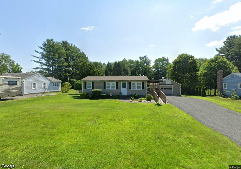
477 Country Club Rd Greenfield, MA 01301
Estimated Value: $356,979 - $385,000
4
Beds
1
Bath
1,200
Sq Ft
$308/Sq Ft
Est. Value
About This Home
This home is located at 477 Country Club Rd, Greenfield, MA 01301 and is currently estimated at $369,245, approximately $307 per square foot. 477 Country Club Rd is a home located in Franklin County with nearby schools including Cornerstone Christian School.
Ownership History
Date
Name
Owned For
Owner Type
Purchase Details
Closed on
Jul 31, 2006
Sold by
Mendyk Michael P and Mcgrath Michael J
Bought by
Wenzler Karl E and Wenzler Cindy A
Current Estimated Value
Purchase Details
Closed on
May 15, 2001
Sold by
Tetreault Deboarh J
Bought by
Houle Terri L
Create a Home Valuation Report for This Property
The Home Valuation Report is an in-depth analysis detailing your home's value as well as a comparison with similar homes in the area
Home Values in the Area
Average Home Value in this Area
Purchase History
| Date | Buyer | Sale Price | Title Company |
|---|---|---|---|
| Wenzler Karl E | $225,000 | -- | |
| Wenzler Karl E | $225,000 | -- | |
| Houle Terri L | $125,000 | -- | |
| Houle Terri L | $125,000 | -- |
Source: Public Records
Mortgage History
| Date | Status | Borrower | Loan Amount |
|---|---|---|---|
| Open | Houle Terri L | $122,000 | |
| Closed | Houle Terri L | $25,000 |
Source: Public Records
Tax History Compared to Growth
Tax History
| Year | Tax Paid | Tax Assessment Tax Assessment Total Assessment is a certain percentage of the fair market value that is determined by local assessors to be the total taxable value of land and additions on the property. | Land | Improvement |
|---|---|---|---|---|
| 2025 | $4,784 | $244,600 | $82,400 | $162,200 |
| 2024 | $4,779 | $234,400 | $70,200 | $164,200 |
| 2023 | $4,341 | $220,900 | $70,200 | $150,700 |
| 2022 | $4,535 | $203,200 | $70,300 | $132,900 |
| 2021 | $4,872 | $209,800 | $74,300 | $135,500 |
| 2020 | $4,538 | $197,900 | $74,300 | $123,600 |
| 2019 | $4,226 | $189,000 | $64,700 | $124,300 |
| 2018 | $4,190 | $186,800 | $63,500 | $123,300 |
| 2017 | $4,014 | $184,700 | $63,500 | $121,200 |
| 2016 | $3,954 | $181,300 | $63,500 | $117,800 |
| 2015 | $4,025 | $178,800 | $65,100 | $113,700 |
| 2014 | $3,677 | $179,100 | $65,100 | $114,000 |
Source: Public Records
Map
Nearby Homes
- 72 Meadowood Dr
- 34 Brookside Ave
- 31 Lovers Ln
- 696 Bernardston Rd
- 001 Adams Rd
- 79 Burnham Rd
- 83 Eden Trail Branch
- 4 Pickett Ln
- 0 Pickett Ln
- 104 Leyden Rd
- 187 Plain Rd
- 336 Plain Rd
- 35-37 Shattuck St
- 35 Shattuck St Unit 37
- 335 Federal St
- 27 Lunt Dr
- 24 Cypress St
- 306 Davis St
- 311 Chapman St
- 254 Davis St
- 473 Country Club Rd
- 481 Country Club Rd
- 469 Country Club Rd
- 463 Country Club Rd
- 461 Country Club Rd
- 449 Country Club Rd
- 8 Plantation Cir
- 12 Plantation Cir
- 4 Plantation Cir
- 20 Plantation Cir
- 24 Plantation Cir
- 446 Country Club Rd
- 28 Plantation Cir
- 7 Plantation Cir
- 3 Plantation Cir
- 15 Plantation Cir
- 25 Plantation Cir
- 436 Country Club Rd
- 31 Plantation Cir
- 32 Plantation Cir