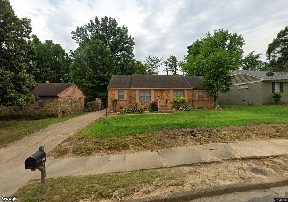
4777 Scottsdale Ave Memphis, TN 38118
Parkway Village NeighborhoodEstimated Value: $131,000 - $148,000
3
Beds
1
Bath
1,486
Sq Ft
$93/Sq Ft
Est. Value
About This Home
This home is located at 4777 Scottsdale Ave, Memphis, TN 38118 and is currently estimated at $138,586, approximately $93 per square foot. 4777 Scottsdale Ave is a home located in Shelby County with nearby schools including Cromwell Elementary School, Wooddale High School, and Memphis School of Excellence.
Ownership History
Date
Name
Owned For
Owner Type
Purchase Details
Closed on
Mar 5, 2004
Sold by
Woods Antonio
Bought by
Woods Natasha Cassimere
Current Estimated Value
Purchase Details
Closed on
Nov 24, 1998
Sold by
Fry Lennie B
Bought by
Woods Natasha
Home Financials for this Owner
Home Financials are based on the most recent Mortgage that was taken out on this home.
Original Mortgage
$61,200
Outstanding Balance
$18,773
Interest Rate
11.12%
Estimated Equity
$119,813
Create a Home Valuation Report for This Property
The Home Valuation Report is an in-depth analysis detailing your home's value as well as a comparison with similar homes in the area
Home Values in the Area
Average Home Value in this Area
Purchase History
| Date | Buyer | Sale Price | Title Company |
|---|---|---|---|
| Woods Natasha Cassimere | -- | Chicago Title Co | |
| Woods Natasha | $72,000 | Southern Trust Title Company |
Source: Public Records
Mortgage History
| Date | Status | Borrower | Loan Amount |
|---|---|---|---|
| Open | Woods Natasha | $61,200 | |
| Closed | Woods Natasha | $10,000 |
Source: Public Records
Tax History Compared to Growth
Tax History
| Year | Tax Paid | Tax Assessment Tax Assessment Total Assessment is a certain percentage of the fair market value that is determined by local assessors to be the total taxable value of land and additions on the property. | Land | Improvement |
|---|---|---|---|---|
| 2025 | $666 | $33,400 | $5,000 | $28,400 |
| 2024 | $666 | $19,650 | $3,350 | $16,300 |
| 2023 | $1,197 | $19,650 | $3,350 | $16,300 |
| 2022 | $1,197 | $19,650 | $3,350 | $16,300 |
| 2021 | $1,211 | $19,650 | $3,350 | $16,300 |
| 2020 | $1,152 | $15,900 | $3,350 | $12,550 |
| 2019 | $1,152 | $15,900 | $3,350 | $12,550 |
| 2018 | $1,152 | $15,900 | $3,350 | $12,550 |
| 2017 | $653 | $15,900 | $3,350 | $12,550 |
| 2016 | $682 | $15,600 | $0 | $0 |
| 2014 | $682 | $15,600 | $0 | $0 |
Source: Public Records
Map
Nearby Homes
- 3287 Boxdale St
- 3274 Gaylord Ln
- 4833 Scottsdale Ave
- 3339 S Perkins Rd
- 3347 S Perkins Rd
- 3240 Boxdale St
- 4864 Cloister Ave
- 3433 S Perkins Rd
- 4616 Blanding Dr
- 4612 Chuck Ave
- 4763 Wooddale Ave
- 4817 Wooddale Ave
- 4947 Demeter Cove
- 3408 Clearbrook St
- 3118 Arrendale St
- 4773 Aloha Ave
- 3395 Mckenzie St Unit 35581
- 4772 James Kent Ct
- 3083 Arrendale St
- 3075 Dewitt Cove
- 4785 Scottsdale Ave
- 4765 Scottsdale Ave
- 4793 Scottsdale Ave
- 3326 Gaylord Ln
- 4775 Blanding Cove
- 4774 Blanding Cove
- 4776 Scottsdale Ave
- 3334 Gaylord Ln
- 4799 Scottsdale Ave
- 4782 Scottsdale Ave
- 4779 Blanding Cove
- 4788 Scottsdale Ave
- 4784 Blanding Cove
- 3294 Gaylord Ln
- 3340 Gaylord Ln
- 4794 Scottsdale Ave
- 4757 Scottsdale Ave
- 4805 Scottsdale Ave
- 4756 Scottsdale Ave
- 4785 Blanding Cove