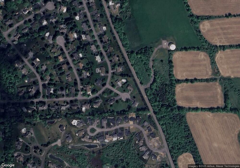
4781 Queen Victoria Cir Manlius, NY 13104
Estimated Value: $567,000 - $639,000
4
Beds
4
Baths
3,045
Sq Ft
$201/Sq Ft
Est. Value
About This Home
This home is located at 4781 Queen Victoria Cir, Manlius, NY 13104 and is currently estimated at $611,805, approximately $200 per square foot. 4781 Queen Victoria Cir is a home located in Onondaga County with nearby schools including Enders Road Elementary School, Eagle Hill Middle School, and Immaculate Conception School.
Ownership History
Date
Name
Owned For
Owner Type
Purchase Details
Closed on
Dec 1, 2009
Sold by
White Derek
Bought by
White Kristin
Current Estimated Value
Purchase Details
Closed on
Apr 11, 2006
Sold by
Munster Michael J
Bought by
White Derek
Purchase Details
Closed on
Jul 7, 2003
Sold by
Stevens Dirk E Nancy N
Bought by
Munster Michael J Deborah
Purchase Details
Closed on
Jul 31, 1997
Sold by
Barry Robert W
Bought by
Stevens Dirk and Stevens Nancy
Purchase Details
Closed on
Jun 14, 1996
Sold by
Eagle View Inc
Bought by
Barry Robert W
Create a Home Valuation Report for This Property
The Home Valuation Report is an in-depth analysis detailing your home's value as well as a comparison with similar homes in the area
Home Values in the Area
Average Home Value in this Area
Purchase History
| Date | Buyer | Sale Price | Title Company |
|---|---|---|---|
| White Kristin | -- | -- | |
| White Derek | $336,500 | Edwina Schleider | |
| Munster Michael J Deborah | $264,500 | Vaughn Lang | |
| Stevens Dirk | $230,000 | -- | |
| Barry Robert W | $35,000 | -- |
Source: Public Records
Tax History Compared to Growth
Tax History
| Year | Tax Paid | Tax Assessment Tax Assessment Total Assessment is a certain percentage of the fair market value that is determined by local assessors to be the total taxable value of land and additions on the property. | Land | Improvement |
|---|---|---|---|---|
| 2024 | $15,608 | $489,300 | $92,300 | $397,000 |
| 2023 | $14,430 | $424,300 | $80,000 | $344,300 |
| 2022 | $13,821 | $374,700 | $72,300 | $302,400 |
| 2021 | $13,588 | $331,600 | $69,500 | $262,100 |
| 2020 | $12,577 | $331,600 | $39,300 | $292,300 |
| 2019 | $4,514 | $318,800 | $37,800 | $281,000 |
| 2018 | $12,307 | $318,800 | $37,800 | $281,000 |
| 2017 | $4,386 | $312,500 | $37,100 | $275,400 |
| 2016 | $12,028 | $312,500 | $37,100 | $275,400 |
| 2015 | -- | $312,500 | $37,100 | $275,400 |
| 2014 | -- | $312,500 | $37,100 | $275,400 |
Source: Public Records
Map
Nearby Homes
- 117 Indian Runner Cir
- 8429 Prestwick Dr
- Lot 238 Muscovy Ln
- Lot the Reserve @ Bishop Brook
- Lot 1 the Reserve @ Bishop Brook
- 8252 Iliad Dr
- 8327 Decoy Run
- 8428 Hobnail Rd
- 8324 Decoy Run
- 8302 Decoy Run
- 8237 Penstock Way
- 8190 Pembroke Dr
- 7103 Kittiwake Run
- 8174 Old Sunridge Dr
- 4715 Woodbridge Dr
- 4869 Westfield Dr
- 7101 Kittiwake Run
- 7127 Kittiwake Run Lot 457
- 7131 Kittiwake Run Lot 456
- 4854 Pembroke Dr
- 8473 Woodbox Rd
- 4775 Queen Victoria Cir
- 8472 Woodbox Rd
- 8466 Woodbox Rd
- 8481 Woodbox Rd
- 4770 Queen Victoria Cir
- 4801 Hepplewhite Dr
- 8487 Woodbox Rd
- 8462 Woodbox Rd
- 4803 Hepplewhite Dr
- 8465 Woodbox Rd
- 122 Crane Landing
- 124 Crane Landing
- 126 Crane Landing
- 116 Craine Dr
- 4807 Hepplewhite Dr
- 8491 Woodbox Rd
- 128 Crane Landing
- 8458 Woodbox Rd
- 130 Crane Landing
