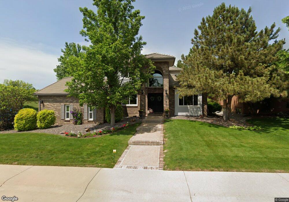
4781 W Fremont Ct Littleton, CO 80128
Estimated Value: $1,266,000 - $1,505,000
4
Beds
6
Baths
3,301
Sq Ft
$419/Sq Ft
Est. Value
About This Home
This home is located at 4781 W Fremont Ct, Littleton, CO 80128 and is currently estimated at $1,383,389, approximately $419 per square foot. 4781 W Fremont Ct is a home located in Arapahoe County with nearby schools including Wilder Elementary School, Goddard Middle School, and Heritage High School.
Ownership History
Date
Name
Owned For
Owner Type
Purchase Details
Closed on
Jul 2, 2020
Sold by
Fitzjarrell Philip Blake and Moore Barbara Jo
Bought by
Fitzjarrell Philip Blake and Fitzjarrell Barbara Jo
Current Estimated Value
Home Financials for this Owner
Home Financials are based on the most recent Mortgage that was taken out on this home.
Original Mortgage
$352,600
Outstanding Balance
$313,530
Interest Rate
3.25%
Mortgage Type
New Conventional
Estimated Equity
$1,069,859
Purchase Details
Closed on
Apr 9, 2004
Sold by
Fitzjarrell Philip Blake
Bought by
Fitzjarrell Philip Blake and Moore Barbara Jo
Purchase Details
Closed on
May 22, 2003
Sold by
Fitzjarrell Philip B and Moore Barbara Jo
Bought by
Fitzjarrell Philip B
Home Financials for this Owner
Home Financials are based on the most recent Mortgage that was taken out on this home.
Original Mortgage
$474,400
Interest Rate
5.65%
Mortgage Type
Unknown
Purchase Details
Closed on
Dec 30, 2002
Sold by
Fitzjarrell Philip Blake
Bought by
Fitzjarrell Philip Blake and Moore Barbara Jo
Purchase Details
Closed on
Jul 26, 2002
Sold by
Befus Craig J and Desalvo Denise B
Bought by
Fitzjarrell Philip B
Home Financials for this Owner
Home Financials are based on the most recent Mortgage that was taken out on this home.
Original Mortgage
$474,400
Interest Rate
6.53%
Purchase Details
Closed on
Nov 22, 1996
Sold by
Ramsgate Enterprises Ltd
Bought by
Befus Craig J and Desalvo Denise B
Home Financials for this Owner
Home Financials are based on the most recent Mortgage that was taken out on this home.
Original Mortgage
$400,000
Interest Rate
7.75%
Purchase Details
Closed on
Apr 5, 1996
Sold by
Odum Larry G and Odum Sandra L
Bought by
Ramsgate Enterprises Ltd
Purchase Details
Closed on
Jan 12, 1996
Sold by
Odum Larry G and Odum Sandra L
Bought by
Ramsgate Enterprises Ltd
Purchase Details
Closed on
Sep 5, 1995
Sold by
Meadowbrook Development Llc
Bought by
Odum Larry G and Odum Sandra L
Home Financials for this Owner
Home Financials are based on the most recent Mortgage that was taken out on this home.
Original Mortgage
$25,000
Interest Rate
11.5%
Mortgage Type
Seller Take Back
Create a Home Valuation Report for This Property
The Home Valuation Report is an in-depth analysis detailing your home's value as well as a comparison with similar homes in the area
Home Values in the Area
Average Home Value in this Area
Purchase History
| Date | Buyer | Sale Price | Title Company |
|---|---|---|---|
| Fitzjarrell Philip Blake | -- | Servicelink | |
| Fitzjarrell Philip Blake | -- | -- | |
| Fitzjarrell Philip B | -- | Security Title | |
| Fitzjarrell Philip Blake | -- | -- | |
| Fitzjarrell Philip B | $593,000 | Title America | |
| Befus Craig J | $444,500 | Land Title | |
| Ramsgate Enterprises Ltd | -- | Land Title Guarantee Company | |
| Ramsgate Enterprises Ltd | -- | Land Title | |
| Odum Larry G | $59,500 | Land Title |
Source: Public Records
Mortgage History
| Date | Status | Borrower | Loan Amount |
|---|---|---|---|
| Open | Fitzjarrell Philip Blake | $352,600 | |
| Closed | Fitzjarrell Philip B | $474,400 | |
| Closed | Fitzjarrell Philip B | $474,400 | |
| Previous Owner | Befus Craig J | $400,000 | |
| Previous Owner | Odum Larry G | $25,000 |
Source: Public Records
Tax History Compared to Growth
Tax History
| Year | Tax Paid | Tax Assessment Tax Assessment Total Assessment is a certain percentage of the fair market value that is determined by local assessors to be the total taxable value of land and additions on the property. | Land | Improvement |
|---|---|---|---|---|
| 2024 | $6,977 | $72,963 | -- | -- |
| 2023 | $6,977 | $72,963 | $0 | $0 |
| 2022 | $6,142 | $60,500 | $0 | $0 |
| 2021 | $6,125 | $60,500 | $0 | $0 |
| 2020 | $6,139 | $62,391 | $0 | $0 |
| 2019 | $5,775 | $62,391 | $0 | $0 |
| 2018 | $5,020 | $57,636 | $0 | $0 |
| 2017 | $4,651 | $57,636 | $0 | $0 |
| 2016 | $4,829 | $57,487 | $0 | $0 |
| 2015 | $4,841 | $57,487 | $0 | $0 |
| 2014 | -- | $51,151 | $0 | $0 |
| 2013 | -- | $56,370 | $0 | $0 |
Source: Public Records
Map
Nearby Homes
- 7175 S Polo Ridge Dr
- 7425 S Utica St
- 7452 S Utica St
- 5040 W Geddes Cir
- 7079 S Polo Ridge Dr
- 7351 S Sheridan Ct
- 4431 W Jamison Place
- 7120 S Sheridan Ct
- 7427 S Ames Ct
- 7604 S Platteview Dr
- 5274 W Rowland Place
- 5466 W Indore Dr
- 7000 S Sheridan Blvd
- 5041 W Portland Dr
- 7504 S Depew St
- 5295 W Plymouth Dr
- 7753 S Ames Way
- 7636 S Eaton Way
- 5200 W Ontario Ave
- 7729 S Eaton Way
- 4771 W Fremont Ct
- 4770 W Easter Ct
- 4750 W Easter Ct
- 4780 W Fremont Ct
- 4741 W Fremont Ct
- 4770 W Fremont Ct
- 4720 W Easter Ct
- 4710 W Fremont Ct
- 2730 S Wolff St
- 4740 W Fremont Ct
- 4691 W Geddes Ave
- 4753 W Easter Ct
- 4681 W Hanoverian Way
- 4681 W Geddes Ave
- 7254 S Platte Canyon Dr
- 4661 W Geddes Ave
- 7306 S Platte Canyon Dr
- 7244 S Platte Canyon Dr
- 4680 W Hanoverian Way
- 7130 Old Farm Rd