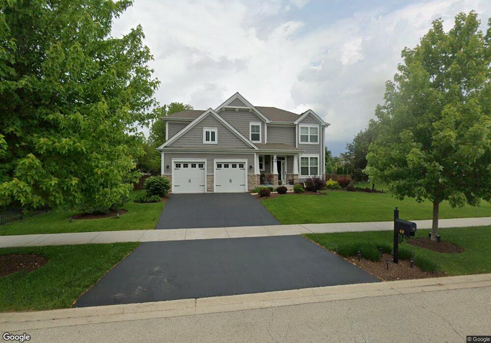
48 Robert Rd Oswego, IL 60543
South Oswego NeighborhoodEstimated Value: $520,000 - $554,000
3
Beds
3
Baths
2,798
Sq Ft
$193/Sq Ft
Est. Value
About This Home
This home is located at 48 Robert Rd, Oswego, IL 60543 and is currently estimated at $540,462, approximately $193 per square foot. 48 Robert Rd is a home located in Kendall County with nearby schools including Southbury Elementary School, Traughber Junior High School, and Oswego High School.
Ownership History
Date
Name
Owned For
Owner Type
Purchase Details
Closed on
Aug 17, 2016
Sold by
Drh Cambridge Homes Inc
Bought by
Rafferty Sean and Ewing Rafferty Christina M
Current Estimated Value
Home Financials for this Owner
Home Financials are based on the most recent Mortgage that was taken out on this home.
Original Mortgage
$332,800
Outstanding Balance
$264,589
Interest Rate
3.37%
Mortgage Type
FHA
Estimated Equity
$275,873
Purchase Details
Closed on
Oct 11, 2015
Sold by
Oswego 75 Llc
Bought by
Drh Cambridge Homes Inc
Purchase Details
Closed on
Nov 4, 2010
Sold by
Bolnick Andrew J
Bought by
Oswego 75 Llc
Home Financials for this Owner
Home Financials are based on the most recent Mortgage that was taken out on this home.
Original Mortgage
$3,200,000
Interest Rate
4.27%
Mortgage Type
Purchase Money Mortgage
Create a Home Valuation Report for This Property
The Home Valuation Report is an in-depth analysis detailing your home's value as well as a comparison with similar homes in the area
Home Values in the Area
Average Home Value in this Area
Purchase History
| Date | Buyer | Sale Price | Title Company |
|---|---|---|---|
| Rafferty Sean | $339,000 | First American Title | |
| Drh Cambridge Homes Inc | $243,000 | Chicago Title | |
| Oswego 75 Llc | $3,900,000 | Chicago Title Insurance Co |
Source: Public Records
Mortgage History
| Date | Status | Borrower | Loan Amount |
|---|---|---|---|
| Open | Rafferty Sean | $332,800 | |
| Previous Owner | Oswego 75 Llc | $3,200,000 |
Source: Public Records
Tax History
| Year | Tax Paid | Tax Assessment Tax Assessment Total Assessment is a certain percentage of the fair market value that is determined by local assessors to be the total taxable value of land and additions on the property. | Land | Improvement |
|---|---|---|---|---|
| 2024 | $12,173 | $157,264 | $29,975 | $127,289 |
| 2023 | $11,100 | $137,951 | $26,294 | $111,657 |
| 2022 | $11,100 | $128,926 | $24,574 | $104,352 |
| 2021 | $10,405 | $117,205 | $22,340 | $94,865 |
| 2020 | $9,881 | $110,570 | $21,075 | $89,495 |
| 2019 | $9,551 | $105,505 | $21,075 | $84,430 |
| 2018 | $9,962 | $107,978 | $21,569 | $86,409 |
| 2017 | $9,730 | $100,914 | $20,158 | $80,756 |
| 2016 | $3,663 | $37,737 | $7,538 | $30,199 |
| 2015 | -- | $16 | $16 | $0 |
| 2014 | -- | $16 | $16 | $0 |
| 2013 | -- | $16 | $16 | $0 |
Source: Public Records
Map
Nearby Homes
- 734 Alberta Ave
- 740 Alberta Ave
- 621 Mansfield Way
- 401 Bower Ln
- 739 Alberta Ave
- 704 Pomfret Ct
- Lyndale Plan at Southbury
- Hudson Plan at Southbury
- 215 Willington Way
- Essex Plan at Southbury
- 420 Bower Ln
- 446 Bower Ln
- 448 Bower Ln
- 450 Bower Ln
- 860 Preston Ln
- 422 Bower Ln
- 858 Preston Ln
- 856 Preston Ln
- 737 Alberta Ave
- 1444 Vintage Dr