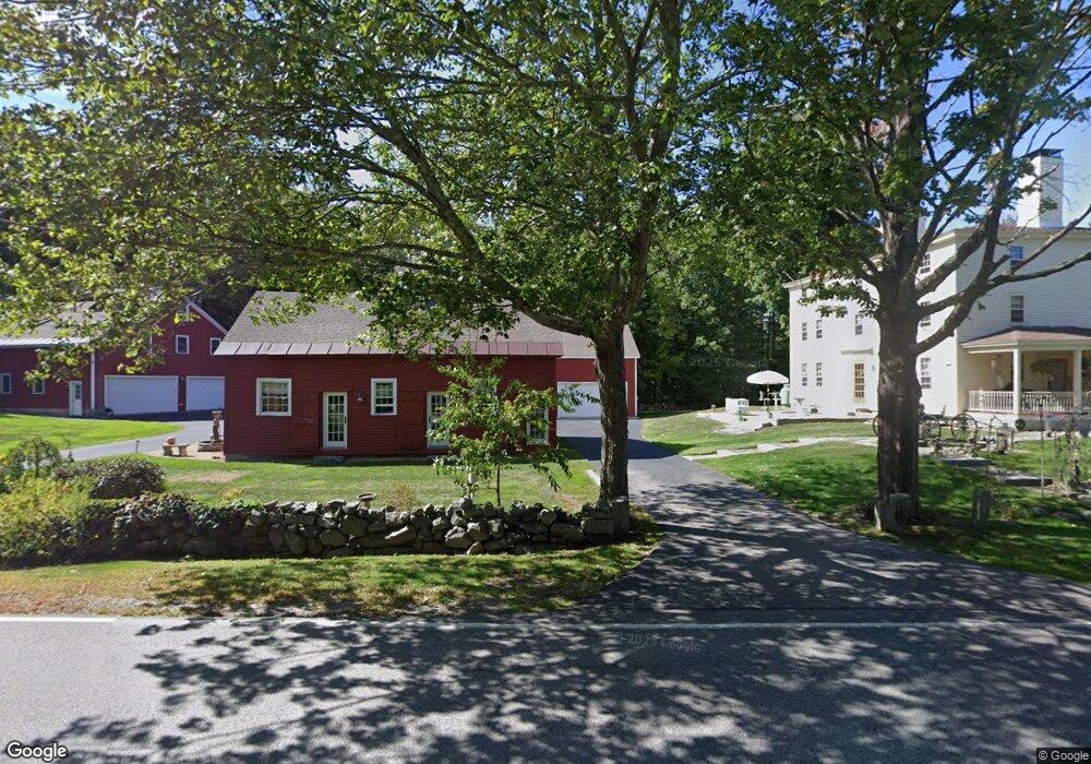
48 Woodland Rd North Hampton, NH 03862
Estimated Value: $1,153,826 - $2,058,000
5
Beds
3
Baths
2,891
Sq Ft
$519/Sq Ft
Est. Value
About This Home
This home is located at 48 Woodland Rd, North Hampton, NH 03862 and is currently estimated at $1,501,707, approximately $519 per square foot. 48 Woodland Rd is a home with nearby schools including North Hampton School, Winnacunnet High School, and Sacred Heart School.
Ownership History
Date
Name
Owned For
Owner Type
Purchase Details
Closed on
Jan 24, 2023
Sold by
Whitcomb Cynthia A
Bought by
Cynthia A Whitcomb Lt
Current Estimated Value
Purchase Details
Closed on
Nov 10, 1993
Bought by
Whitcomb Wayne R and Whitcomb Cynthia A
Create a Home Valuation Report for This Property
The Home Valuation Report is an in-depth analysis detailing your home's value as well as a comparison with similar homes in the area
Home Values in the Area
Average Home Value in this Area
Purchase History
| Date | Buyer | Sale Price | Title Company |
|---|---|---|---|
| Cynthia A Whitcomb Lt | -- | None Available | |
| Whitcomb Wayne R | $225,000 | -- |
Source: Public Records
Mortgage History
| Date | Status | Borrower | Loan Amount |
|---|---|---|---|
| Previous Owner | Whitcomb Wayne R | $320,000 | |
| Previous Owner | Whitcomb Wayne R | $100,000 | |
| Previous Owner | Whitcomb Wayne R | $210,800 |
Source: Public Records
Tax History Compared to Growth
Tax History
| Year | Tax Paid | Tax Assessment Tax Assessment Total Assessment is a certain percentage of the fair market value that is determined by local assessors to be the total taxable value of land and additions on the property. | Land | Improvement |
|---|---|---|---|---|
| 2024 | $12,965 | $1,012,900 | $335,200 | $677,700 |
| 2023 | $12,561 | $1,008,900 | $335,200 | $673,700 |
| 2022 | $11,969 | $697,100 | $216,300 | $480,800 |
| 2021 | $11,551 | $697,100 | $216,300 | $480,800 |
| 2020 | $7,571 | $697,100 | $216,300 | $480,800 |
| 2019 | $11,642 | $697,100 | $216,300 | $480,800 |
| 2018 | $11,321 | $697,100 | $216,300 | $480,800 |
| 2017 | $8,479 | $589,700 | $195,300 | $394,400 |
| 2016 | $9,983 | $580,600 | $195,300 | $385,300 |
| 2015 | $10,149 | $580,600 | $195,300 | $385,300 |
| 2014 | $9,899 | $580,600 | $195,300 | $385,300 |
| 2013 | $9,732 | $581,000 | $195,300 | $385,700 |
Source: Public Records
Map
Nearby Homes
- 12 Runnymede Dr
- 139 Atlantic Ave
- 23 Rockrimmon Rd
- 19 Rockrimmon Rd
- 19 Juniper Ln
- 00 Ocean Blvd
- 15 Atlantic Ave
- 16 Briar Rd
- 17 Pond Path
- 61 Acorn Rd
- 20 Causeway Rd
- 951 Ocean Blvd Unit 7
- 495 South Rd
- 7 Hunter Dr
- 190 Kings Hwy Unit A1
- 182 Kings Hwy
- 78 South Rd
- 221 Atlantic Ave
- 467 High St Unit 22
- 430 High St
- 92 Atlantic Ave
- 44 Woodland Rd
- 94A Atlantic Ave Unit A
- 94 Atlantic Ave
- 94A Atlantic Ave
- 94 Atlantic Ave Unit A
- 94A Atlantic Ave Unit B
- 94A Atlantic Ave Unit 94-B
- 94 Atlantic Ave Unit B
- 26 Shiprock Estate
- 56 Woodland Rd
- 3 River Rd
- 82 Atlantic Ave
- 87 Atlantic Ave
- 96 Atlantic Ave
- 21 Shiprock Rd
- 21 Shiprock Estate
- 53 Woodland Rd
- 59 Woodland Rd
- 78 Atlantic Ave