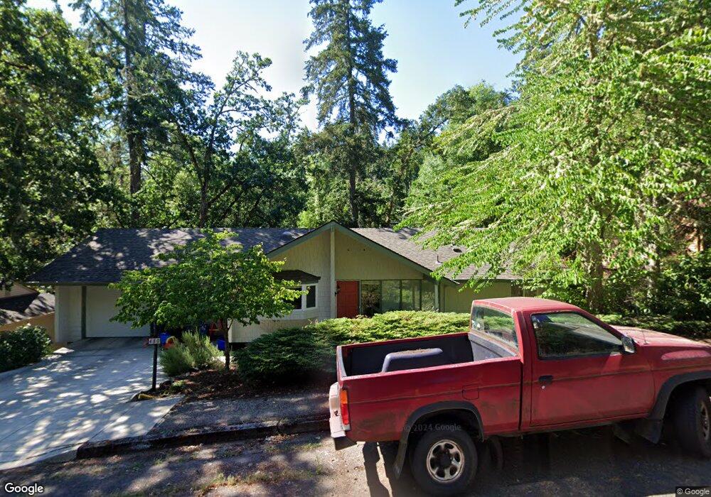
480 Lochmoor Place Unit 1 Eugene, OR 97405
Crest Drive NeighborhoodEstimated Value: $595,000 - $671,000
4
Beds
2
Baths
2,480
Sq Ft
$252/Sq Ft
Est. Value
About This Home
This home is located at 480 Lochmoor Place Unit 1, Eugene, OR 97405 and is currently estimated at $626,168, approximately $252 per square foot. 480 Lochmoor Place Unit 1 is a home located in Lane County with nearby schools including Edgewood Community Elementary School, Spencer Butte Middle School, and South Eugene High School.
Ownership History
Date
Name
Owned For
Owner Type
Purchase Details
Closed on
Jun 24, 2019
Sold by
Green Lewenberg Henry M and Green Lewenberg Harriet
Bought by
Jordan Cynthia A
Current Estimated Value
Home Financials for this Owner
Home Financials are based on the most recent Mortgage that was taken out on this home.
Original Mortgage
$320,000
Outstanding Balance
$280,196
Interest Rate
4%
Mortgage Type
New Conventional
Estimated Equity
$345,972
Purchase Details
Closed on
May 28, 2002
Sold by
Taylor Sharon J and Kocurek Patrick P
Bought by
Lewenberg Henry M and Lewenberg Harriet Green
Create a Home Valuation Report for This Property
The Home Valuation Report is an in-depth analysis detailing your home's value as well as a comparison with similar homes in the area
Home Values in the Area
Average Home Value in this Area
Purchase History
| Date | Buyer | Sale Price | Title Company |
|---|---|---|---|
| Jordan Cynthia A | $400,000 | Cascade Title Co | |
| Lewenberg Henry M | $207,000 | Western Pioneer Title Co |
Source: Public Records
Mortgage History
| Date | Status | Borrower | Loan Amount |
|---|---|---|---|
| Open | Jordan Cynthia A | $320,000 |
Source: Public Records
Tax History Compared to Growth
Tax History
| Year | Tax Paid | Tax Assessment Tax Assessment Total Assessment is a certain percentage of the fair market value that is determined by local assessors to be the total taxable value of land and additions on the property. | Land | Improvement |
|---|---|---|---|---|
| 2025 | $6,589 | $338,200 | -- | -- |
| 2024 | $6,507 | $328,350 | -- | -- |
| 2023 | $6,507 | $318,787 | $0 | $0 |
| 2022 | $6,096 | $309,502 | $0 | $0 |
| 2021 | $5,726 | $300,488 | $0 | $0 |
| 2020 | $5,746 | $291,736 | $0 | $0 |
| 2019 | $5,550 | $283,239 | $0 | $0 |
| 2018 | $5,224 | $266,981 | $0 | $0 |
| 2017 | $4,990 | $266,981 | $0 | $0 |
| 2016 | $4,866 | $259,205 | $0 | $0 |
| 2015 | $4,726 | $251,655 | $0 | $0 |
| 2014 | $4,631 | $244,325 | $0 | $0 |
Source: Public Records
Map
Nearby Homes
- 1065 Brookside Dr
- 396 Brae Burn Dr
- 278 Rockridge Ct
- 602 Startouch Dr
- 653 Brookside Dr
- 0 Pine View Ct Unit 758820410
- 418 Stonewood Dr Unit 418
- 121 Westbrook Way
- 152 Treehill Loop Unit 152
- 151 Treehill Loop Unit 151
- 124 Brae Burn Dr
- 143 Treehill Loop Unit 143
- 223 Trailside Loop Unit 223
- 75 Westbrook Way
- 760 W 40th Ave
- 36 Westbrook Way
- 4046 Normandy Way
- 5159 Solar Heights Dr
- 4200 Oak St
- 806 Sundance St
- 480 Lochmoor Place
- 470 Lochmoor Place
- 490 Lochmoor Place
- 485 Lochmoor Place
- 475 Lochmoor Place
- 460 Lochmoor Place
- 500 Lochmoor Place
- 427 Brookside Dr
- 429 Brookside Dr
- 425 Brookside Dr
- 465 Lochmoor Place
- 4445 Inwood Ln
- 4490 Inwood Ln
- 510 Lochmoor Place
- 440 Lochmoor Place
- 505 Lochmoor Place
- 431 Brookside Dr
- 455 Lochmoor Place
- 4460 Inwood Ln
- 423 Brookside Dr