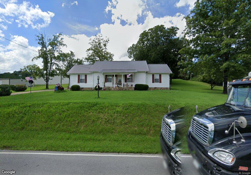
480 N Mohawk Rd Mohawk, TN 37810
Estimated Value: $199,000 - $342,000
3
Beds
3
Baths
1,700
Sq Ft
$149/Sq Ft
Est. Value
About This Home
This home is located at 480 N Mohawk Rd, Mohawk, TN 37810 and is currently estimated at $253,146, approximately $148 per square foot. 480 N Mohawk Rd is a home located in Greene County with nearby schools including McDonald Elementary School, West Greene Middle Schools, and West Greene High School.
Ownership History
Date
Name
Owned For
Owner Type
Purchase Details
Closed on
Jul 2, 2015
Sold by
Carpenter Larry
Bought by
Bible Arthur M Life Estate
Current Estimated Value
Purchase Details
Closed on
Mar 30, 2005
Sold by
Cupp Jack D
Bought by
Carpenter Larry
Purchase Details
Closed on
Apr 23, 2004
Sold by
Cupp Jack D
Bought by
Rogers Donald C
Home Financials for this Owner
Home Financials are based on the most recent Mortgage that was taken out on this home.
Original Mortgage
$510,000
Interest Rate
5.36%
Create a Home Valuation Report for This Property
The Home Valuation Report is an in-depth analysis detailing your home's value as well as a comparison with similar homes in the area
Purchase History
| Date | Buyer | Sale Price | Title Company |
|---|---|---|---|
| Bible Arthur M Life Estate | $105,000 | -- | |
| Carpenter Larry | $105,000 | -- | |
| Rogers Donald C | $75,000 | -- |
Source: Public Records
Mortgage History
| Date | Status | Borrower | Loan Amount |
|---|---|---|---|
| Previous Owner | Rogers Donald C | $510,000 |
Source: Public Records
Tax History
| Year | Tax Paid | Tax Assessment Tax Assessment Total Assessment is a certain percentage of the fair market value that is determined by local assessors to be the total taxable value of land and additions on the property. | Land | Improvement |
|---|---|---|---|---|
| 2025 | -- | $45,125 | $4,575 | $40,550 |
| 2024 | $745 | $45,125 | $4,575 | $40,550 |
| 2023 | $745 | $45,125 | $0 | $0 |
| 2022 | $57,200 | $28,375 | $3,375 | $25,000 |
| 2021 | $572 | $28,375 | $3,375 | $25,000 |
| 2020 | $572 | $28,375 | $3,375 | $25,000 |
| 2019 | $572 | $28,375 | $3,375 | $25,000 |
| 2018 | $572 | $28,375 | $3,375 | $25,000 |
| 2017 | $473 | $23,950 | $3,375 | $20,575 |
| 2016 | $449 | $23,950 | $3,375 | $20,575 |
| 2015 | $449 | $23,950 | $3,375 | $20,575 |
| 2014 | -- | $23,950 | $3,375 | $20,575 |
Source: Public Records
Map
Nearby Homes
- 0 Gap Creek Rd Unit 22620366
- 915 Porter Kite Rd
- 1210 Oasis Rd
- 1365 Mohawk Ridge Rd
- 200 Dogwood Cir
- 330 Oasis Rd
- Tbd Hogan Ln
- 15460 W Andrew Johnson Hwy
- Tbd Copperhead Hollow Rd Unit LotWP001
- 7 W Andrew Johnson Hwy
- 15 Stone Mountain Rd
- Tbd Stone Mountain Rd
- 750 Tom White Hollow Rd
- 415 Stone Mountain Rd
- 40 Iron Bridge Rd
- 635 McDonald Rd
- 1365 Stone Mountain Rd
- 860 Yellow Springs Rd
- 995 Gilbreath Mill Rd
- 1040 Yellow Springs Rd
- 450 N Mohawk Rd
- 540 N Mohawk Rd
- 606 Idell Rd
- 775 N Mohawk Rd
- 590 N Mohawk Rd
- 536 Idell Rd
- 0 Idell Rd
- 0 Idell Rd
- 611 Idell Rd
- 611 Idell Rd
- 461 Idell Rd
- 326 Idell Rd
- 691 Idell Rd
- LOT 18 Gap Creek Rd
- 10 Gap Creek Rd
- 1 Gap Creek Rd
- 12455 W Andrew Johnson Hwy
- Lot 6 Gap Creek Rd
- Lot 4 Gap Creek Rd
- 65 Gap Creek
Your Personal Tour Guide
Ask me questions while you tour the home.