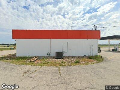
4804 S Highway 61 Muscatine, IA 52761
--
Bed
--
Bath
2,386
Sq Ft
1.21
Acres
About This Home
This home is located at 4804 S Highway 61, Muscatine, IA 52761. 4804 S Highway 61 is a home located in Muscatine County with nearby schools including Susan Clark Junior High School and Muscatine High School.
Ownership History
Date
Name
Owned For
Owner Type
Purchase Details
Closed on
Oct 19, 2022
Sold by
Aviya Llc
Bought by
Rp Brothers Llc
Home Financials for this Owner
Home Financials are based on the most recent Mortgage that was taken out on this home.
Original Mortgage
$475,000
Outstanding Balance
$447,369
Interest Rate
5.89%
Mortgage Type
New Conventional
Purchase Details
Closed on
Oct 31, 2016
Sold by
Curry Jason and Curry Hope
Bought by
Aviya Llc
Home Financials for this Owner
Home Financials are based on the most recent Mortgage that was taken out on this home.
Original Mortgage
$490,000
Interest Rate
3.95%
Mortgage Type
Future Advance Clause Open End Mortgage
Purchase Details
Closed on
Oct 3, 2014
Sold by
Hartsock Ladonna J
Bought by
Curry Jason and Curry Hope
Create a Home Valuation Report for This Property
The Home Valuation Report is an in-depth analysis detailing your home's value as well as a comparison with similar homes in the area
Home Values in the Area
Average Home Value in this Area
Purchase History
| Date | Buyer | Sale Price | Title Company |
|---|---|---|---|
| Rp Brothers Llc | $350,000 | -- | |
| Aviya Llc | $300,000 | None Available | |
| Curry Jason | $500,000 | None Available |
Source: Public Records
Mortgage History
| Date | Status | Borrower | Loan Amount |
|---|---|---|---|
| Open | Rp Brothers Llc | $475,000 | |
| Previous Owner | Aviya Llc | $490,000 | |
| Closed | Rp Brothers Llc | $275,000 |
Source: Public Records
Tax History Compared to Growth
Tax History
| Year | Tax Paid | Tax Assessment Tax Assessment Total Assessment is a certain percentage of the fair market value that is determined by local assessors to be the total taxable value of land and additions on the property. | Land | Improvement |
|---|---|---|---|---|
| 2024 | $8,917 | $373,990 | $52,940 | $321,050 |
| 2023 | $8,863 | $350,210 | $52,940 | $297,270 |
| 2022 | $7,192 | $336,450 | $48,620 | $287,830 |
| 2021 | $7,129 | $303,940 | $48,620 | $255,320 |
| 2020 | $6,889 | $297,380 | $48,620 | $248,760 |
| 2019 | $6,589 | $0 | $0 | $0 |
| 2018 | $6,520 | $0 | $0 | $0 |
| 2017 | $5,593 | $261,770 | $0 | $0 |
| 2016 | $5,606 | $261,770 | $0 | $0 |
| 2015 | $5,606 | $235,620 | $0 | $0 |
| 2014 | $5,578 | $235,620 | $0 | $0 |
Source: Public Records
Map
Nearby Homes
- 6702 Mcintire Rd
- 6713 Wellington Dr
- 122 Cedar St
- 102 Summer Place
- 203 Meadow View Ln
- 121 Turkey Rd
- 2282 Mittman Rd
- 0 Unit 24-52
- 1034 Kammerer Ct
- 2208 Sampson St
- 1605 Indiana St
- 1908 Sampson St
- 1915 Demorest Ave
- 1706 Baker Ave
- 915 Nebraska St
- 609 Liberty St
- 216 Clinton St
- 17138 County Road X61
- 0 Towhead Island Unit 23-716
- 3120 Linden Ln
- 4804 S Highway 61
- 4804 S Highway 61
- 4810 U S 61
- 5010 67th Ave W
- 5020 67th Ave W
- 6703 51st St S
- 6707 51st St S
- 6801 51st St S
- 6805 51st St S
- 6809 51st St S
- 6813 51st St S
- 5102 67th Ave W
- 6704 51st St S
- 6708 51st St S
- 6802 51st St S
- 6806 51st St S
- 6810 51st St S
- 6501 49th St S
- 6814 51st St S
- 6705 52nd St S