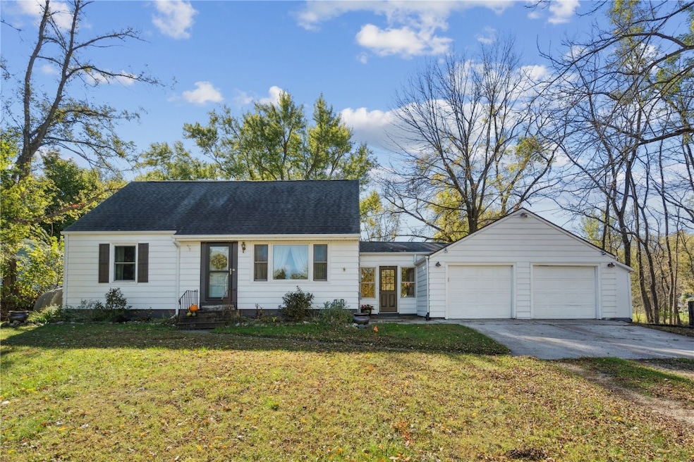
4809 Mcgowan Dr Cedar Rapids, IA 52403
Estimated payment $1,716/month
Highlights
- Deck
- Main Floor Primary Bedroom
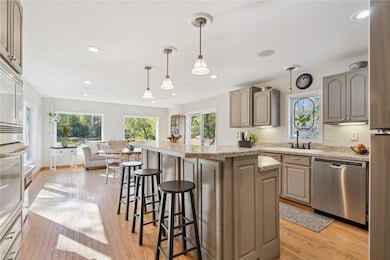
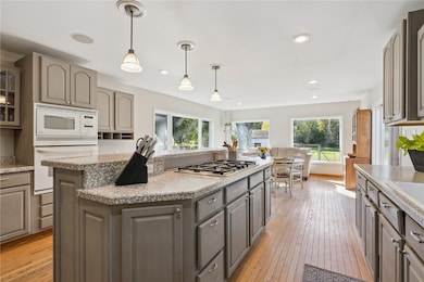
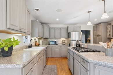
- Eat-In Kitchen
- Wooded Lot
- 2 Car Attached Garage
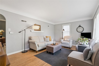
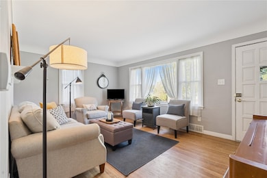
- Living Room
About This Home
Looking for a property in Cedar Rapids but want to feel like you live in the country? This is the property for you! Featuring 3 bedrooms 1 and a half bathrooms on almost an acre of land this property is ready for a new family to enjoy and make memories for many years to come. Enjoy the views of your beautiful wooded back yard while having a cup of coffee at your dining room table in the winter or tend to your garden while enjoying the nice peace and quiet in the spring. This home also features a spacious kitchen and a beautiful living space all with original hard wood floors! So what are you waiting for? Come take a look at this property today and start making new memories before you know it!
Home Details
Home Type
- Single Family
Est. Annual Taxes
- $2,882
Year Built
- Built in 1951
Lot Details
- 0.94 Acre Lot
- Fenced
- Wooded Lot
Parking
- 2 Car Attached Garage
- Garage Door Opener
- Off-Street Parking
Home Design
- Brick Exterior Construction
- Block Foundation
- Frame Construction
- Vinyl Siding
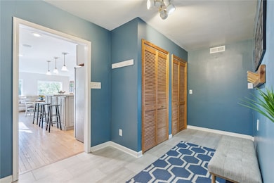
Interior Spaces
- 1.5-Story Property
- Wired For Sound
- Living Room
- Basement Fills Entire Space Under The House
Kitchen
- Eat-In Kitchen
- Range
- Microwave
- Dishwasher
- Disposal
Bedrooms and Bathrooms
- 3 Bedrooms
- Primary Bedroom on Main
Laundry
- Dryer
- Washer
Outdoor Features
- Deck
- Shed
Schools
- Erskine Elementary School
- Mckinley Middle School
- Washington High School
Utilities
- Forced Air Heating and Cooling System
- Heating System Uses Gas
- Well
- Gas Water Heater
- Water Softener is Owned
Listing and Financial Details
- Home warranty included in the sale of the property
- Assessor Parcel Number 151930400400000
Map
Home Values in the Area
Average Home Value in this Area
Tax History
| Year | Tax Paid | Tax Assessment Tax Assessment Total Assessment is a certain percentage of the fair market value that is determined by local assessors to be the total taxable value of land and additions on the property. | Land | Improvement |
|---|---|---|---|---|
| 2025 | $2,802 | $276,400 | $49,000 | $227,400 |
| 2024 | $2,646 | $257,600 | $49,000 | $208,600 |
| 2023 | $2,646 | $257,600 | $49,000 | $208,600 |
| 2022 | $2,602 | $196,400 | $49,000 | $147,400 |
| 2021 | $2,588 | $196,400 | $49,000 | $147,400 |
| 2020 | $2,588 | $180,800 | $34,300 | $146,500 |
| 2019 | $2,352 | $168,300 | $34,300 | $134,000 |
| 2018 | $2,296 | $168,300 | $34,300 | $134,000 |
| 2017 | $2,296 | $161,100 | $34,300 | $126,800 |
| 2016 | $2,366 | $161,100 | $34,300 | $126,800 |
| 2015 | $2,378 | $161,100 | $34,300 | $126,800 |
| 2014 | $2,250 | $161,100 | $34,300 | $126,800 |
| 2013 | $2,202 | $161,100 | $34,300 | $126,800 |
Property History
| Date | Event | Price | List to Sale | Price per Sq Ft |
|---|---|---|---|---|
| 11/06/2025 11/06/25 | Price Changed | $280,000 | -6.6% | $141 / Sq Ft |
| 10/15/2025 10/15/25 | For Sale | $299,900 | -- | $151 / Sq Ft |
Purchase History
| Date | Type | Sale Price | Title Company |
|---|---|---|---|
| Warranty Deed | $158,500 | None Available |
Mortgage History
| Date | Status | Loan Amount | Loan Type |
|---|---|---|---|
| Open | $127,200 | Purchase Money Mortgage |
Source: Cedar Rapids Area Association of REALTORS®
MLS Number: 2508813
APN: 15193-04004-00000
Disclaimer: Certain information contained herein is derived from information provided by parties other than Homes.com. All information provided is deemed reliable, but is not guaranteed to be accurate and should be independently verified.
![]() IDX information is provided exclusively for personal, non-commercial use, and may not be used for any purpose other than to identify prospective properties consumers may be interested in purchasing.
IDX information is provided exclusively for personal, non-commercial use, and may not be used for any purpose other than to identify prospective properties consumers may be interested in purchasing.
Information is deemed reliable but not guaranteed.
- 6936 Hackberry Loop
- 6932 Hackberry Loop
- 6849 Pumpkin Patch Blvd
- 6485 Cabbage Patch Place
- 6876 Bottom Land Ln
- 6859 Pumpkin Patch Blvd
- 6934 Hackberry Loop
- 5029 Broadlawn Dr SE
- 5658 Meadow Grass Cir SE
- 5750 Meadow Grass Cir SE
- 5638 Meadow Grass Cir SE
- 819 Tumble Grass Ct SE
- 827 Tumble Grass Ct SE
- 4725 Green Valley Dr SE
- 808 Green Valley Terrace SE
- 921 Rosedale Rd SE
- 725 E Post Ct SE Unit 725C
- 717 E Post Ct SE Unit 717C
- 701 E Post Ct SE Unit 701E
- 705 E Post Rd SE Unit 1
- 903 38th St SE
- 2251 Pleasantview Dr
- 1200 Meadowview Dr
- 1241 Grand Ave
- 330-340 29th St SE
- 2026 1st Ave NE
- 1953 1st Ave SE Unit 202
- 1 Chapel Ridge Cir
- 1820 A Ave NE
- 4200 Armar Dr SE
- 255 38th Street Dr SE
- 210 32nd St NE
- 1569 1st Ave SE Unit 4
- 1537 1st Ave SE
- 906 10th St SE
- 4580 Tama St SE
- 1400 2nd Ave SW
- 205 40th Street Dr SE
- 850 Bridgit Ln SE
- 810-830 Bridgit Ln SE
