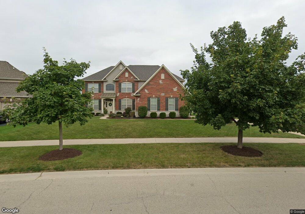
481 Bloomfield Cir W Oswego, IL 60543
South Oswego NeighborhoodEstimated Value: $658,000 - $724,000
4
Beds
4
Baths
4,295
Sq Ft
$159/Sq Ft
Est. Value
About This Home
This home is located at 481 Bloomfield Cir W, Oswego, IL 60543 and is currently estimated at $684,418, approximately $159 per square foot. 481 Bloomfield Cir W is a home located in Kendall County with nearby schools including Southbury Elementary School, Traughber Junior High School, and Oswego High School.
Ownership History
Date
Name
Owned For
Owner Type
Purchase Details
Closed on
Dec 30, 2020
Sold by
Rosenow Eric R and Rosenow Susan M
Bought by
Rosenow Living Trust and Rosenow
Current Estimated Value
Purchase Details
Closed on
Jan 14, 2009
Sold by
Faganel Construction Management Banbury
Bought by
Rosenow Eric and Rosenow Susan
Home Financials for this Owner
Home Financials are based on the most recent Mortgage that was taken out on this home.
Original Mortgage
$375,920
Interest Rate
5.19%
Mortgage Type
Purchase Money Mortgage
Create a Home Valuation Report for This Property
The Home Valuation Report is an in-depth analysis detailing your home's value as well as a comparison with similar homes in the area
Home Values in the Area
Average Home Value in this Area
Purchase History
| Date | Buyer | Sale Price | Title Company |
|---|---|---|---|
| Rosenow Living Trust | -- | None Listed On Document | |
| Rosenow Eric | $470,000 | Chicago Title Insurance Co |
Source: Public Records
Mortgage History
| Date | Status | Borrower | Loan Amount |
|---|---|---|---|
| Previous Owner | Rosenow Eric | $375,920 |
Source: Public Records
Tax History Compared to Growth
Tax History
| Year | Tax Paid | Tax Assessment Tax Assessment Total Assessment is a certain percentage of the fair market value that is determined by local assessors to be the total taxable value of land and additions on the property. | Land | Improvement |
|---|---|---|---|---|
| 2024 | $16,615 | $212,471 | $30,192 | $182,279 |
| 2023 | $15,612 | $191,415 | $27,200 | $164,215 |
| 2022 | $15,612 | $178,893 | $25,421 | $153,472 |
| 2021 | $15,082 | $167,190 | $23,758 | $143,432 |
| 2020 | $14,337 | $157,726 | $22,413 | $135,313 |
| 2019 | $14,694 | $159,079 | $22,413 | $136,666 |
| 2018 | $14,703 | $152,755 | $21,522 | $131,233 |
| 2017 | $14,737 | $149,760 | $21,100 | $128,660 |
| 2016 | $14,916 | $149,406 | $27,095 | $122,311 |
| 2015 | $14,436 | $138,339 | $25,088 | $113,251 |
| 2014 | -- | $138,339 | $25,088 | $113,251 |
| 2013 | -- | $138,339 | $25,088 | $113,251 |
Source: Public Records
Map
Nearby Homes
- 94 Templeton Dr
- 80 Stonehill Rd
- 706 Springside Ct
- 809 Canton Dr
- 210 Dorset Ave
- 748 Juniper St
- 521 Litchfield Way
- 639 Vista Dr
- 616 Briarwood Ln
- 177 Franklin St
- 395 Danforth Dr
- 101 Bell Ct
- 2489 Semillon St
- 2486 Semillon St
- 2319 Hirsch Dr
- 612 Murdock Place
- 2492 Semillon St
- 2259 Riesling Rd
- 2255 Riesling Rd
- 2253 Riesling Rd
- 479 Bloomfield Cir W
- 304 Amston Ct
- 485 Bloomfield Cir W
- 477 W Bloomfield Lot#19 Cir
- 306 Amston Ct
- 484 Bloomfield Cir W
- 486 Bloomfield Cir W
- 482 Bloomfield Cir W
- 487 Bloomfield Cir W
- 303 Amston Ct
- 475 Bloomfield Cir W
- 308 Amston Ct
- 488 Bloomfield Cir W
- 480 Bloomfield Cir W
- 305 Amston Ct
- 307 Amston Ct
- 473 Bloomfield Cir W
- 489 Bloomfield Cir W
- 490 Bloomfield Cir W
- 211 Redding Ct