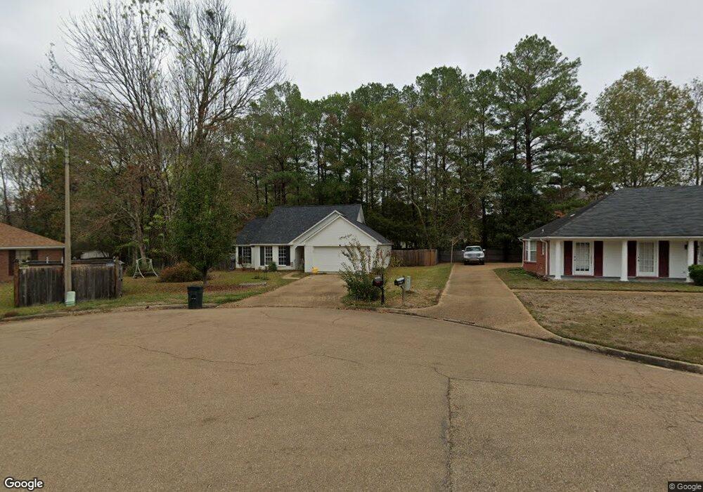
481 Mockingbird Ln Madison, MS 39110
Estimated Value: $236,406 - $290,000
3
Beds
5
Baths
1,778
Sq Ft
$146/Sq Ft
Est. Value
About This Home
This home is located at 481 Mockingbird Ln, Madison, MS 39110 and is currently estimated at $260,352, approximately $146 per square foot. 481 Mockingbird Ln is a home located in Madison County with nearby schools including Madison Avenue Upper Elementary School, Madison Avenue Elementary, and Madison Middle School.
Ownership History
Date
Name
Owned For
Owner Type
Purchase Details
Closed on
Dec 5, 2025
Sold by
Jmh Enterprises Inc
Bought by
Hines Amanda Meadows and Hines Joseph M
Current Estimated Value
Purchase Details
Closed on
Feb 6, 2024
Sold by
Chism Dennis R and Chism Lisa G
Bought by
Jmh Enterprises Inc
Home Financials for this Owner
Home Financials are based on the most recent Mortgage that was taken out on this home.
Original Mortgage
$213,032
Interest Rate
6.61%
Mortgage Type
Credit Line Revolving
Create a Home Valuation Report for This Property
The Home Valuation Report is an in-depth analysis detailing your home's value as well as a comparison with similar homes in the area
Home Values in the Area
Average Home Value in this Area
Purchase History
| Date | Buyer | Sale Price | Title Company |
|---|---|---|---|
| Hines Amanda Meadows | -- | None Listed On Document | |
| Jmh Enterprises Inc | -- | Benchmark Title |
Source: Public Records
Mortgage History
| Date | Status | Borrower | Loan Amount |
|---|---|---|---|
| Previous Owner | Jmh Enterprises Inc | $213,032 |
Source: Public Records
Tax History
| Year | Tax Paid | Tax Assessment Tax Assessment Total Assessment is a certain percentage of the fair market value that is determined by local assessors to be the total taxable value of land and additions on the property. | Land | Improvement |
|---|---|---|---|---|
| 2025 | $2,194 | $18,828 | $0 | $0 |
| 2024 | $1,162 | $12,543 | $0 | $0 |
| 2023 | $1,162 | $12,543 | $0 | $0 |
| 2022 | $1,162 | $12,543 | $0 | $0 |
| 2021 | $1,109 | $12,089 | $0 | $0 |
| 2020 | $1,109 | $12,089 | $0 | $0 |
| 2019 | $1,109 | $12,089 | $0 | $0 |
| 2018 | $1,109 | $12,089 | $0 | $0 |
| 2017 | $1,088 | $11,907 | $0 | $0 |
| 2016 | $1,088 | $11,907 | $0 | $0 |
| 2015 | $1,088 | $11,907 | $0 | $0 |
| 2014 | $1,211 | $12,969 | $0 | $0 |
Source: Public Records
Map
Nearby Homes
- 268 Sundial Rd
- 202 Saint Pierre Cove
- 106 Normandy Ct
- 441 W Oak Cir
- 325 Mockingbird Ln
- 213 S Woodcreek Rd
- 717 Wildberry Pointe
- 865 Wellington Way
- 114 Anna Cove
- 116 Anna Cove
- 138 Oakmont Dr
- 216 Woodland Brook Dr
- 112 Woodsong Way
- 0 Christmas Ln
- 1205 Woodberry Dr
- 1241 Woodberry Dr
- 169 Saint Ives Dr
- 0 Deerfield Dr Unit 4140244
- 129 Victoria Place
- 133 Oak Ridge Cir
- 485 Mockingbird Ln
- 477 Mockingbird Ln
- 142 St Regis Dr
- 144 St Regis Dr
- 631 Huntington Dr
- 632 Huntington Dr
- 140 St Regis Dr
- 469 Mockingbird Ln
- 143 St Regis Dr
- 626 Huntington Dr
- 625 Huntington Dr
- 465 Mockingbird Ln
- 138 St Regis Dr
- 704 Cedar Pointe
- 464 Mockingbird Ln
- 620 Huntington Dr
- 461 Mockingbird Ln
- 106 St Livie Ct
- 613 Huntington Dr
- 460 Mockingbird Ln
Your Personal Tour Guide
Ask me questions while you tour the home.