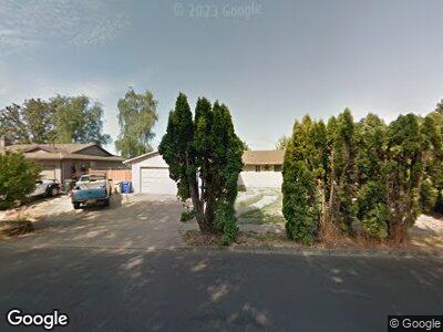
481 S 2nd Ave Cornelius, OR 97113
Estimated Value: $465,114 - $479,000
3
Beds
2
Baths
1,432
Sq Ft
$328/Sq Ft
Est. Value
About This Home
This home is located at 481 S 2nd Ave, Cornelius, OR 97113 and is currently estimated at $470,029, approximately $328 per square foot. 481 S 2nd Ave is a home located in Washington County with nearby schools including Fern Hill Elementary School, Neil Armstrong Middle School, and Tom McCall Upper Elementary School.
Ownership History
Date
Name
Owned For
Owner Type
Purchase Details
Closed on
Jan 3, 1996
Sold by
Brown Lyman Mangas and Brown Anne Elizabeth
Bought by
Jaquez David Rios
Current Estimated Value
Home Financials for this Owner
Home Financials are based on the most recent Mortgage that was taken out on this home.
Original Mortgage
$103,750
Outstanding Balance
$9,571
Interest Rate
7.36%
Estimated Equity
$465,648
Create a Home Valuation Report for This Property
The Home Valuation Report is an in-depth analysis detailing your home's value as well as a comparison with similar homes in the area
Home Values in the Area
Average Home Value in this Area
Purchase History
| Date | Buyer | Sale Price | Title Company |
|---|---|---|---|
| Jaquez David Rios | $107,000 | Oregon Title Insurance Co |
Source: Public Records
Mortgage History
| Date | Status | Borrower | Loan Amount |
|---|---|---|---|
| Open | Jaquez David Rios | $103,750 |
Source: Public Records
Tax History Compared to Growth
Tax History
| Year | Tax Paid | Tax Assessment Tax Assessment Total Assessment is a certain percentage of the fair market value that is determined by local assessors to be the total taxable value of land and additions on the property. | Land | Improvement |
|---|---|---|---|---|
| 2025 | $3,705 | $207,040 | -- | -- |
| 2024 | $3,383 | $201,010 | -- | -- |
| 2023 | $3,383 | $195,160 | $0 | $0 |
| 2022 | $2,998 | $195,160 | $0 | $0 |
| 2021 | $2,962 | $183,970 | $0 | $0 |
| 2020 | $2,951 | $178,620 | $0 | $0 |
| 2019 | $2,887 | $173,420 | $0 | $0 |
| 2018 | $2,798 | $168,370 | $0 | $0 |
| 2017 | $2,711 | $163,470 | $0 | $0 |
| 2016 | $2,635 | $158,710 | $0 | $0 |
| 2015 | $2,479 | $154,090 | $0 | $0 |
| 2014 | $2,394 | $149,610 | $0 | $0 |
Source: Public Records
Map
Nearby Homes
- 385 S Cherry Dr
- 4413 Settlers Loop
- 1502 Frontier Cir
- 689 S Alpine St
- 738 N Adair St Unit 6
- 1835 Tamarack Ct
- 285 N 7th Ave
- 3839 Pacific Ave Unit 302
- 925 S Magnolia St
- 449 S 12th Ave
- 1126 S Jasper St
- 3831 Pacific Ave Unit c14
- 1343 S 11th Place
- 1371 S Ginger Ct
- 1450 S Cherry St
- 570 N 10th St Unit 29
- 1599 S Alpine St
- 570 N 10th Ave Unit 21
- 570 N 10th Ave Unit 75
- 570 N 10th Ave Unit 6
- 481 S 2nd Ave
- 465 S Dogwood Cir
- 497 S 2nd Ave
- 439 S Dogwood Cir
- 523 S Tarrybrook Place
- 478 S 2nd Ave Unit 1
- 478 S 2nd Ave
- 517 S Tarrybrook Dr
- 490 S 2nd Ave
- 423 S Dogwood Cir
- 539 S Tarrybrook Place
- 200 S Dogwood Dr
- 245 S Dogwood Dr
- 365 S Dogwood Dr
- 224 S Dogwood Dr
- 417 S Dogwood Cir
- 236 S Tarrybrook Dr
- 565 S Tarrybrooke Place
- 565 S Tarrybrook Place
- 399 S Dogwood Cir