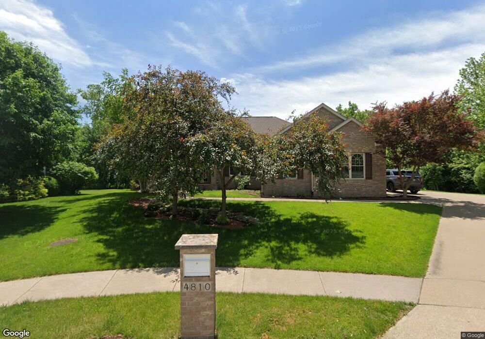
4810 Fairhaven Rd Davenport, IA 52807
North Side NeighborhoodEstimated Value: $493,000 - $597,000
4
Beds
6
Baths
2,209
Sq Ft
$239/Sq Ft
Est. Value
About This Home
This home is located at 4810 Fairhaven Rd, Davenport, IA 52807 and is currently estimated at $528,094, approximately $239 per square foot. 4810 Fairhaven Rd is a home located in Scott County with nearby schools including Jones Park Elementary School, Eisenhower Elementary School, and Casey County Middle School.
Ownership History
Date
Name
Owned For
Owner Type
Purchase Details
Closed on
May 23, 2024
Sold by
Byrne Terrence F and Byrne Elaine V
Bought by
Davis Michael A and Davis Kimberly A
Current Estimated Value
Home Financials for this Owner
Home Financials are based on the most recent Mortgage that was taken out on this home.
Original Mortgage
$508,800
Outstanding Balance
$501,510
Interest Rate
7.1%
Mortgage Type
VA
Estimated Equity
$26,584
Create a Home Valuation Report for This Property
The Home Valuation Report is an in-depth analysis detailing your home's value as well as a comparison with similar homes in the area
Home Values in the Area
Average Home Value in this Area
Purchase History
| Date | Buyer | Sale Price | Title Company |
|---|---|---|---|
| Davis Michael A | $509,000 | None Listed On Document |
Source: Public Records
Mortgage History
| Date | Status | Borrower | Loan Amount |
|---|---|---|---|
| Open | Davis Michael A | $508,800 |
Source: Public Records
Tax History Compared to Growth
Tax History
| Year | Tax Paid | Tax Assessment Tax Assessment Total Assessment is a certain percentage of the fair market value that is determined by local assessors to be the total taxable value of land and additions on the property. | Land | Improvement |
|---|---|---|---|---|
| 2025 | $570 | $507,320 | $63,270 | $444,050 |
| 2024 | $7,994 | $468,850 | $63,270 | $405,580 |
| 2023 | $8,334 | $468,850 | $63,270 | $405,580 |
| 2022 | $8,228 | $399,060 | $57,520 | $341,540 |
| 2021 | $8,228 | $392,370 | $57,520 | $334,850 |
| 2020 | $7,678 | $362,230 | $57,520 | $304,710 |
| 2019 | $7,710 | $352,190 | $57,520 | $294,670 |
| 2018 | $7,322 | $352,190 | $57,520 | $294,670 |
| 2017 | $1,903 | $342,140 | $57,520 | $284,620 |
| 2016 | $7,302 | $342,140 | $0 | $0 |
| 2015 | $7,302 | $339,670 | $0 | $0 |
| 2014 | $7,350 | $339,670 | $0 | $0 |
| 2013 | $7,220 | $0 | $0 | $0 |
| 2012 | -- | $312,160 | $65,250 | $246,910 |
Source: Public Records
Map
Nearby Homes
- 4919 Lorton Ave
- 2916 E 45th Ct
- 2924 E 45th Ct
- 2919 E 44th Ct
- 2422 E 51st St Unit E
- 2403 E 51st St Unit 102E
- 2321 E 47th St
- 2318 E 46th St
- 4005 Forest Rd
- 4230 Jersey Ridge Rd
- 2203 E 46th St
- 2723 E 58th St
- 4406 Belle Ave
- 1960 E 50th Ct
- 4554 Bunker Hill Dr
- 1120 Terrace Park Dr
- 4324 Spring St
- 5811 Duggleby Ave
- 2506 E 35th Street Ct
- 4600 Eastern Ave
- 4810 Fairhaven Ct
- 4802 Fairhaven Rd
- 4802 Fairhaven Ct
- 4816 Fairhaven Rd
- 4816 Fairhaven Ct
- 4805 Fairhaven Ct
- 4822 Fairhaven Ct
- 4822 Fairhaven Ct
- 4829 Fairhaven Ct
- 4805 Fairhaven Rd
- 4829 Fairhaven Rd
- 4828 Fairhaven Rd
- 4841 Fairhaven Ct
- 4841 Fairhaven Rd
- 4834 Fairhaven Ct
- 3006 E 46th St
- 4834 Fairhaven Ct
- 4840 Fairhaven Ct
- 4840 Fairhaven Ct
- 2916 E 46th St