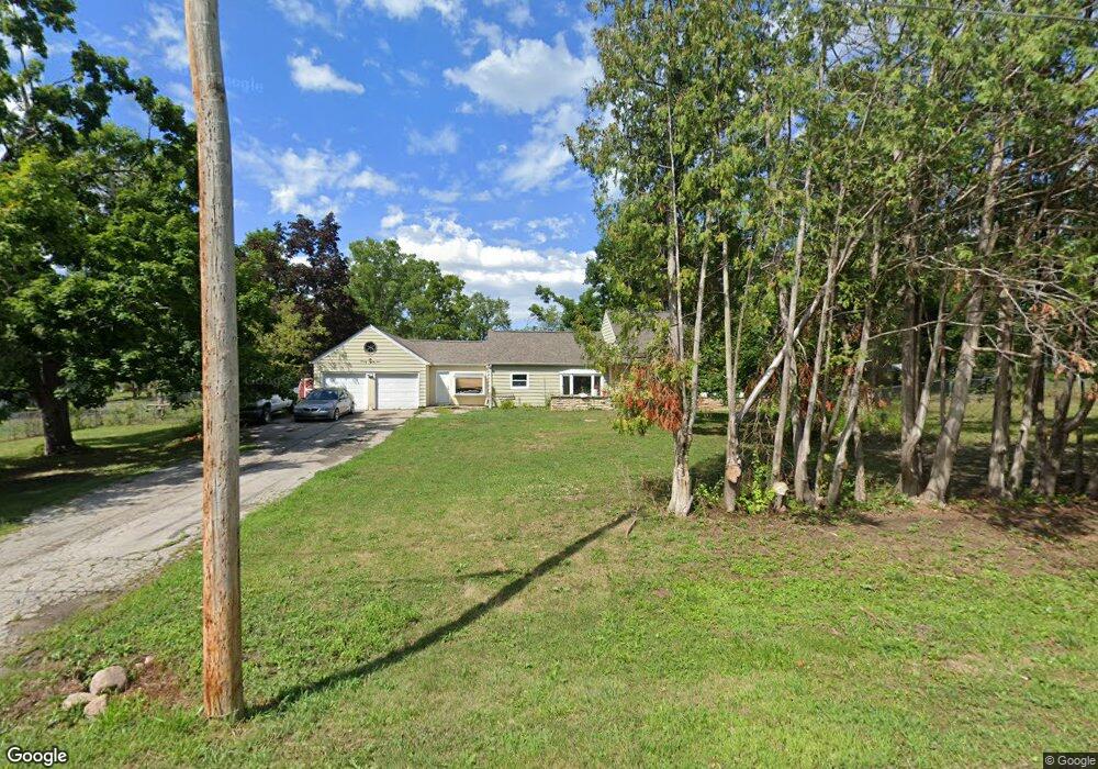
4810 Mcgowan Dr Cedar Rapids, IA 52403
Estimated Value: $257,000 - $316,000
3
Beds
2
Baths
1,858
Sq Ft
$155/Sq Ft
Est. Value
About This Home
This home is located at 4810 Mcgowan Dr, Cedar Rapids, IA 52403 and is currently estimated at $287,501, approximately $154 per square foot. 4810 Mcgowan Dr is a home located in Linn County with nearby schools including Erskine Elementary School, McKinley STEAM Academy, and George Washington High School.
Ownership History
Date
Name
Owned For
Owner Type
Purchase Details
Closed on
Mar 11, 2022
Sold by
Platten Keith P
Bought by
Platten Nicholas
Current Estimated Value
Home Financials for this Owner
Home Financials are based on the most recent Mortgage that was taken out on this home.
Original Mortgage
$121,250
Outstanding Balance
$112,470
Interest Rate
3.92%
Mortgage Type
New Conventional
Estimated Equity
$175,031
Purchase Details
Closed on
Jun 29, 2000
Sold by
Mcgowan Garald Jon
Bought by
Melchert Dean J and Melchert Malissa E
Home Financials for this Owner
Home Financials are based on the most recent Mortgage that was taken out on this home.
Original Mortgage
$91,600
Interest Rate
9.99%
Purchase Details
Closed on
Oct 23, 1998
Sold by
Sramek James F and Sramek Jeanne T
Bought by
Sramek James F and Sramek Jeanne T
Create a Home Valuation Report for This Property
The Home Valuation Report is an in-depth analysis detailing your home's value as well as a comparison with similar homes in the area
Purchase History
| Date | Buyer | Sale Price | Title Company |
|---|---|---|---|
| Platten Nicholas | $125,000 | None Listed On Document | |
| Melchert Dean J | $114,000 | -- | |
| Sramek James F | -- | -- |
Source: Public Records
Mortgage History
| Date | Status | Borrower | Loan Amount |
|---|---|---|---|
| Open | Platten Nicholas | $121,250 | |
| Previous Owner | Melchert Dean J | $91,600 | |
| Closed | Melchert Dean J | $22,900 |
Source: Public Records
Tax History
| Year | Tax Paid | Tax Assessment Tax Assessment Total Assessment is a certain percentage of the fair market value that is determined by local assessors to be the total taxable value of land and additions on the property. | Land | Improvement |
|---|---|---|---|---|
| 2025 | $2,906 | $267,000 | $54,000 | $213,000 |
| 2024 | $2,764 | $249,000 | $54,000 | $195,000 |
| 2023 | $2,764 | $249,000 | $54,000 | $195,000 |
| 2022 | $2,720 | $196,000 | $54,000 | $142,000 |
| 2021 | $2,654 | $196,000 | $54,000 | $142,000 |
| 2020 | $2,654 | $176,600 | $37,000 | $139,600 |
| 2019 | $2,424 | $164,700 | $37,000 | $127,700 |
Source: Public Records
Map
Nearby Homes
- 600 Carlton Rd SE
- 6932 Hackberry Loop
- 6934 Hackberry Loop
- 5658 Meadow Grass Cir SE
- 5700 Meadow Grass Cir SE
- 5750 Meadow Grass Cir SE
- 1839-41 Mount Vernon Rd SE
- 5638 Meadow Grass Cir SE
- 819 Tumble Grass Ct SE
- 827 Tumble Grass Ct SE
- 5997 Meadow Grass Cir SE
- 394 E Post Rd SE
- 1807 Aspen Cir SE
- 4018 Dalewood Ave SE
- 645 40th St SE
- 3831 Tomahawk Trail SE
- 2403 Kestrel Dr SE
- 2226 Kestrel Dr SE
- 3112 Peregrine Ct SE
- 2306 Kestrel Dr SE
- 4921 Mcgowan Dr
- 4808 Mcgowan Dr
- 4925 Mcgowan Dr
- 4920 Mcgowan Dr
- 4802 Mcgowan Dr
- 4918 Mcgowan Dr
- 508 Valley View Dr
- 600 Carlton Rd
- 0 Wilder Dr SE
- 500 Wilder Dr
- 510 Valley View Dr
- 480 Wilder Dr
- 505 Valley View Dr
- 4700 Korff Rd SE
- 4790 Mcgowan Dr
- 4700 Korff Rd
- 470 Wilder Dr
- 601 Wilder Dr
- 4701 Korff Rd
- 4736 Savannah Ct SE
Your Personal Tour Guide
Ask me questions while you tour the home.