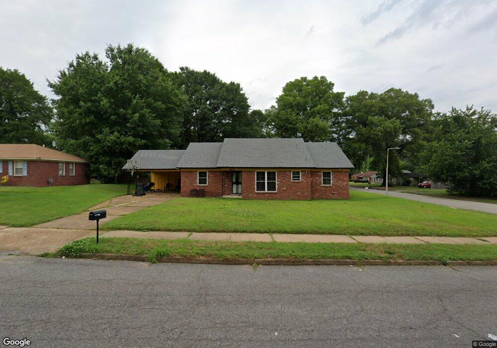
4810 Scottsdale Ave Memphis, TN 38118
Parkway Village NeighborhoodEstimated Value: $148,226 - $182,000
3
Beds
2
Baths
1,619
Sq Ft
$101/Sq Ft
Est. Value
About This Home
This home is located at 4810 Scottsdale Ave, Memphis, TN 38118 and is currently estimated at $163,557, approximately $101 per square foot. 4810 Scottsdale Ave is a home located in Shelby County with nearby schools including Cromwell Elementary School, Wooddale High School, and Wooddale Middle School.
Ownership History
Date
Name
Owned For
Owner Type
Purchase Details
Closed on
May 9, 2022
Sold by
Jones Bobbie J and Jones Wendell
Bought by
Jones Bobbie J and Jones Wendolyn V
Current Estimated Value
Home Financials for this Owner
Home Financials are based on the most recent Mortgage that was taken out on this home.
Original Mortgage
$117,500
Outstanding Balance
$97,790
Interest Rate
4.52%
Mortgage Type
New Conventional
Estimated Equity
$65,767
Purchase Details
Closed on
Jun 28, 2004
Sold by
Haywood Major L
Bought by
Jones Bobbie J
Home Financials for this Owner
Home Financials are based on the most recent Mortgage that was taken out on this home.
Original Mortgage
$85,000
Interest Rate
6.24%
Mortgage Type
Purchase Money Mortgage
Create a Home Valuation Report for This Property
The Home Valuation Report is an in-depth analysis detailing your home's value as well as a comparison with similar homes in the area
Home Values in the Area
Average Home Value in this Area
Purchase History
| Date | Buyer | Sale Price | Title Company |
|---|---|---|---|
| Jones Bobbie J | -- | Title365 | |
| Jones Bobbie J | $85,000 | -- |
Source: Public Records
Mortgage History
| Date | Status | Borrower | Loan Amount |
|---|---|---|---|
| Open | Jones Bobbie J | $117,500 | |
| Previous Owner | Jones Bobbie J | $85,000 |
Source: Public Records
Tax History Compared to Growth
Tax History
| Year | Tax Paid | Tax Assessment Tax Assessment Total Assessment is a certain percentage of the fair market value that is determined by local assessors to be the total taxable value of land and additions on the property. | Land | Improvement |
|---|---|---|---|---|
| 2025 | $751 | $37,875 | $5,000 | $32,875 |
| 2024 | $751 | $22,150 | $3,350 | $18,800 |
| 2023 | $1,349 | $22,150 | $3,350 | $18,800 |
| 2022 | $1,349 | $22,150 | $3,350 | $18,800 |
| 2021 | $1,365 | $22,150 | $3,350 | $18,800 |
| 2020 | $1,288 | $17,775 | $3,350 | $14,425 |
| 2019 | $568 | $17,775 | $3,350 | $14,425 |
| 2018 | $568 | $17,775 | $3,350 | $14,425 |
| 2017 | $582 | $17,775 | $3,350 | $14,425 |
| 2016 | $765 | $17,500 | $0 | $0 |
| 2014 | $765 | $17,500 | $0 | $0 |
Source: Public Records
Map
Nearby Homes
- 3287 Boxdale St
- 4833 Scottsdale Ave
- 3240 Boxdale St
- 3274 Gaylord Ln
- 3339 S Perkins Rd
- 3347 S Perkins Rd
- 4864 Cloister Ave
- 4616 Blanding Dr
- 3433 S Perkins Rd
- 4817 Wooddale Ave
- 4763 Wooddale Ave
- 4612 Chuck Ave
- 3408 Clearbrook St
- 4947 Demeter Cove
- 4773 Aloha Ave
- 3118 Arrendale St
- 3395 Mckenzie St Unit 35581
- 3075 Dewitt Cove
- 3083 Arrendale St
- 5051 Bryndale Ave
- 4800 Scottsdale Ave
- 3271 Boxdale Cove
- 4794 Scottsdale Ave
- 3267 Boxdale Cove
- 4828 Scottsdale Ave
- 4813 Scottsdale Ave
- 4805 Scottsdale Ave
- 3265 Boxdale Cove
- 4799 Scottsdale Ave
- 4788 Scottsdale Ave
- 4834 Scottsdale Ave
- 3280 Boxdale St
- 3323 Boxdale St
- 4793 Scottsdale Ave
- 3263 Boxdale Cove
- 3264 Boxdale St
- 4782 Scottsdale Ave
- 4785 Scottsdale Ave
- 4838 Scottsdale Ave
- 3318 Boxdale St