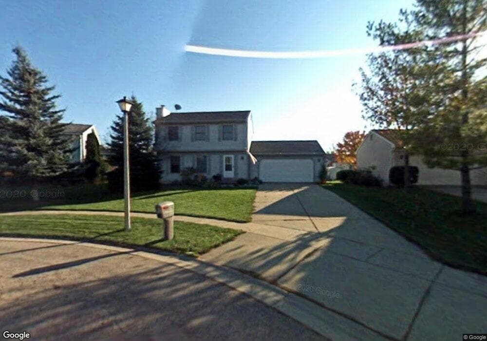
4815 Moultrie Cir Lansing, MI 48917
Estimated Value: $258,000 - $262,000
3
Beds
3
Baths
1,400
Sq Ft
$186/Sq Ft
Est. Value
About This Home
This home is located at 4815 Moultrie Cir, Lansing, MI 48917 and is currently estimated at $260,228, approximately $185 per square foot. 4815 Moultrie Cir is a home located in Eaton County with nearby schools including Waverly Senior High School, Greater Lansing Adventist School, and Montessori Childrens House.
Ownership History
Date
Name
Owned For
Owner Type
Purchase Details
Closed on
Aug 6, 2004
Sold by
Hollins Harvey and Hollins Natreece
Bought by
Marwede Randy and Noice Marwede Jane
Current Estimated Value
Home Financials for this Owner
Home Financials are based on the most recent Mortgage that was taken out on this home.
Original Mortgage
$138,712
Outstanding Balance
$70,378
Interest Rate
6.35%
Mortgage Type
VA
Estimated Equity
$189,850
Create a Home Valuation Report for This Property
The Home Valuation Report is an in-depth analysis detailing your home's value as well as a comparison with similar homes in the area
Home Values in the Area
Average Home Value in this Area
Purchase History
| Date | Buyer | Sale Price | Title Company |
|---|---|---|---|
| Marwede Randy | $162,000 | Devon Title |
Source: Public Records
Mortgage History
| Date | Status | Borrower | Loan Amount |
|---|---|---|---|
| Open | Marwede Randy | $138,712 |
Source: Public Records
Tax History
| Year | Tax Paid | Tax Assessment Tax Assessment Total Assessment is a certain percentage of the fair market value that is determined by local assessors to be the total taxable value of land and additions on the property. | Land | Improvement |
|---|---|---|---|---|
| 2025 | $3,626 | $113,800 | $0 | $0 |
| 2024 | $2,068 | $106,400 | $0 | $0 |
| 2023 | $1,988 | $95,500 | $0 | $0 |
| 2022 | $3,164 | $88,900 | $0 | $0 |
| 2021 | $3,056 | $85,800 | $0 | $0 |
| 2020 | $3,137 | $81,200 | $0 | $0 |
| 2019 | $3,119 | $76,897 | $0 | $0 |
| 2018 | $3,064 | $74,200 | $0 | $0 |
| 2017 | $2,992 | $71,900 | $0 | $0 |
| 2016 | -- | $69,700 | $0 | $0 |
| 2015 | -- | $65,700 | $0 | $0 |
| 2014 | -- | $62,788 | $0 | $0 |
| 2013 | -- | $61,800 | $0 | $0 |
Source: Public Records
Map
Nearby Homes
- 4616 W Saint Joe Hwy
- 4705 Norwick St
- 515 Chanticleer Trail
- 215 Winifred Ave Unit A & B
- 5137 Dorene Dr
- 1109 Boulder Ct Unit 46
- 1011 Old Erin Way
- 5535 W Saint Joe Hwy Unit B12
- 5535 W Saint Joseph Hwy Unit B3
- 4236 Oakcrest Dr
- 401 Richard Ave
- 415 Winifred Ave
- 918 Harvest Ln
- 321 Renker Rd
- 516 Hume Blvd
- 1412 Marcy Ave
- 410 Renker Rd
- 916 Montevideo Dr Unit E
- 906 Montevideo Dr Unit B
- 929 Grenoble Dr Unit B
Your Personal Tour Guide
Ask me questions while you tour the home.