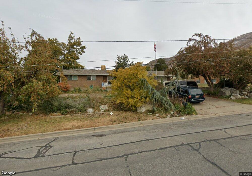
483 E 400 N Centerville, UT 84014
Estimated Value: $463,000 - $612,326
5
Beds
2
Baths
1,569
Sq Ft
$357/Sq Ft
Est. Value
About This Home
This home is located at 483 E 400 N, Centerville, UT 84014 and is currently estimated at $560,832, approximately $357 per square foot. 483 E 400 N is a home located in Davis County with nearby schools including Centerville Elementary, Centerville Jr High, and Viewmont High School.
Ownership History
Date
Name
Owned For
Owner Type
Purchase Details
Closed on
Aug 24, 2017
Sold by
Pettit Deven and Pettit Janeen
Bought by
Utah Dept Of Transportation
Current Estimated Value
Home Financials for this Owner
Home Financials are based on the most recent Mortgage that was taken out on this home.
Original Mortgage
$50,000
Outstanding Balance
$41,800
Interest Rate
4.03%
Mortgage Type
Commercial
Estimated Equity
$519,032
Purchase Details
Closed on
Jun 6, 2011
Sold by
Keil Della Mae and Keil Philip A
Bought by
Keil Philip A
Create a Home Valuation Report for This Property
The Home Valuation Report is an in-depth analysis detailing your home's value as well as a comparison with similar homes in the area
Purchase History
| Date | Buyer | Sale Price | Title Company |
|---|---|---|---|
| Utah Dept Of Transportation | -- | -- | |
| Keil Philip A | -- | None Available |
Source: Public Records
Mortgage History
| Date | Status | Borrower | Loan Amount |
|---|---|---|---|
| Open | Utah Dept Of Transportation | $50,000 |
Source: Public Records
Tax History
| Year | Tax Paid | Tax Assessment Tax Assessment Total Assessment is a certain percentage of the fair market value that is determined by local assessors to be the total taxable value of land and additions on the property. | Land | Improvement |
|---|---|---|---|---|
| 2025 | -- | $319,000 | $188,616 | $130,384 |
| 2024 | -- | $308,000 | $176,126 | $131,874 |
| 2023 | $2,434 | $515,000 | $280,219 | $234,781 |
| 2022 | $2,797 | $299,200 | $143,250 | $155,950 |
| 2021 | $2,440 | $418,000 | $228,676 | $189,324 |
| 2020 | $2,173 | $377,000 | $218,236 | $158,764 |
| 2019 | $2,204 | $373,000 | $202,345 | $170,655 |
| 2018 | $2,046 | $345,000 | $186,891 | $158,109 |
| 2016 | $1,943 | $157,080 | $72,283 | $84,797 |
| 2015 | $1,893 | $144,375 | $72,283 | $72,092 |
| 2014 | $1,652 | $128,919 | $72,283 | $56,636 |
| 2013 | -- | $126,722 | $49,464 | $77,258 |
Source: Public Records
Map
Nearby Homes
Your Personal Tour Guide
Ask me questions while you tour the home.