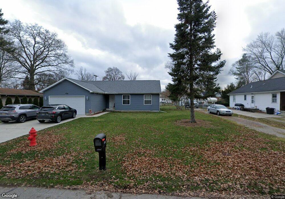
483 Maple St Unit Bldg-Unit Algonac, MI 48001
Estimated Value: $308,665 - $327,000
Studio
--
Bath
--
Sq Ft
12,197
Sq Ft Lot
About This Home
This home is located at 483 Maple St Unit Bldg-Unit, Algonac, MI 48001 and is currently estimated at $317,666. 483 Maple St Unit Bldg-Unit is a home located in St. Clair County.
Ownership History
Date
Name
Owned For
Owner Type
Purchase Details
Closed on
Mar 31, 2021
Sold by
Polito Dave
Bought by
Phelan Patricia and Proctor Randall
Current Estimated Value
Purchase Details
Closed on
May 17, 2019
Sold by
Joseph Polito
Bought by
Polito Dave
Purchase Details
Closed on
Apr 29, 2019
Sold by
Kay Smith Sharon
Bought by
Polito Joseph
Create a Home Valuation Report for This Property
The Home Valuation Report is an in-depth analysis detailing your home's value as well as a comparison with similar homes in the area
Home Values in the Area
Average Home Value in this Area
Purchase History
| Date | Buyer | Sale Price | Title Company |
|---|---|---|---|
| Phelan Patricia | $227,000 | None Available | |
| Polito Dave | -- | New Title Company Name | |
| Polito Joseph | $26,000 | None Listed On Document |
Source: Public Records
Tax History
| Year | Tax Paid | Tax Assessment Tax Assessment Total Assessment is a certain percentage of the fair market value that is determined by local assessors to be the total taxable value of land and additions on the property. | Land | Improvement |
|---|---|---|---|---|
| 2025 | $3,012 | $154,000 | $0 | $0 |
| 2024 | $4,529 | $146,900 | $0 | $0 |
| 2023 | $4,223 | $126,900 | $0 | $0 |
| 2022 | $4,476 | $111,400 | $0 | $0 |
| 2020 | $2,661 | $64,400 | $15,000 | $49,400 |
| 2019 | $736 | $17,800 | $0 | $0 |
| 2018 | $724 | $18,100 | $0 | $0 |
| 2017 | $691 | $23,700 | $0 | $0 |
| 2016 | $651 | $23,700 | $0 | $0 |
| 2015 | -- | $20,100 | $15,000 | $5,100 |
| 2014 | -- | $20,000 | $15,000 | $5,000 |
| 2013 | -- | $19,100 | $0 | $0 |
Source: Public Records
Map
Nearby Homes
- 1806 Michigan St
- 474 South St
- 142 Channel Syde Dr
- 1719 Saint Clair River Dr
- 226 Roselawn St
- 130 Delta Dr
- 114 Interlochen Dr
- 00 Roselawn St
- 1609 Saint Clair River Dr
- 2037 W Park Dr
- 1523 Saint Clair River Dr
- 1516 Saint Clair River Dr
- 919 Smith St
- 2567 St Clair River Dr
- 9287 N River Rd Unit 1
- 9287 N River Rd Unit 1 2 & 3
- 9287 N River Rd Unit 3
- 9287 N River Rd Unit 2
- 9898 N River Rd
- 9188 Marsh Rd
Your Personal Tour Guide
Ask me questions while you tour the home.