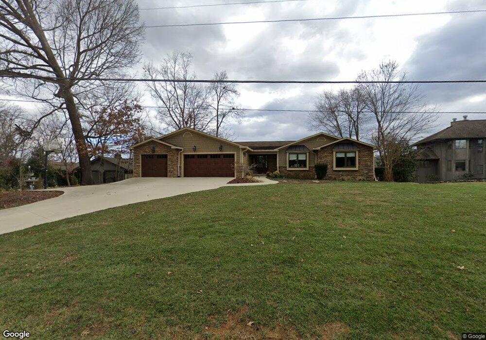
483 Steadman Rd Blountville, TN 37617
Estimated Value: $497,000 - $672,000
3
Beds
2
Baths
1,875
Sq Ft
$321/Sq Ft
Est. Value
About This Home
This home is located at 483 Steadman Rd, Blountville, TN 37617 and is currently estimated at $601,285, approximately $320 per square foot. 483 Steadman Rd is a home located in Sullivan County with nearby schools including Holston Elementary School and Sullivan Central Middle School.
Ownership History
Date
Name
Owned For
Owner Type
Purchase Details
Closed on
Aug 6, 2003
Sold by
Mark Carver and Mark Chandra
Bought by
Carver Living Trust
Current Estimated Value
Purchase Details
Closed on
May 15, 2003
Sold by
Roger Reeser and Roger Jo Betty
Bought by
Carver Mark E
Home Financials for this Owner
Home Financials are based on the most recent Mortgage that was taken out on this home.
Original Mortgage
$164,000
Interest Rate
5.79%
Create a Home Valuation Report for This Property
The Home Valuation Report is an in-depth analysis detailing your home's value as well as a comparison with similar homes in the area
Home Values in the Area
Average Home Value in this Area
Purchase History
| Date | Buyer | Sale Price | Title Company |
|---|---|---|---|
| Carver Living Trust | -- | -- | |
| Carver Mark E | $205,000 | -- |
Source: Public Records
Mortgage History
| Date | Status | Borrower | Loan Amount |
|---|---|---|---|
| Previous Owner | Carver Mark E | $164,000 |
Source: Public Records
Tax History Compared to Growth
Tax History
| Year | Tax Paid | Tax Assessment Tax Assessment Total Assessment is a certain percentage of the fair market value that is determined by local assessors to be the total taxable value of land and additions on the property. | Land | Improvement |
|---|---|---|---|---|
| 2024 | $2,122 | $85,025 | $9,800 | $75,225 |
| 2023 | $2,046 | $85,025 | $9,800 | $75,225 |
| 2022 | $2,046 | $85,025 | $9,800 | $75,225 |
| 2021 | $2,046 | $85,025 | $9,800 | $75,225 |
| 2020 | $2,012 | $85,025 | $9,800 | $75,225 |
| 2019 | $2,012 | $78,300 | $9,800 | $68,500 |
| 2018 | $1,997 | $78,300 | $9,800 | $68,500 |
| 2017 | $1,997 | $78,300 | $9,800 | $68,500 |
| 2016 | $2,046 | $79,425 | $9,800 | $69,625 |
| 2014 | $1,831 | $79,435 | $0 | $0 |
Source: Public Records
Map
Nearby Homes
- 1033 Haw Ridge Rd
- 780 Hamilton Rd Unit 6
- 780 Hamilton Rd Unit I-4
- 500 Geisler Rd
- 417 Cope Rd
- 411 Gammon Rd
- 456 Geisler Rd
- 341 Haw Ridge Rd E
- 225 Forest Ln N
- TBD Haw Ridge Rd
- 145 Grande Harbor Way
- 412 Haw Ridge Rd E
- 112 Cardinal Point
- 200 Deck Ln Unit 1105
- 200 Deck Ln Unit 803
- 200 Deck Ln Unit 802
- 200 Deck Ln Unit 801
- 205 Forest Ct
- 421 Haw Ridge Rd
- 164 Forest Ln N
- 487 Steadman Rd
- 477 Steadman Rd
- 492 Steadman Rd
- 505 Steadman Rd
- 449 Steadman Rd
- 440 Steadman Rd
- 387 Steadman Rd
- 385 Steadman Rd
- 436 Center Dr
- 377 Steadman Rd
- 411 Center Dr
- 406 Center Dr
- 405 Center Dr
- 341 Barbara Dr
- 337 Barbara Dr
- 380 Center Dr
- 340 Barbara Dr
- 392 Center Dr
- 392 Center Dr Unit 1
- 321 Barbara Dr