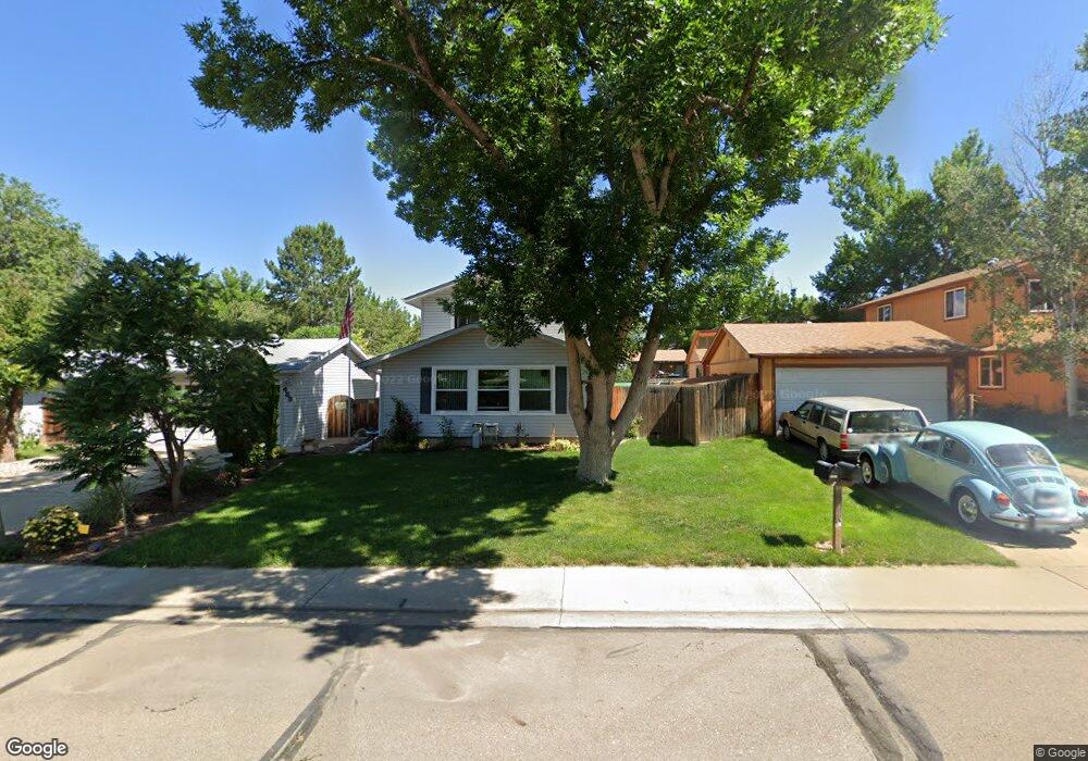
483 Verdant Cir Longmont, CO 80504
Clark Centennial NeighborhoodEstimated Value: $486,978 - $529,000
4
Beds
2
Baths
1,680
Sq Ft
$300/Sq Ft
Est. Value
About This Home
This home is located at 483 Verdant Cir, Longmont, CO 80504 and is currently estimated at $503,995, approximately $299 per square foot. 483 Verdant Cir is a home located in Boulder County with nearby schools including Timberline Pk-8, Skyline High School, and Longmont Christian School.
Ownership History
Date
Name
Owned For
Owner Type
Purchase Details
Closed on
Jul 22, 2021
Sold by
Taylor Randall A and Taylor Sally A
Bought by
Taylor Randall L and Taylor Sally A
Current Estimated Value
Purchase Details
Closed on
Jul 20, 2004
Sold by
Sivey Knarr Co
Bought by
Taylor Randall A
Purchase Details
Closed on
Apr 16, 1980
Bought by
Taylor Randall A and Taylor Sally A
Purchase Details
Closed on
Jun 8, 1979
Bought by
Taylor Randall A and Taylor Sally A
Create a Home Valuation Report for This Property
The Home Valuation Report is an in-depth analysis detailing your home's value as well as a comparison with similar homes in the area
Home Values in the Area
Average Home Value in this Area
Purchase History
| Date | Buyer | Sale Price | Title Company |
|---|---|---|---|
| Taylor Randall L | -- | None Available | |
| Taylor Randall A | -- | -- | |
| Taylor Randall A | -- | -- | |
| Taylor Randall A | $57,000 | -- |
Source: Public Records
Tax History Compared to Growth
Tax History
| Year | Tax Paid | Tax Assessment Tax Assessment Total Assessment is a certain percentage of the fair market value that is determined by local assessors to be the total taxable value of land and additions on the property. | Land | Improvement |
|---|---|---|---|---|
| 2025 | $1,941 | $28,082 | $8,069 | $20,013 |
| 2024 | $1,941 | $28,082 | $8,069 | $20,013 |
| 2023 | $1,915 | $26,994 | $8,904 | $21,775 |
| 2022 | $1,593 | $23,046 | $6,693 | $16,353 |
| 2021 | $1,613 | $23,709 | $6,885 | $16,824 |
| 2020 | $1,261 | $20,128 | $5,935 | $14,193 |
| 2019 | $1,241 | $20,128 | $5,935 | $14,193 |
| 2018 | $983 | $17,546 | $5,976 | $11,570 |
| 2017 | $969 | $19,399 | $6,607 | $12,792 |
| 2016 | $744 | $15,570 | $5,254 | $10,316 |
| 2015 | $709 | $13,094 | $4,139 | $8,955 |
| 2014 | $1,223 | $13,094 | $4,139 | $8,955 |
Source: Public Records
Map
Nearby Homes
- 1214 Autumn Ct
- 884 Elliott St
- 311 Chinook Ave
- 1310 Hilltop Dr
- 811 Brookside Dr
- 829 Independence Dr
- 747 Elliott St
- 908 Sugar Mill Ave
- 902 Sugar Mill Ave
- 107 Caribou Place
- 727 Mount Evans St
- 742 Megan Ct
- 1455 Hilltop Dr
- 1267 E 9th Ave
- 1430 Lashley St
- 1245 Trail Ridge Rd
- 225 E 8th Ave Unit A2
- 225 E 8th Ave Unit E20
- 225 E 8th Ave Unit E10
- 712 Pendleton Ave
- 487 Verdant Cir
- 479 Verdant Cir
- 417 Crystal Place
- 421 Crystal Place
- 413 Crystal Place
- 491 Verdant Cir
- 475 Verdant Cir
- 482 Verdant Cir
- 478 Verdant Cir
- 409 Crystal Place
- 486 Verdant Cir
- 474 Verdant Cir
- 495 Verdant Cir
- 490 Verdant Cir
- 471 Verdant Cir
- 405 Crystal Place
- 470 Verdant Cir
- 429 Crystal Place
- 416 Crystal Place
- 416 Verdant Cir