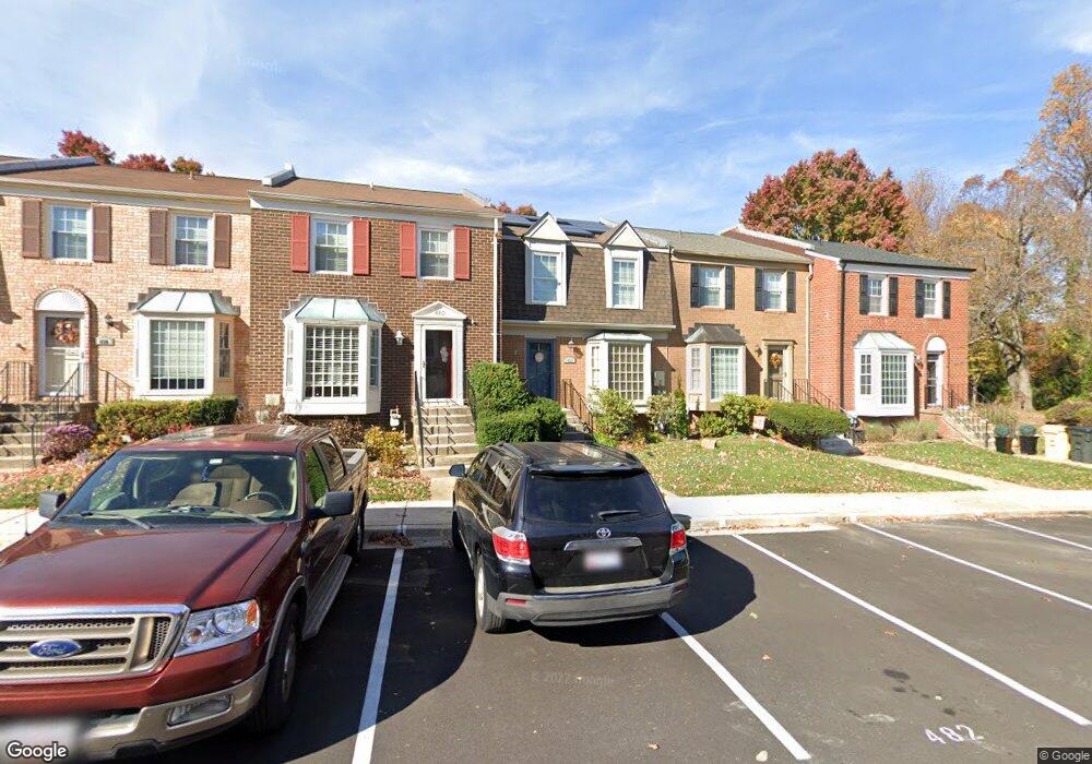
484 Colonial Ridge Ln Arnold, MD 21012
Estimated Value: $411,341 - $464,000
--
Bed
4
Baths
1,440
Sq Ft
$308/Sq Ft
Est. Value
About This Home
This home is located at 484 Colonial Ridge Ln, Arnold, MD 21012 and is currently estimated at $443,835, approximately $308 per square foot. 484 Colonial Ridge Ln is a home located in Anne Arundel County with nearby schools including Broadneck Elementary School, Magothy River Middle School, and Broadneck High School.
Ownership History
Date
Name
Owned For
Owner Type
Purchase Details
Closed on
Apr 24, 2014
Sold by
Stoneman Allan and Stoneman Maria
Bought by
Gonzales Benjamin and Madej Gonzales Rosina
Current Estimated Value
Home Financials for this Owner
Home Financials are based on the most recent Mortgage that was taken out on this home.
Original Mortgage
$314,105
Interest Rate
4.25%
Mortgage Type
FHA
Purchase Details
Closed on
Aug 12, 2003
Sold by
Edmonston Christopher N
Bought by
Stoneman Alan and Stoneman Maria
Purchase Details
Closed on
Nov 3, 1995
Sold by
Sangston Katherine K
Bought by
Edmonston Christopher N and Edmonston Jennifer
Create a Home Valuation Report for This Property
The Home Valuation Report is an in-depth analysis detailing your home's value as well as a comparison with similar homes in the area
Home Values in the Area
Average Home Value in this Area
Purchase History
| Date | Buyer | Sale Price | Title Company |
|---|---|---|---|
| Gonzales Benjamin | $319,900 | Sage Title Group Llc | |
| Stoneman Alan | $250,000 | -- | |
| Edmonston Christopher N | $119,000 | -- |
Source: Public Records
Mortgage History
| Date | Status | Borrower | Loan Amount |
|---|---|---|---|
| Previous Owner | Gonzales Benjamin | $314,105 | |
| Closed | Edmonston Christopher N | -- |
Source: Public Records
Tax History Compared to Growth
Tax History
| Year | Tax Paid | Tax Assessment Tax Assessment Total Assessment is a certain percentage of the fair market value that is determined by local assessors to be the total taxable value of land and additions on the property. | Land | Improvement |
|---|---|---|---|---|
| 2025 | $3,970 | $343,333 | -- | -- |
| 2024 | $3,970 | $322,900 | $150,000 | $172,900 |
| 2023 | $3,879 | $317,833 | $0 | $0 |
| 2022 | $3,268 | $312,767 | $0 | $0 |
| 2021 | $7,166 | $307,700 | $150,000 | $157,700 |
| 2020 | $3,439 | $297,967 | $0 | $0 |
| 2019 | $6,496 | $288,233 | $0 | $0 |
| 2018 | $2,824 | $278,500 | $100,000 | $178,500 |
| 2017 | $2,992 | $268,767 | $0 | $0 |
| 2016 | -- | $259,033 | $0 | $0 |
| 2015 | -- | $249,300 | $0 | $0 |
| 2014 | -- | $249,300 | $0 | $0 |
Source: Public Records
Map
Nearby Homes
- 400 Colonial Ridge Ln
- 478 Bay Green Dr
- 349 Candle Ridge Ct
- 618 Andrew Hill Rd
- 340 Candle Ridge Dr
- 633 Andrew Hill Rd
- 515 Bay Hills Dr
- 1256 Crowell Ct
- 533 Bay Green Dr
- 537 Bay Green Dr
- 543 Bay Green Dr
- 1512 Winterberry Dr
- 553 Bay Green Dr
- 1553 Star Pine Dr
- 1231 Summerwood Ct
- 1217 Springwood Ct
- 1583 Star Pine Dr
- 1116 Riverboat Ct
- 1584 Lodge Pole Ct
- 599 Oakland Hills Dr Unit 1A
- 484 Colonial Ridge Ln Unit 100
- 482 Colonial Ridge Ln
- 482 Colonial Ridge Ln Unit 99
- 480 Colonial Ridge Ln
- 488 Colonial Ridge Ln
- 478 Colonial Ridge Ln
- 490 Colonial Ridge Ln
- 1231 Brunswick Ct
- 497 Colonial Ridge Ln
- 492 Colonial Ridge Ln
- 492 Colonial Ridge Ln Unit 104
- 496 Colonial Ridge Ln
- 495 Colonial Ridge Ln
- 1215 Brunswick Ct
- 1215 Brunswick Ct Unit 79
- 491 Colonial Ridge Ln
- 491 Colonial Ridge Ln Unit 123
- 1229 Brunswick Ct
- 494 Colonial Ridge Ln
- 1213 Brunswick Ct Unit 78