Estimated Value: $386,000 - $427,000
4
Beds
3
Baths
1,946
Sq Ft
$208/Sq Ft
Est. Value
About This Home
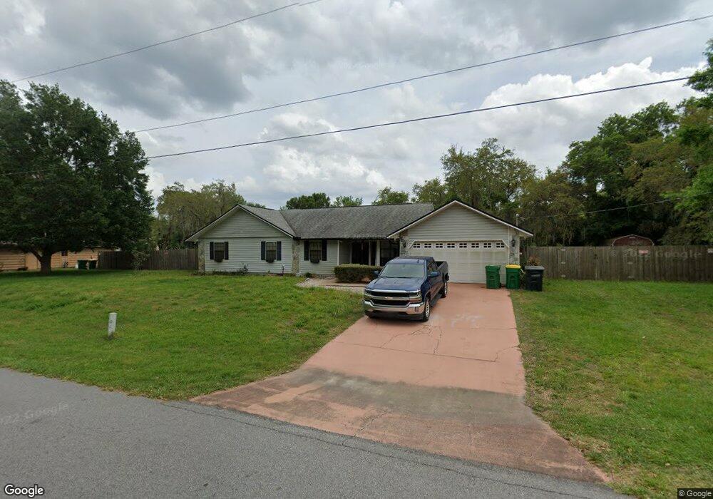
This home is located at 4845 Doreen Rd Unit 8, Cocoa, FL 32927 and is currently estimated at $405,392, approximately $208 per square foot. 4845 Doreen Rd Unit 8 is a home located in Brevard County with nearby schools including Atlantis Elementary School, Space Coast Junior/Senior High School, and Sculptor Charter School.
Ownership History
Date
Name
Owned For
Owner Type
Purchase Details
Closed on
Apr 28, 2011
Sold by
Meier Laura
Bought by
Bennett Christopher R
Current Estimated Value
Home Financials for this Owner
Home Financials are based on the most recent Mortgage that was taken out on this home.
Original Mortgage
$114,400
Outstanding Balance
$79,246
Interest Rate
4.81%
Estimated Equity
$326,146
Purchase Details
Closed on
Oct 26, 1999
Sold by
Meier James R and Meier Laura
Bought by
Meier Laura
Create a Home Valuation Report for This Property
The Home Valuation Report is an in-depth analysis detailing your home's value as well as a comparison with similar homes in the area
Home Values in the Area
Average Home Value in this Area
Purchase History
| Date | Buyer | Sale Price | Title Company |
|---|---|---|---|
| Bennett Christopher R | $143,000 | Attorney | |
| Meier Laura | -- | -- |
Source: Public Records
Mortgage History
| Date | Status | Borrower | Loan Amount |
|---|---|---|---|
| Open | Bennett Christopher R | $114,400 |
Source: Public Records
Tax History
| Year | Tax Paid | Tax Assessment Tax Assessment Total Assessment is a certain percentage of the fair market value that is determined by local assessors to be the total taxable value of land and additions on the property. | Land | Improvement |
|---|---|---|---|---|
| 2025 | $1,967 | $142,730 | -- | -- |
| 2024 | $1,926 | $138,710 | -- | -- |
| 2023 | $1,926 | $134,670 | $0 | $0 |
| 2022 | $1,802 | $130,750 | $0 | $0 |
| 2021 | $1,817 | $126,950 | $0 | $0 |
| 2020 | $1,745 | $125,200 | $0 | $0 |
| 2019 | $1,684 | $122,390 | $0 | $0 |
| 2018 | $1,681 | $120,110 | $0 | $0 |
| 2017 | $1,681 | $117,640 | $0 | $0 |
| 2016 | $1,693 | $115,230 | $36,000 | $79,230 |
| 2015 | $1,723 | $114,430 | $30,000 | $84,430 |
| 2014 | $1,728 | $113,530 | $22,000 | $91,530 |
Source: Public Records
Map
Nearby Homes
- 4824 Curtis Blvd
- 7045 Grissom Pkwy
- 4765 Curtis Blvd
- 6990 Camden Ave
- 4760 Ivan St
- 7155 Export Ave
- 5080 Mayflower St
- 5075 Carter St
- 7245 Grissom Pkwy
- 5200 Frisco St
- 4625 Curtis Blvd
- 6820 Caliph Ave
- 7363 Glenwood Rd
- 5155 Mayflower St
- 4790 Greenhill St
- 4575 Curtis Blvd
- 5165 Patricia St
- 4715 Greenhill St
- 4852 Alfred St
- 5150 Melody St
- 4825 Doreen Rd
- 4865 Doreen Rd
- 4830 Doreen Rd
- 4900 Mayflower St
- 4815 Doreen Rd
- 4820 Curtis Blvd
- 4911 Patricia St
- 4910 Mayflower St
- 4885 Doreen Rd
- 4900 Patricia St
- 4915 Mayflower St
- 4809 Doreen Rd
- 4870 Doreen Rd
- 4830 Fresno St
- 4908 Patricia St
- 4851 Falcon Blvd
- 4927 Patricia St
- 4810 Fresno St
- 4920 Mayflower St
- 4895 Doreen Rd
Your Personal Tour Guide
Ask me questions while you tour the home.