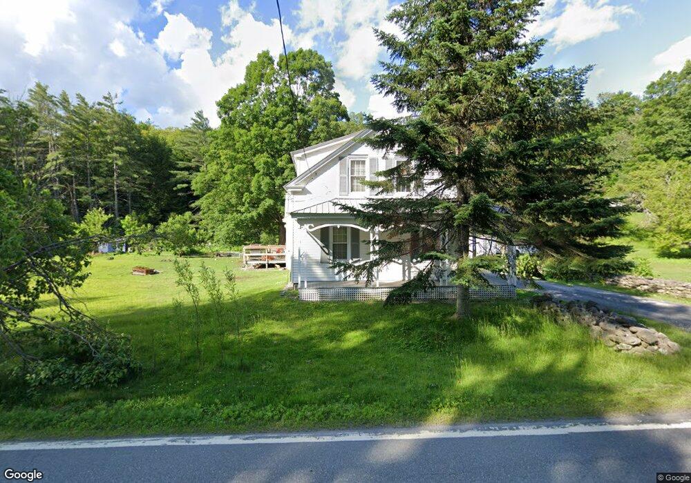
485 Langdon Rd Charlestown, NH 03603
Estimated Value: $274,631 - $395,000
4
Beds
2
Baths
1,952
Sq Ft
$173/Sq Ft
Est. Value
About This Home
This home is located at 485 Langdon Rd, Charlestown, NH 03603 and is currently estimated at $336,908, approximately $172 per square foot. 485 Langdon Rd is a home located in Sullivan County with nearby schools including Charlestown Primary School, Charlestown Middle School, and Fall Mountain Regional High School.
Ownership History
Date
Name
Owned For
Owner Type
Purchase Details
Closed on
Oct 28, 2021
Sold by
Green Melissa P
Bought by
Houghton Tobin J
Current Estimated Value
Home Financials for this Owner
Home Financials are based on the most recent Mortgage that was taken out on this home.
Original Mortgage
$171,830
Outstanding Balance
$157,033
Interest Rate
2.8%
Mortgage Type
FHA
Estimated Equity
$179,875
Purchase Details
Closed on
Sep 27, 2018
Sold by
Prouty Woodrow A and Prouty Linda M
Bought by
Green Melissa P
Home Financials for this Owner
Home Financials are based on the most recent Mortgage that was taken out on this home.
Original Mortgage
$162,000
Interest Rate
4.5%
Mortgage Type
Purchase Money Mortgage
Create a Home Valuation Report for This Property
The Home Valuation Report is an in-depth analysis detailing your home's value as well as a comparison with similar homes in the area
Home Values in the Area
Average Home Value in this Area
Purchase History
| Date | Buyer | Sale Price | Title Company |
|---|---|---|---|
| Houghton Tobin J | $175,000 | None Available | |
| Green Melissa P | $172,000 | -- |
Source: Public Records
Mortgage History
| Date | Status | Borrower | Loan Amount |
|---|---|---|---|
| Open | Houghton Tobin J | $171,830 | |
| Previous Owner | Green Melissa P | $162,000 |
Source: Public Records
Tax History Compared to Growth
Tax History
| Year | Tax Paid | Tax Assessment Tax Assessment Total Assessment is a certain percentage of the fair market value that is determined by local assessors to be the total taxable value of land and additions on the property. | Land | Improvement |
|---|---|---|---|---|
| 2024 | $6,148 | $169,100 | $31,800 | $137,300 |
| 2023 | $5,802 | $169,100 | $31,800 | $137,300 |
| 2022 | $5,457 | $169,100 | $31,800 | $137,300 |
| 2021 | $5,345 | $169,100 | $31,800 | $137,300 |
| 2020 | $6,292 | $162,800 | $27,900 | $134,900 |
| 2019 | $6,813 | $174,200 | $27,900 | $146,300 |
| 2017 | $6,106 | $174,200 | $27,900 | $146,300 |
| 2016 | $6,106 | $174,200 | $27,900 | $146,300 |
| 2015 | $6,161 | $191,400 | $29,600 | $161,800 |
| 2014 | $6,027 | $191,400 | $29,600 | $161,800 |
| 2013 | $6,178 | $191,400 | $29,600 | $161,800 |
Source: Public Records
Map
Nearby Homes
- 0 Langdon Rd Unit 22 5042572
- 103 Schoolbus Depot Rd
- 458 Cheshire Turnpike
- 98 Darby Hill Rd
- 31 Mountain View Rd
- 45 Church St
- 9 Merchant St
- 9 Center St
- 20 Green Rd
- 29 Green Rd
- 12 Laurel Ave
- 34 Williams St
- 24 Rockingham St
- 236 Hall Bridge Rd
- 13 Prospect St
- 10 Riverfront Dr
- 24 South St
- 88 Westminster St
- 77 Griswold Dr
- 2 Lower Landing Park
- 499 Langdon Rd
- 48 Old Alstead Rd
- 32 Carters Rd
- 511 New Hampshire 12a
- 44 Old Alstead Rd
- 443 Langdon Rd
- 12 Carters Rd
- 418 Langdon Rd
- 43 Old State Rd
- 30 Wetherby Rd
- 46 Wetherby Rd
- 31 Wetherby Rd
- 62 Wetherby Rd
- 24 Old Ferry Rd
- 121 Old State Rd
- 59 Old Ferry Rd
- 78 Wetherby Rd
- 125 Old State Rd
- 00 Langdon Rd
- 0 Langdon Rd