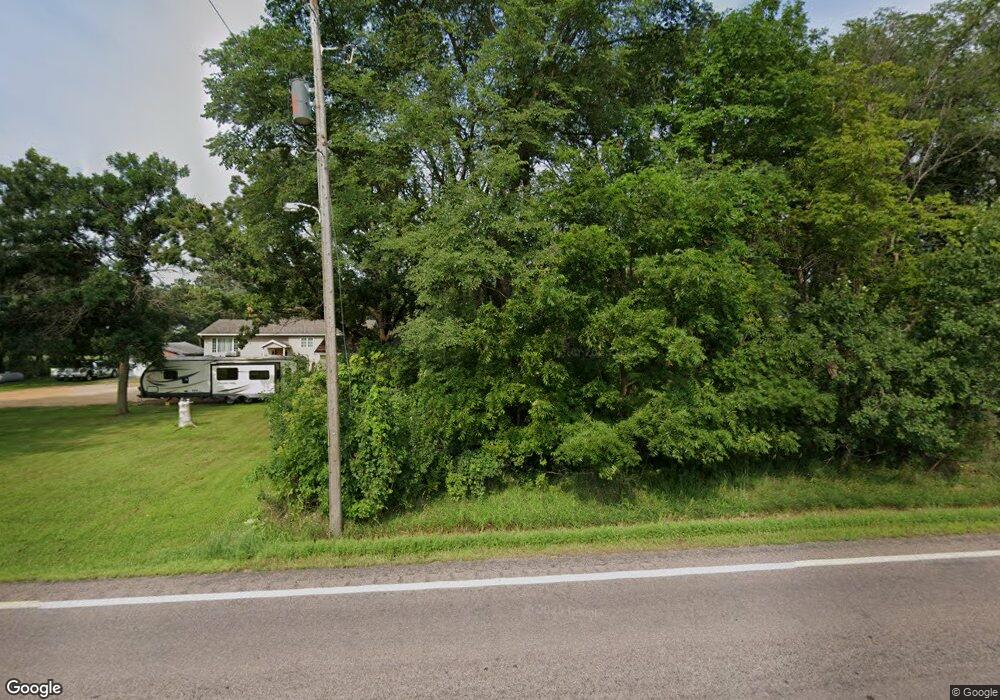
48586 355th Ave Kasota, MN 56050
Estimated Value: $315,912 - $370,000
3
Beds
1
Bath
1,364
Sq Ft
$246/Sq Ft
Est. Value
About This Home
This home is located at 48586 355th Ave, Kasota, MN 56050 and is currently estimated at $334,978, approximately $245 per square foot. 48586 355th Ave is a home located in Le Sueur County with nearby schools including South Elementary Early Learning Center, North Elementary School, and St. Peter Middle School.
Ownership History
Date
Name
Owned For
Owner Type
Purchase Details
Closed on
Jan 7, 2021
Sold by
Deegan Dylan Dylan
Bought by
Dirksen Kellie Kellie
Current Estimated Value
Home Financials for this Owner
Home Financials are based on the most recent Mortgage that was taken out on this home.
Original Mortgage
$228,000
Outstanding Balance
$203,276
Interest Rate
2.65%
Estimated Equity
$131,702
Purchase Details
Closed on
Sep 29, 2015
Sold by
Kneefe Frances Frances
Bought by
Deegan Dylan Dylan
Home Financials for this Owner
Home Financials are based on the most recent Mortgage that was taken out on this home.
Original Mortgage
$74,500
Interest Rate
3.86%
Create a Home Valuation Report for This Property
The Home Valuation Report is an in-depth analysis detailing your home's value as well as a comparison with similar homes in the area
Home Values in the Area
Average Home Value in this Area
Purchase History
| Date | Buyer | Sale Price | Title Company |
|---|---|---|---|
| Dirksen Kellie Kellie | $240,000 | -- | |
| Deegan Dylan Dylan | $75,000 | -- | |
| Dirksen Kellie Kellie | $240,000 | -- |
Source: Public Records
Mortgage History
| Date | Status | Borrower | Loan Amount |
|---|---|---|---|
| Open | Dirksen Kellie Kellie | $228,000 | |
| Closed | Dirksen Kellie Kellie | -- | |
| Previous Owner | Deegan Dylan Dylan | $74,500 | |
| Closed | Dirksen Kellie Kellie | $228,000 |
Source: Public Records
Tax History Compared to Growth
Tax History
| Year | Tax Paid | Tax Assessment Tax Assessment Total Assessment is a certain percentage of the fair market value that is determined by local assessors to be the total taxable value of land and additions on the property. | Land | Improvement |
|---|---|---|---|---|
| 2025 | $2,630 | $263,300 | $92,000 | $171,300 |
| 2024 | $2,374 | $257,300 | $92,000 | $165,300 |
| 2023 | $2,304 | $250,000 | $92,000 | $158,000 |
| 2022 | $2,102 | $236,100 | $82,000 | $154,100 |
| 2021 | $1,954 | $193,400 | $65,000 | $128,400 |
| 2020 | $1,840 | $183,500 | $65,000 | $118,500 |
| 2019 | $1,756 | $157,300 | $57,280 | $100,020 |
| 2018 | $1,741 | $148,100 | $56,626 | $91,474 |
| 2017 | $1,665 | $140,400 | $54,265 | $86,135 |
| 2016 | $956 | $113,500 | $47,599 | $65,901 |
| 2015 | $941 | $81,600 | $41,923 | $39,677 |
| 2014 | $765 | $77,600 | $41,230 | $36,370 |
| 2013 | $764 | $77,600 | $41,230 | $36,370 |
Source: Public Records
Map
Nearby Homes
- 47173 Sunset Ridge Dr
- TBD Lime Valley Rd
- 58605 243rd St
- 48818 Old River Bluff Rd
- 0 R40 04 33 126 001 Unit XXXXX 231st Street
- 583rd Street
- 100 N Hill Dr
- 180 Joray Dr
- 101 Mill St N
- 22911 N Riverfront Dr
- 22973 Minnesota 22
- 0 Tbd 458th Ln
- 38124 Honeysuckle Ln
- 241 Webster St N
- 133 Maple Dr Unit 59
- 126 Maple Dr Unit 62
- 25 Wood Dr Unit 9
- 130 Maple Dr Unit 64
- 23 Wood Dr Unit 8
- 17 Wood Dr Unit 5
- 48476 355th Ave
- 48481 355th Ave
- 35445 Shakpays Cove Rd
- 35522 Shakpays Cove Rd
- 35522 Shakpays Cove Rd
- 35425 Shakpays Cove Rd
- 35477 Shakpays Cove Rd
- 48390 355th Ave
- 35458 Shakapay Cove Rd
- 35458 Shakpays Cove Rd
- 35275 Oak Ridge Rd
- 35275 Oak Ridge Rd Unit Thunderbird Hills 2
- 48335 Prairie Cove Rd
- 35462 Shakpays Cove Rd
- 35476 35476 Shakpays Cove Rd
- 35476 Shakpays Cove Rd
- 48318 355th Ave
- 48302 Prairie Cove Rd
- 48300 Prairie Cove Rd
- 48301 Prairie Cove Rd
