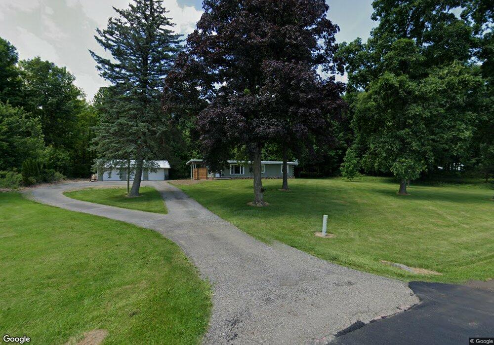
4866 State Route 598 Crestline, OH 44827
Estimated Value: $172,000 - $244,000
3
Beds
1
Bath
1,344
Sq Ft
$162/Sq Ft
Est. Value
About This Home
This home is located at 4866 State Route 598, Crestline, OH 44827 and is currently estimated at $217,888, approximately $162 per square foot. 4866 State Route 598 is a home located in Crawford County with nearby schools including Buckeye Central Elementary School, Buckeye Central Middle School, and Buckeye Central High School.
Ownership History
Date
Name
Owned For
Owner Type
Purchase Details
Closed on
May 23, 2019
Sold by
Swank Karen E
Bought by
Swank Isaac C
Current Estimated Value
Home Financials for this Owner
Home Financials are based on the most recent Mortgage that was taken out on this home.
Original Mortgage
$122,580
Outstanding Balance
$107,554
Interest Rate
4.1%
Mortgage Type
VA
Estimated Equity
$110,334
Purchase Details
Closed on
Jun 20, 2014
Sold by
Fried Michael L and Fried Monte A
Bought by
Swank Karen E
Home Financials for this Owner
Home Financials are based on the most recent Mortgage that was taken out on this home.
Original Mortgage
$88,000
Interest Rate
2.99%
Mortgage Type
Adjustable Rate Mortgage/ARM
Create a Home Valuation Report for This Property
The Home Valuation Report is an in-depth analysis detailing your home's value as well as a comparison with similar homes in the area
Home Values in the Area
Average Home Value in this Area
Purchase History
| Date | Buyer | Sale Price | Title Company |
|---|---|---|---|
| Swank Isaac C | $122,600 | Barrister Title | |
| Swank Karen E | $110,000 | Chicago Title |
Source: Public Records
Mortgage History
| Date | Status | Borrower | Loan Amount |
|---|---|---|---|
| Open | Swank Isaac C | $122,580 | |
| Previous Owner | Swank Karen E | $88,000 |
Source: Public Records
Tax History Compared to Growth
Tax History
| Year | Tax Paid | Tax Assessment Tax Assessment Total Assessment is a certain percentage of the fair market value that is determined by local assessors to be the total taxable value of land and additions on the property. | Land | Improvement |
|---|---|---|---|---|
| 2024 | $1,806 | $56,040 | $16,240 | $39,800 |
| 2023 | $1,814 | $32,000 | $8,710 | $23,290 |
| 2022 | $1,268 | $32,000 | $8,710 | $23,290 |
| 2021 | $1,271 | $32,000 | $8,710 | $23,290 |
| 2020 | $983 | $25,990 | $8,710 | $17,280 |
| 2019 | $647 | $25,990 | $8,710 | $17,280 |
| 2018 | $696 | $25,990 | $8,710 | $17,280 |
| 2017 | $629 | $24,620 | $8,710 | $15,910 |
| 2016 | $604 | $24,620 | $8,710 | $15,910 |
| 2015 | $609 | $24,620 | $8,710 | $15,910 |
| 2014 | $658 | $25,440 | $8,710 | $16,730 |
| 2013 | $658 | $25,440 | $8,710 | $16,730 |
Source: Public Records
Map
Nearby Homes
- 0 Tiro Rd
- 4705 Tiro Rd
- 4673 Tiro Rd
- 4091 State Route 598
- 0000 Swisher Rd
- 348 W Main St
- 5166 Ohio 98
- 6784 Remlinger Rd
- 5949 Ohio 96
- 102 Mckinley Place
- 0 Auburn Center Rd
- 32 Grove Ave
- 20 Seltzer Ave
- 24 Sunset Dr
- 59 Sunset Dr
- 32 Sharon St
- 16 Grace Ave
- 7199 State Route 598
- 671 Bendle Ave
- 12 Franklin Ave
- 4900 State Route 598
- 4840 State Route 598
- 4826 State Route 598
- 4799 State Route 598
- 4790 State Route 598
- 4960 State Route 598
- 7369 Ohio 39
- 4776 Ohio 598
- 7369 State Route 39
- 4776 State Route 598
- 4770 State Route 598
- 7550 State Route 39
- 4953 State Route 39
- 5064 State Route 598
- 4953 Ohio 39
- 4742 State Route 598
- 4939 Tiro Rd
- 7249 State Route 39
- 7251 State Route 39
- 7606 Ohio 39