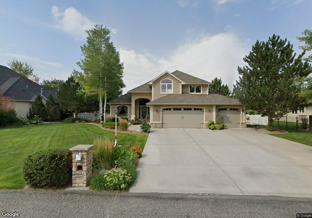
4869 Cedar Ridge Cir Billings, MT 59106
Shiloh NeighborhoodEstimated Value: $720,797 - $821,000
5
Beds
3
Baths
3,388
Sq Ft
$230/Sq Ft
Est. Value
About This Home
This home is located at 4869 Cedar Ridge Cir, Billings, MT 59106 and is currently estimated at $779,699, approximately $230 per square foot. 4869 Cedar Ridge Cir is a home located in Yellowstone County with nearby schools including Meadowlark School, Ben Steele Middle School, and Billings West High School.
Ownership History
Date
Name
Owned For
Owner Type
Purchase Details
Closed on
Jul 24, 2024
Sold by
Shald Robert M and Shald Susan K
Bought by
Taylor Michael Z and Taylor Kaitlin N
Current Estimated Value
Home Financials for this Owner
Home Financials are based on the most recent Mortgage that was taken out on this home.
Original Mortgage
$703,000
Outstanding Balance
$695,166
Interest Rate
6.95%
Mortgage Type
New Conventional
Estimated Equity
$59,546
Create a Home Valuation Report for This Property
The Home Valuation Report is an in-depth analysis detailing your home's value as well as a comparison with similar homes in the area
Home Values in the Area
Average Home Value in this Area
Purchase History
| Date | Buyer | Sale Price | Title Company |
|---|---|---|---|
| Taylor Michael Z | -- | Flying S Title And Escrow |
Source: Public Records
Mortgage History
| Date | Status | Borrower | Loan Amount |
|---|---|---|---|
| Open | Taylor Michael Z | $703,000 |
Source: Public Records
Tax History Compared to Growth
Tax History
| Year | Tax Paid | Tax Assessment Tax Assessment Total Assessment is a certain percentage of the fair market value that is determined by local assessors to be the total taxable value of land and additions on the property. | Land | Improvement |
|---|---|---|---|---|
| 2025 | $4,858 | $718,300 | $126,892 | $591,408 |
| 2024 | $4,858 | $600,200 | $93,686 | $506,514 |
| 2023 | $4,968 | $600,200 | $93,686 | $506,514 |
| 2022 | $3,703 | $482,400 | $0 | $0 |
| 2021 | $4,461 | $482,400 | $0 | $0 |
| 2020 | $4,149 | $451,800 | $0 | $0 |
| 2019 | $4,071 | $451,800 | $0 | $0 |
| 2018 | $4,271 | $465,200 | $0 | $0 |
| 2017 | $4,092 | $465,200 | $0 | $0 |
| 2016 | $3,862 | $442,200 | $0 | $0 |
| 2015 | $3,772 | $442,200 | $0 | $0 |
| 2014 | $3,529 | $220,268 | $0 | $0 |
Source: Public Records
Map
Nearby Homes
- 661 Light Stream Ln
- 4645 Shining Light Ln
- 4625 Shining Light Ln
- 4613 Shining Light Ln
- 4641 Sunburst Ln
- 4646 Sunburst Ln
- 700 Bluegrass Place
- 1200 Bluegrass Dr W
- TBD 52nd St W
- 5208 Dovetail Ave
- 4606 Liahona Ln
- 5220 Rich Ln
- 4635 Leading Light Ln
- 5203 Camp Ln
- 1025 Vinyard Way
- 267 Sundance Ridge Rd
- 5226 Rich Ln
- 5232 Rich Ln
- 1542 Silver Run Trail
- Block 1 Lot 5 Hawk Creek Ave
- 4847 Cedar Ridge Cir
- 4885 Cedar Ridge Cir
- 4821 Cedar Ridge Cir
- 4909 Cedar Ridge Cir
- 4868 Cedar Ridge Cir
- 4846 Cedar Ridge Cir
- 4892 Cedar Ridge Cir
- 4820 Cedar Ridge Cir
- 4927 Dovetail Ave
- 4883 Dovetail Ave
- 4806 Cedar Ridge Cir
- 4867 Dovetail Ave
- 4931 Dovetail Ave
- 4845 Dovetail Ave
- 4819 Dovetail Ave
- 4929 Stone Ridge Cir
- 4932 Dovetail Ave
- 4801 Dovetail Ave
- 4945 Dovetail Ave
- 4738 N Woodhaven Way