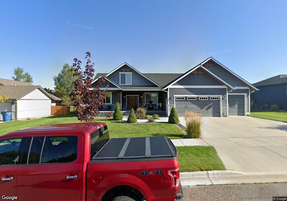
4875 Jeff Dr Missoula, MT 59803
Miller Creek NeighborhoodEstimated Value: $777,000 - $911,000
5
Beds
3
Baths
2,286
Sq Ft
$370/Sq Ft
Est. Value
About This Home
This home is located at 4875 Jeff Dr, Missoula, MT 59803 and is currently estimated at $845,561, approximately $369 per square foot. 4875 Jeff Dr is a home with nearby schools including Jeannette Rankin Elementary School, Porter Middle School, and Sentinel High School.
Ownership History
Date
Name
Owned For
Owner Type
Purchase Details
Closed on
Sep 4, 2020
Sold by
Twite Scott A
Bought by
Twite Brothers Construction Llc
Current Estimated Value
Purchase Details
Closed on
Apr 15, 2014
Sold by
Lloyd A Twite Family Partnership
Bought by
Daniels David J and Daniels Deby
Home Financials for this Owner
Home Financials are based on the most recent Mortgage that was taken out on this home.
Original Mortgage
$70,540
Interest Rate
4.32%
Mortgage Type
Purchase Money Mortgage
Create a Home Valuation Report for This Property
The Home Valuation Report is an in-depth analysis detailing your home's value as well as a comparison with similar homes in the area
Home Values in the Area
Average Home Value in this Area
Purchase History
| Date | Buyer | Sale Price | Title Company |
|---|---|---|---|
| Twite Brothers Construction Llc | -- | Insred Titles Llc | |
| Daniels David J | -- | Insured Titles Llc |
Source: Public Records
Mortgage History
| Date | Status | Borrower | Loan Amount |
|---|---|---|---|
| Previous Owner | Daniels David J | $70,540 |
Source: Public Records
Tax History Compared to Growth
Tax History
| Year | Tax Paid | Tax Assessment Tax Assessment Total Assessment is a certain percentage of the fair market value that is determined by local assessors to be the total taxable value of land and additions on the property. | Land | Improvement |
|---|---|---|---|---|
| 2025 | $8,878 | $862,800 | $107,400 | $755,400 |
| 2024 | $8,519 | $700,100 | $89,625 | $610,475 |
| 2023 | $8,208 | $700,100 | $89,625 | $610,475 |
| 2022 | $7,022 | $519,500 | $0 | $0 |
| 2021 | $6,310 | $519,500 | $0 | $0 |
| 2020 | $5,795 | $461,300 | $0 | $0 |
| 2019 | $5,779 | $461,300 | $0 | $0 |
| 2018 | $5,588 | $432,900 | $0 | $0 |
| 2017 | $4,952 | $432,900 | $0 | $0 |
| 2016 | $4,492 | $371,950 | $0 | $0 |
| 2015 | $1,185 | $105,870 | $0 | $0 |
| 2014 | $752 | $37,951 | $0 | $0 |
Source: Public Records
Map
Nearby Homes
- 7083 Shaver Dr
- 7206 Shaver Dr
- Nhn Avery Ln
- 6994 Shaver Dr
- 7123 Shaver Dr
- 7032 Jenaya Ct
- 4060 Jamie Ann Ln
- 7070 Max Dr
- 7006 Max Dr
- 6610 Justin Ct
- 7022 Max Dr
- 7037 Max Dr
- 5065 Jeff Dr
- 7155 Brooke Lynn Ct
- 6915 Shaver Dr
- 7202 Shaver Dr
- 7055 Guinevere Dr
- 6650 Linda Vista Blvd
- 7044 Guinevere Dr
- The Alpine Plan at Linda Vista