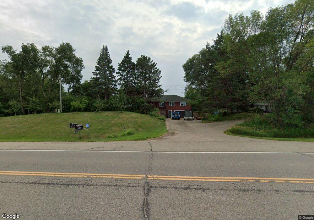
4875 Lonsdale Blvd E Northfield, MN 55057
Estimated Value: $453,967 - $533,000
4
Beds
3
Baths
2,242
Sq Ft
$219/Sq Ft
Est. Value
About This Home
This home is located at 4875 Lonsdale Blvd E, Northfield, MN 55057 and is currently estimated at $491,742, approximately $219 per square foot. 4875 Lonsdale Blvd E is a home located in Rice County with nearby schools including Bridgewater Elementary School, Northfield Middle School, and Northfield Senior High School.
Ownership History
Date
Name
Owned For
Owner Type
Purchase Details
Closed on
Sep 1, 2023
Sold by
Lufkin Gregory Hall and Lufkin Deeann Michelle
Bought by
Lufkin Gregory Hall and Lufkin Deeann Michelle
Current Estimated Value
Purchase Details
Closed on
Jun 28, 2004
Sold by
Unavailable
Bought by
Lufkin Gregory H and Lufkin Deeann M
Create a Home Valuation Report for This Property
The Home Valuation Report is an in-depth analysis detailing your home's value as well as a comparison with similar homes in the area
Home Values in the Area
Average Home Value in this Area
Purchase History
| Date | Buyer | Sale Price | Title Company |
|---|---|---|---|
| Lufkin Gregory Hall | -- | None Listed On Document | |
| Lufkin Gregory H | $264,000 | -- |
Source: Public Records
Tax History Compared to Growth
Tax History
| Year | Tax Paid | Tax Assessment Tax Assessment Total Assessment is a certain percentage of the fair market value that is determined by local assessors to be the total taxable value of land and additions on the property. | Land | Improvement |
|---|---|---|---|---|
| 2025 | $4,850 | $456,900 | $115,000 | $341,900 |
| 2024 | $4,850 | $418,600 | $100,000 | $318,600 |
| 2023 | $4,000 | $418,600 | $100,000 | $318,600 |
| 2022 | $3,870 | $375,400 | $88,000 | $287,400 |
| 2021 | $3,920 | $337,200 | $84,000 | $253,200 |
| 2020 | $3,762 | $325,000 | $84,000 | $241,000 |
| 2019 | $3,874 | $307,100 | $84,000 | $223,100 |
| 2018 | $3,514 | $306,200 | $84,000 | $222,200 |
| 2017 | $3,148 | $273,200 | $84,000 | $189,200 |
| 2016 | $3,300 | $271,300 | $84,000 | $187,300 |
| 2015 | $3,258 | $273,400 | $84,000 | $189,400 |
| 2014 | -- | $272,100 | $84,000 | $188,100 |
Source: Public Records
Map
Nearby Homes
- 9206 Edgebrook Dr
- XXXXX 330th St
- TBD Hwy 19 / Lonsdal Lonsdale Blvd E
- 1108 Greenvale Ave W Unit 2
- 1105 Hawthorne Ct
- 717 Lincoln St N
- 1000 Cannon Valley Dr Unit 143
- 1504 Independence Dr Unit 603
- 1507 Independence Dr
- 904 Forest Ave
- 621 Highland Ave W
- 812 Ivanhoe Dr
- 616 Greenvale Ave W
- 612 Greenvale Ave W
- 602 Greenvale Ave W
- 708 Saint Olaf Ave
- 732 Lathrop Dr
- 728 Lathrop Dr
- 706 Greenvale Ave W
- 1025 Summerfield Dr
- 4867 Lonsdale Blvd E
- 4811 Lonsdale Blvd E
- 1395 85th Court Way
- 1395 85th Ct
- 4945 Lonsdale Blvd E
- 4815 Lonsdale Blvd E
- 19 Field & Stream Acres
- xxxx Albany Ave
- Outlot A Gleason 3rd Addn
- XXX Division St
- 5052 Lonsdale Blvd E
- 5062 Lonsdale Blvd E
- 8583 Dixon Ave
- 8539 Dixon Ave
- 5111 Lonsdale Blvd E
- 5074 Lonsdale Blvd E
- 8997 Eaves Ave
- 5048 Ebel Way
- 5094 Lonsdale Blvd E
- 4660 86th St E