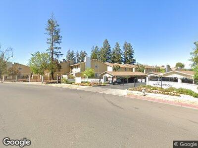
4875 N Backer Ave Unit 141 Fresno, CA 93726
Hoover NeighborhoodEstimated Value: $238,625 - $263,000
3
Beds
2
Baths
1,390
Sq Ft
$181/Sq Ft
Est. Value
About This Home
This home is located at 4875 N Backer Ave Unit 141, Fresno, CA 93726 and is currently estimated at $250,906, approximately $180 per square foot. 4875 N Backer Ave Unit 141 is a home located in Fresno County with nearby schools including Vinland Elementary School, Tioga Middle School, and Herbert Hoover High School.
Ownership History
Date
Name
Owned For
Owner Type
Purchase Details
Closed on
Oct 5, 2020
Sold by
Rodriguez Edward M
Bought by
Rodriguez Traci
Current Estimated Value
Purchase Details
Closed on
Oct 3, 2002
Sold by
Rodriguez Traci
Bought by
Rodriguez Edward M
Home Financials for this Owner
Home Financials are based on the most recent Mortgage that was taken out on this home.
Original Mortgage
$74,400
Interest Rate
5.58%
Purchase Details
Closed on
Mar 15, 1999
Sold by
Michael Graham and Michael Cynthia D
Bought by
Rodriguez Edward
Home Financials for this Owner
Home Financials are based on the most recent Mortgage that was taken out on this home.
Original Mortgage
$47,500
Interest Rate
6.54%
Create a Home Valuation Report for This Property
The Home Valuation Report is an in-depth analysis detailing your home's value as well as a comparison with similar homes in the area
Home Values in the Area
Average Home Value in this Area
Purchase History
| Date | Buyer | Sale Price | Title Company |
|---|---|---|---|
| Rodriguez Traci | -- | None Available | |
| Rodriguez Edward M | -- | Fidelity National Title Co | |
| Rodriguez Edward | $50,000 | Fidelity National Title Co |
Source: Public Records
Mortgage History
| Date | Status | Borrower | Loan Amount |
|---|---|---|---|
| Closed | Rodriguez Edward M | $74,400 | |
| Closed | Rodriguez Edward | $47,500 |
Source: Public Records
Tax History Compared to Growth
Tax History
| Year | Tax Paid | Tax Assessment Tax Assessment Total Assessment is a certain percentage of the fair market value that is determined by local assessors to be the total taxable value of land and additions on the property. | Land | Improvement |
|---|---|---|---|---|
| 2023 | $993 | $75,316 | $19,578 | $55,738 |
| 2022 | $962 | $73,841 | $19,195 | $54,646 |
| 2021 | $936 | $72,394 | $18,819 | $53,575 |
| 2020 | $932 | $71,653 | $18,627 | $53,026 |
| 2019 | $897 | $70,249 | $18,262 | $51,987 |
| 2018 | $877 | $68,872 | $17,904 | $50,968 |
| 2017 | $863 | $67,522 | $17,553 | $49,969 |
| 2016 | $835 | $66,199 | $17,209 | $48,990 |
| 2015 | $822 | $65,206 | $16,951 | $48,255 |
| 2014 | $807 | $63,929 | $16,619 | $47,310 |
Source: Public Records
Map
Nearby Homes
- 4885 N Backer Ave Unit 148
- 4676 E Alamos Ave
- 4676 E Alamos Ave Unit 127
- 4627 N Maple Ave
- 4561 N Price Ave
- 4760 N Rowell Ave
- 4750 E Norwich Ave
- 4485 E Indianapolis Ave
- 4489 N Chestnut Ave
- 4869 E Santa Ana Ave
- 4779 N Cedar Ave Unit 109
- 4879 E San Gabriel Ave
- 4881 E Rialto Ave
- 4481 E Holland Ave
- 4473 E Holland Ave
- 955 W San Gabriel Ave
- 4023 E Santa Ana Ave
- 3920 E Rialto Ave
- 3919 E Pico Ave
- 2739 Fine Ave
- 4875 N Backer Ave
- 4875 N Backer Ave Unit 184
- 4875 N Backer Ave
- 4875 N Backer Ave Unit 161
- 4875 N Backer Ave Unit 170
- 4875 N Backer Ave Unit 143
- 4875 N Backer Ave Unit 158
- 4875 N Backer Ave Unit 162
- 4875 N Backer Ave Unit 142
- 4875 N Backer Ave Unit 165
- 4875 N Backer Ave Unit 145
- 4875 N Backer Ave Unit 163
- 4875 N Backer Ave Unit 159
- 4875 N Backer Ave Unit 164
- 4875 N Backer Ave Unit 141
- 4875 N Backer Ave Unit 144
- 4875 N Backer Ave Unit 157
- 4875 N Backer Ave Unit 134
- 4875 N Backer Ave Unit 160
- 4875 N Backer Ave Unit 148