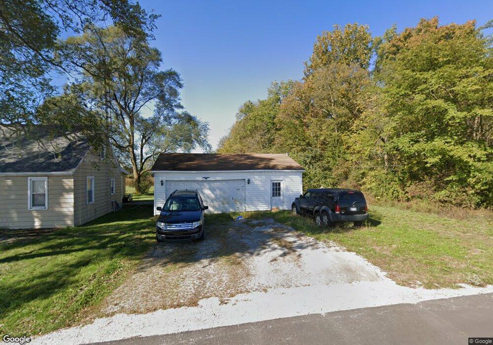
4877 Karafit Rd Celina, OH 45822
Estimated Value: $162,000 - $201,484
3
Beds
1
Bath
1,140
Sq Ft
$162/Sq Ft
Est. Value
About This Home
This home is located at 4877 Karafit Rd, Celina, OH 45822 and is currently estimated at $184,621, approximately $161 per square foot. 4877 Karafit Rd is a home located in Mercer County with nearby schools including Celina Middle School and Celina High School.
Ownership History
Date
Name
Owned For
Owner Type
Purchase Details
Closed on
Sep 7, 2016
Sold by
Butcher Samuel W and Butcher Connie
Bought by
Swain Rachael
Current Estimated Value
Home Financials for this Owner
Home Financials are based on the most recent Mortgage that was taken out on this home.
Original Mortgage
$77,900
Outstanding Balance
$62,224
Interest Rate
3.43%
Mortgage Type
New Conventional
Estimated Equity
$122,397
Purchase Details
Closed on
Feb 16, 2010
Sold by
Wise Clifford L and Wise Melissa D
Bought by
Butcher Samuel W
Home Financials for this Owner
Home Financials are based on the most recent Mortgage that was taken out on this home.
Original Mortgage
$67,575
Interest Rate
5.11%
Mortgage Type
New Conventional
Purchase Details
Closed on
Jul 25, 2005
Sold by
Grace Daniel Lee and Grace Deborah Ann
Bought by
Wise Clifford L
Create a Home Valuation Report for This Property
The Home Valuation Report is an in-depth analysis detailing your home's value as well as a comparison with similar homes in the area
Home Values in the Area
Average Home Value in this Area
Purchase History
| Date | Buyer | Sale Price | Title Company |
|---|---|---|---|
| Swain Rachael | $82,000 | Attorney | |
| Butcher Samuel W | $62,520 | Attorney | |
| Wise Clifford L | $62,000 | Attorney |
Source: Public Records
Mortgage History
| Date | Status | Borrower | Loan Amount |
|---|---|---|---|
| Open | Swain Rachael | $77,900 | |
| Previous Owner | Butcher Samuel W | $67,575 |
Source: Public Records
Tax History Compared to Growth
Tax History
| Year | Tax Paid | Tax Assessment Tax Assessment Total Assessment is a certain percentage of the fair market value that is determined by local assessors to be the total taxable value of land and additions on the property. | Land | Improvement |
|---|---|---|---|---|
| 2024 | $1,797 | $44,280 | $8,510 | $35,770 |
| 2023 | $1,797 | $44,280 | $8,510 | $35,770 |
| 2022 | $1,410 | $30,000 | $6,060 | $23,940 |
| 2021 | $1,413 | $30,000 | $6,060 | $23,940 |
| 2020 | $1,193 | $30,000 | $6,060 | $23,940 |
| 2019 | $1,128 | $26,640 | $5,780 | $20,860 |
| 2018 | $1,170 | $26,640 | $5,780 | $20,860 |
| 2017 | $1,102 | $26,640 | $5,780 | $20,860 |
| 2016 | $1,033 | $23,210 | $5,670 | $17,540 |
| 2015 | $1,005 | $23,210 | $5,670 | $17,540 |
| 2014 | $1,004 | $23,210 | $5,670 | $17,540 |
| 2013 | $963 | $21,490 | $5,250 | $16,240 |
Source: Public Records
Map
Nearby Homes
- 6953 Ohio 219 Unit Lot 7
- 6953 State Route 219 Unit 4
- 5346 Stillwater Ln
- 77 N Canal St
- 5240 Grove Dr
- 5272 Prairie View Dr
- 5383 U S 127
- 5464 Ada Dr
- 3044 Shore Dr
- 1700 E Market St Unit 310
- 125 Orchard Ave
- 522 Schunk Rd
- 217 Lakeview Dr
- 802 E Market St
- 629 E Livingston St
- 110 N Cherry St
- 320 E Livingston St
- 210 S Elm St
- 515 W Fayette St
- 319 E Wayne St
- 4841 Karafit Rd
- 4821 Karafit Rd
- 4805 Karafit Rd
- 4969 Karafit Rd
- 6977 County Road 219a
- 6928 County Road 219a
- 5042 Karafit Rd
- 6939 County Road 219a
- 5063 Karafit Rd
- 4806 County Road 219a
- 5033 Karafit Rd
- 5033 Karafit Rd
- 6740 Brookside Dr
- 6746 State Route 219
- 6746 State Route 219
- 5130 Karafit Rd
- 5127 Karafit Rd
- 712 Channel Rd
- 6728 Brookside Dr
- 6767 County Road 219a