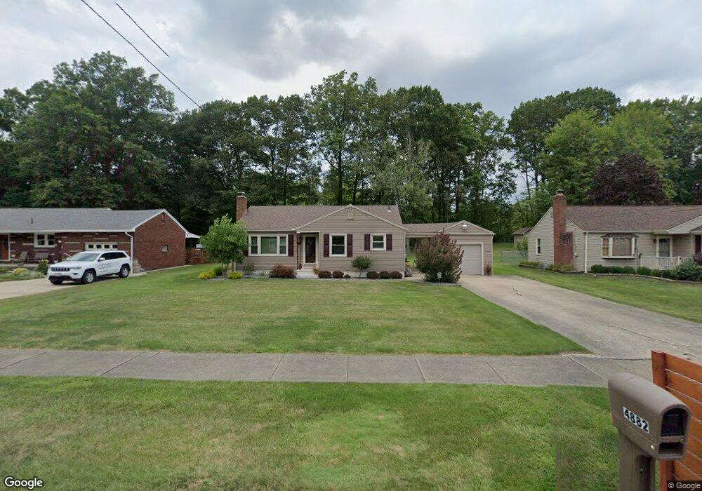
4882 Norquest Blvd Youngstown, OH 44515
Austintown NeighborhoodEstimated Value: $129,000 - $171,000
3
Beds
1
Bath
1,116
Sq Ft
$143/Sq Ft
Est. Value
About This Home
This home is located at 4882 Norquest Blvd, Youngstown, OH 44515 and is currently estimated at $159,468, approximately $142 per square foot. 4882 Norquest Blvd is a home located in Mahoning County with nearby schools including Austintown Elementary School, Austintown Intermediate School, and Austintown Middle School.
Ownership History
Date
Name
Owned For
Owner Type
Purchase Details
Closed on
Nov 12, 2007
Sold by
Miller Dolores and Miller Robert
Bought by
Chance Mary Ellen
Current Estimated Value
Home Financials for this Owner
Home Financials are based on the most recent Mortgage that was taken out on this home.
Original Mortgage
$80,000
Outstanding Balance
$50,851
Interest Rate
6.47%
Mortgage Type
Purchase Money Mortgage
Estimated Equity
$108,617
Purchase Details
Closed on
Jun 27, 1978
Bought by
Miller Delores
Create a Home Valuation Report for This Property
The Home Valuation Report is an in-depth analysis detailing your home's value as well as a comparison with similar homes in the area
Home Values in the Area
Average Home Value in this Area
Purchase History
| Date | Buyer | Sale Price | Title Company |
|---|---|---|---|
| Chance Mary Ellen | $80,000 | Attorney | |
| Miller Delores | -- | -- |
Source: Public Records
Mortgage History
| Date | Status | Borrower | Loan Amount |
|---|---|---|---|
| Open | Chance Mary Ellen | $80,000 |
Source: Public Records
Tax History Compared to Growth
Tax History
| Year | Tax Paid | Tax Assessment Tax Assessment Total Assessment is a certain percentage of the fair market value that is determined by local assessors to be the total taxable value of land and additions on the property. | Land | Improvement |
|---|---|---|---|---|
| 2024 | $1,696 | $46,820 | $7,420 | $39,400 |
| 2023 | $1,697 | $46,820 | $7,420 | $39,400 |
| 2022 | $1,283 | $31,550 | $7,420 | $24,130 |
| 2021 | $1,283 | $31,550 | $7,420 | $24,130 |
| 2020 | $1,289 | $31,550 | $7,420 | $24,130 |
| 2019 | $1,147 | $27,200 | $6,750 | $20,450 |
| 2018 | $1,103 | $27,200 | $6,750 | $20,450 |
| 2017 | $1,028 | $27,200 | $6,750 | $20,450 |
| 2016 | $956 | $24,610 | $6,750 | $17,860 |
| 2015 | $927 | $24,610 | $6,750 | $17,860 |
| 2014 | $931 | $24,610 | $6,750 | $17,860 |
| 2013 | $921 | $24,610 | $6,750 | $17,860 |
Source: Public Records
Map
Nearby Homes
- 112 Benton St
- 5231 W Rockwell Rd
- 148 N Kimberly Ave
- 170 Idaho Rd
- 124 S Inglewood Ave
- 148 Marcia Dr
- 5451 Virginia Dr
- 3794-3796 Mahoning Ave
- 5109 W Elmwood Ave
- 97 Idlewood Rd
- 4258 Mahoning Ave
- 225 S Raccoon Rd
- 138 N Canfield Niles Rd
- 161 N Roanoke Ave
- 107 N Roanoke Ave
- 176 N Canfield Niles Rd
- 0 S Raccoon Rd Unit 5142489
- 111 Ohltown Rd
- 210 S Beverly Ave
- 5560 Norquest Blvd
- 4892 Norquest Blvd
- 4874 Norquest Blvd
- 00 Anderson Ave
- 4866 Norquest Blvd
- 4858 Norquest Blvd
- 4905 E Rockwell Rd
- 4891 Norquest Blvd
- 4908 Norquest Blvd
- 4895 Norquest Blvd
- 4850 Norquest Blvd
- 4877 Norquest Blvd
- 4915 E Rockwell Rd
- 4905 Norquest Blvd
- 4867 Norquest Blvd
- 4842 Norquest Blvd
- 4920 Norquest Blvd
- 4923 E Rockwell Rd
- 4917 Norquest Blvd
- 4857 Norquest Blvd
- 4832 Norquest Blvd