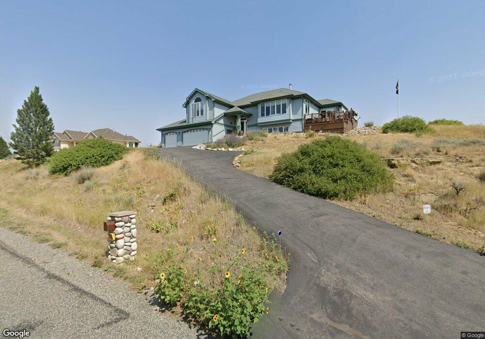
4883 Arapaho Trail Billings, MT 59106
Estimated Value: $566,000 - $673,000
4
Beds
3
Baths
3,158
Sq Ft
$195/Sq Ft
Est. Value
About This Home
This home is located at 4883 Arapaho Trail, Billings, MT 59106 and is currently estimated at $614,369, approximately $194 per square foot. 4883 Arapaho Trail is a home located in Yellowstone County with nearby schools including Alkali Creek School, Castle Rock Junior High School, and Skyview High School.
Ownership History
Date
Name
Owned For
Owner Type
Purchase Details
Closed on
Feb 27, 2018
Sold by
Reiss Greg and Reiss Cindy
Bought by
French David W and French Ruth A
Current Estimated Value
Home Financials for this Owner
Home Financials are based on the most recent Mortgage that was taken out on this home.
Original Mortgage
$316,800
Outstanding Balance
$270,436
Interest Rate
4.22%
Mortgage Type
New Conventional
Estimated Equity
$343,933
Create a Home Valuation Report for This Property
The Home Valuation Report is an in-depth analysis detailing your home's value as well as a comparison with similar homes in the area
Home Values in the Area
Average Home Value in this Area
Purchase History
| Date | Buyer | Sale Price | Title Company |
|---|---|---|---|
| French David W | -- | -- |
Source: Public Records
Mortgage History
| Date | Status | Borrower | Loan Amount |
|---|---|---|---|
| Open | French David W | $316,800 |
Source: Public Records
Tax History Compared to Growth
Tax History
| Year | Tax Paid | Tax Assessment Tax Assessment Total Assessment is a certain percentage of the fair market value that is determined by local assessors to be the total taxable value of land and additions on the property. | Land | Improvement |
|---|---|---|---|---|
| 2025 | $4,200 | $614,900 | $62,705 | $552,195 |
| 2024 | $4,200 | $494,400 | $56,035 | $438,365 |
| 2023 | $4,101 | $494,400 | $56,035 | $438,365 |
| 2022 | $3,153 | $410,800 | $0 | $0 |
| 2021 | $3,931 | $410,800 | $0 | $0 |
| 2020 | $3,633 | $396,300 | $0 | $0 |
| 2019 | $3,564 | $396,300 | $0 | $0 |
| 2018 | $3,364 | $364,100 | $0 | $0 |
| 2017 | $2,794 | $364,100 | $0 | $0 |
| 2016 | $2,951 | $329,100 | $0 | $0 |
| 2015 | $2,859 | $387,400 | $0 | $0 |
| 2014 | $2,759 | $167,851 | $0 | $0 |
Source: Public Records
Map
Nearby Homes
- TBD Arapaho Trail
- 4699 Palisades Park
- 3706 Iroquois Trail
- 4960 Whisper Way
- 4984 Whisper Way Unit 5
- 3485 Stone Mountain Cir
- 2711 Tulane Dr
- 4448 Toyon Dr
- 5404 Gene Sarazen Dr
- 4706 Sky Vista Ct
- 2516 Aspen Creek Trail
- 2518 Silver Pine Ct
- 2514 Silver Pine Ct
- 5212 Chapel Hill Dr
- 2509 Buffalo Ridge Trail
- 3043 Lloyd Mangrum Ln
- 4911 Silver Creek Trail
- 5073 Audubon Way
- 4265 Laredo Place
- 4902 Silver Creek Trail
- Lot 6A Arapaho Trail
- 0 Arapaho Trail
- 4906 Piegan Trail
- 4893 Arapaho Trail
- 4882 Arapaho Trail
- 4842 Piegan Trail
- 4904 Nez Perce Lookout
- 4922 Piegan Trail
- 4855 Piegan Trail
- 4905 Piegan Trail
- 4907 Arapaho Trail
- 4870 Arapaho Trail
- 4917 Piegan Trail
- 4843 Piegan Trail
- 4856 Arapaho Trail
- 4933 Piegan Trail
- 4823 Piegan Trail
- 4923 Arapaho Trail
- 4918 Nez Perce Lookout
- 4825 Arapaho Trail