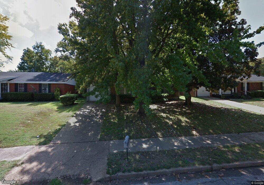
4889 Blanding Ave Memphis, TN 38118
Parkway Village NeighborhoodEstimated Value: $128,000 - $156,000
3
Beds
2
Baths
1,276
Sq Ft
$109/Sq Ft
Est. Value
About This Home
This home is located at 4889 Blanding Ave, Memphis, TN 38118 and is currently estimated at $139,659, approximately $109 per square foot. 4889 Blanding Ave is a home located in Shelby County with nearby schools including Cromwell Elementary School, Wooddale High School, and Memphis School of Excellence.
Ownership History
Date
Name
Owned For
Owner Type
Purchase Details
Closed on
Oct 15, 2002
Sold by
Hibbard Doris June
Bought by
Williams Bonise
Current Estimated Value
Purchase Details
Closed on
Oct 14, 2002
Sold by
Mauck Mary Alice
Bought by
Williams Bonise
Purchase Details
Closed on
Jun 29, 1998
Sold by
Mauck Byron L
Bought by
Williams Bonise
Home Financials for this Owner
Home Financials are based on the most recent Mortgage that was taken out on this home.
Original Mortgage
$56,150
Interest Rate
7.04%
Create a Home Valuation Report for This Property
The Home Valuation Report is an in-depth analysis detailing your home's value as well as a comparison with similar homes in the area
Home Values in the Area
Average Home Value in this Area
Purchase History
| Date | Buyer | Sale Price | Title Company |
|---|---|---|---|
| Williams Bonise | -- | Tri State Title & Escrow Inc | |
| Williams Bonise | -- | Tri State Title & Escrow Inc | |
| Williams Bonise | $68,900 | Transcontinental Title Compa | |
| Williams Bonise | $68,900 | Transcontinental Title Compa |
Source: Public Records
Mortgage History
| Date | Status | Borrower | Loan Amount |
|---|---|---|---|
| Previous Owner | Williams Bonise | $56,150 |
Source: Public Records
Tax History
| Year | Tax Paid | Tax Assessment Tax Assessment Total Assessment is a certain percentage of the fair market value that is determined by local assessors to be the total taxable value of land and additions on the property. | Land | Improvement |
|---|---|---|---|---|
| 2025 | $610 | $31,625 | $5,000 | $26,625 |
| 2024 | $610 | $18,000 | $3,350 | $14,650 |
| 2023 | $1,097 | $18,000 | $3,350 | $14,650 |
| 2022 | $1,078 | $18,000 | $3,350 | $14,650 |
| 2021 | $1,088 | $18,000 | $3,350 | $14,650 |
| 2020 | $1,060 | $14,625 | $3,350 | $11,275 |
| 2019 | $1,060 | $14,625 | $3,350 | $11,275 |
| 2018 | $1,060 | $14,625 | $3,350 | $11,275 |
| 2017 | $601 | $14,625 | $3,350 | $11,275 |
| 2016 | $629 | $14,400 | $0 | $0 |
| 2014 | $629 | $14,400 | $0 | $0 |
Source: Public Records
Map
Nearby Homes
- 3274 Gaylord Ln
- 4947 Demeter Cove
- 3347 S Perkins Rd
- 4763 Wooddale Ave
- 4898 Knight Arnold Rd
- 3331 Chancellor St
- 4828 Knight Arnold Rd
- 4650 Blanding Ave
- 3515 Wooddale Cove
- 4783 Winchester Rd
- 4616 Blanding Dr
- 5134 Scottsdale Ave
- 3626 Outland Rd Unit 86
- 3629 Chesterwood Dr Unit 77
- 5094 Jessie Lee Ln
- 5064 Knight Arnold Rd
- 4797 Myrlen Dr
- 3082 Bluffdale St
- 5128 Jessie Lee Ln
- 4787 Townhouse Way
- 4883 Blanding Ave
- 4895 Blanding Ave
- 4886 Chuck Ave
- 4894 Chuck Ave
- 4875 Blanding Ave
- 4903 Blanding Ave
- 4880 Chuck Ave
- 4900 Chuck Ave
- 4890 Blanding Ave
- 4884 Blanding Ave
- 4896 Blanding Ave
- 4869 Blanding Ave
- 4874 Chuck Ave
- 3357 Starsdale St
- 4876 Blanding Ave
- 4904 Blanding Ave
- 4908 Chuck Ave
- 4866 Chuck Ave
- 4863 Blanding Ave
- 4870 Blanding Ave