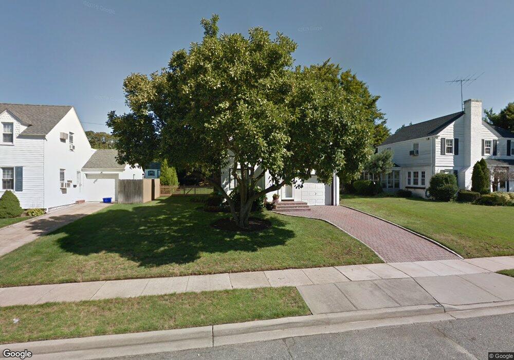
489 Devonshire Rd Baldwin, NY 11510
Estimated Value: $578,564 - $724,000
3
Beds
2
Baths
1,251
Sq Ft
$521/Sq Ft
Est. Value
About This Home
This home is located at 489 Devonshire Rd, Baldwin, NY 11510 and is currently estimated at $651,282, approximately $520 per square foot. 489 Devonshire Rd is a home located in Nassau County with nearby schools including Baldwin Senior High School and St Agnes Cathedral School.
Ownership History
Date
Name
Owned For
Owner Type
Purchase Details
Closed on
Oct 7, 2019
Sold by
Hennessy Thomas F and Hennessy Betty V
Bought by
Soriano Rene A
Current Estimated Value
Home Financials for this Owner
Home Financials are based on the most recent Mortgage that was taken out on this home.
Original Mortgage
$412,250
Outstanding Balance
$360,409
Interest Rate
3.4%
Mortgage Type
New Conventional
Estimated Equity
$290,873
Create a Home Valuation Report for This Property
The Home Valuation Report is an in-depth analysis detailing your home's value as well as a comparison with similar homes in the area
Home Values in the Area
Average Home Value in this Area
Purchase History
| Date | Buyer | Sale Price | Title Company |
|---|---|---|---|
| Soriano Rene A | $485,000 | None Available |
Source: Public Records
Mortgage History
| Date | Status | Borrower | Loan Amount |
|---|---|---|---|
| Open | Soriano Rene A | $412,250 |
Source: Public Records
Tax History
| Year | Tax Paid | Tax Assessment Tax Assessment Total Assessment is a certain percentage of the fair market value that is determined by local assessors to be the total taxable value of land and additions on the property. | Land | Improvement |
|---|---|---|---|---|
| 2025 | $9,992 | $324 | $153 | $171 |
| 2024 | $2,435 | $335 | $158 | $177 |
Source: Public Records
Map
Nearby Homes
- 420 Devonshire Rd
- 2122 Walnut St
- 2116 Maple St
- 590 Haig St Unit 101
- 2270 Edna Ct
- 2357 Rockwood Ave
- 2355 Pershing Blvd Unit 607
- 556 Jackson St
- 2 Meadow Ln
- 619 Ashland Ave
- 623 Ashland Ave
- 720 New York Ave
- 578 Seaman Ave
- 425 Jackson St
- 757 Bixby Dr
- 2 Florence St
- 2316 Harrison Ave
- 1874 Rockville Dr
- 1905 Bryant Place
- 1900 Carleton Place
- 495 Devonshire Rd
- 483 Devonshire Rd
- 2249 Croydon Dr
- 501 Devonshire Rd
- 488 Devonshire Rd
- 474 Devonshire Rd
- 507 Devonshire Rd
- 3 Coventry Rd
- 500 Devonshire Rd
- 2283 Croydon Dr
- 2250 Croydon Dr
- 515 Devonshire Rd
- 506 Devonshire Rd
- 2250 Croydon Dr
- 2280 Coventry Rd
- 2289 Croydon Dr
- 2266 Croydon Dr
- 2279 Coventry Rd
- 455 Devonshire Rd
- 3 Devonshire Rd
Your Personal Tour Guide
Ask me questions while you tour the home.