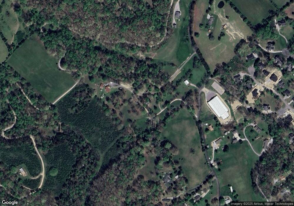
489 Miller Rd Clinton, TN 37716
East Clinton NeighborhoodEstimated Value: $178,762 - $364,000
--
Bed
1
Bath
896
Sq Ft
$293/Sq Ft
Est. Value
About This Home
This home is located at 489 Miller Rd, Clinton, TN 37716 and is currently estimated at $262,941, approximately $293 per square foot. 489 Miller Rd is a home located in Anderson County with nearby schools including Norris Elementary School and Norris Middle School.
Ownership History
Date
Name
Owned For
Owner Type
Purchase Details
Closed on
Nov 29, 2010
Sold by
Beets Millie L
Bought by
Battle Ashley D
Current Estimated Value
Purchase Details
Closed on
Aug 20, 2001
Sold by
Hendrix Floyd
Bought by
Battle Ashley D
Purchase Details
Closed on
May 21, 2001
Sold by
Hendrix Floyd
Bought by
Hendrix Floyd and Hendrix Bonnie
Purchase Details
Closed on
Apr 23, 2001
Sold by
Hendrix Floyd and Hendrix Bonnie
Bought by
Hendrix Floyd and Hendrix Leon
Create a Home Valuation Report for This Property
The Home Valuation Report is an in-depth analysis detailing your home's value as well as a comparison with similar homes in the area
Home Values in the Area
Average Home Value in this Area
Purchase History
| Date | Buyer | Sale Price | Title Company |
|---|---|---|---|
| Battle Ashley D | $10,000 | -- | |
| Battle Ashley D | -- | -- | |
| Hendrix Floyd | $46,000 | -- | |
| Hendrix Floyd | $250 | -- |
Source: Public Records
Tax History Compared to Growth
Tax History
| Year | Tax Paid | Tax Assessment Tax Assessment Total Assessment is a certain percentage of the fair market value that is determined by local assessors to be the total taxable value of land and additions on the property. | Land | Improvement |
|---|---|---|---|---|
| 2024 | $624 | $23,725 | $10,125 | $13,600 |
| 2023 | $624 | $23,725 | $0 | $0 |
| 2022 | $624 | $23,725 | $10,125 | $13,600 |
| 2021 | $605 | $23,000 | $10,125 | $12,875 |
| 2020 | $565 | $23,000 | $10,125 | $12,875 |
| 2019 | $585 | $20,250 | $10,125 | $10,125 |
| 2018 | $565 | $20,250 | $10,125 | $10,125 |
| 2017 | $565 | $20,250 | $10,125 | $10,125 |
| 2016 | $580 | $20,250 | $10,125 | $10,125 |
| 2015 | -- | $20,800 | $10,125 | $10,675 |
| 2014 | -- | $20,800 | $10,125 | $10,675 |
| 2013 | -- | $20,700 | $0 | $0 |
Source: Public Records
Map
Nearby Homes
- 500 Miller Rd
- 149 Mike Miller Ln
- 103 Witt Ct
- 2025 N Charles G Seivers Blvd
- 221 Miller Rd
- 604 Bear Cub Ln
- 706 Saulsbury Ln
- 229 Doe Run Blvd
- 703 Saulsbury Ln
- 702 Saulsbury Ln
- 707 Saulsbury Ln
- 6 Lilac Ct
- 711 Saulsbury Ln
- 124 Pheasant Rd
- 603 Claiborne Dr
- Aria Plan at Mary's Pointe
- Craig Plan at Mary's Pointe
- Glendale Plan at Mary's Pointe
- Hanover Plan at Mary's Pointe
- Green Plan at Mary's Pointe
- 495 Miller Rd
- 0 Mike Miller Rd Unit 1056737
- 487 Miller Rd
- 499 Miller Rd
- 485 Miller Rd
- 482 Miller Rd
- 502 Miller Rd
- 502B Miller Rd
- 465 Miller Rd
- 103 Mike Miller Ln
- 506 Miller Rd
- 464 Miller Rd
- 423 Alpine Dr
- 470 Miller Rd
- 419 Alpine Dr
- 608 Miller Rd
- 415 Alpine Dr
- 111 Mike Miller Ln
- 455 Miller Rd
- 426 Alpine Dr
