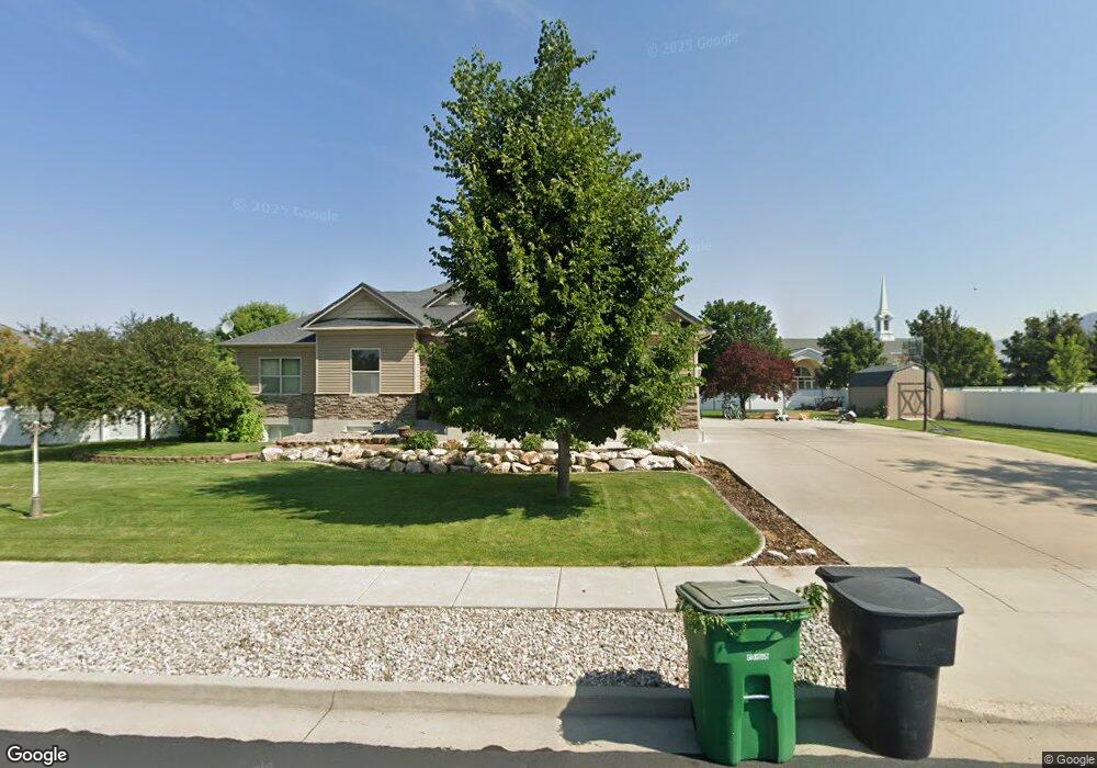
489 Sheridan Ln Nibley, UT 84321
Estimated Value: $624,000 - $731,000
5
Beds
3
Baths
3,687
Sq Ft
$180/Sq Ft
Est. Value
About This Home
This home is located at 489 Sheridan Ln, Nibley, UT 84321 and is currently estimated at $665,059, approximately $180 per square foot. 489 Sheridan Ln is a home located in Cache County with nearby schools including Heritage School, Spring Creek Middle School, and South Cache Middle School.
Ownership History
Date
Name
Owned For
Owner Type
Purchase Details
Closed on
Jul 8, 2020
Sold by
Leishman Mark D and Leishman Lisa
Bought by
Madsen Benjamin and Madsen Christy
Current Estimated Value
Home Financials for this Owner
Home Financials are based on the most recent Mortgage that was taken out on this home.
Original Mortgage
$304,500
Outstanding Balance
$269,408
Interest Rate
3.1%
Mortgage Type
New Conventional
Estimated Equity
$395,651
Purchase Details
Closed on
Jan 10, 2019
Sold by
Leishman Lisa
Bought by
Leishman Mark D and Leishman Lisa
Home Financials for this Owner
Home Financials are based on the most recent Mortgage that was taken out on this home.
Original Mortgage
$200,000
Interest Rate
4.6%
Mortgage Type
New Conventional
Create a Home Valuation Report for This Property
The Home Valuation Report is an in-depth analysis detailing your home's value as well as a comparison with similar homes in the area
Home Values in the Area
Average Home Value in this Area
Purchase History
| Date | Buyer | Sale Price | Title Company |
|---|---|---|---|
| Madsen Benjamin | -- | American Secure Title Logan | |
| Leishman Mark D | -- | American Secure Title Logan | |
| Leishman Lisa | -- | American Secure Title Logan |
Source: Public Records
Mortgage History
| Date | Status | Borrower | Loan Amount |
|---|---|---|---|
| Open | Madsen Benjamin | $304,500 | |
| Previous Owner | Leishman Lisa | $200,000 |
Source: Public Records
Tax History Compared to Growth
Tax History
| Year | Tax Paid | Tax Assessment Tax Assessment Total Assessment is a certain percentage of the fair market value that is determined by local assessors to be the total taxable value of land and additions on the property. | Land | Improvement |
|---|---|---|---|---|
| 2025 | $2,469 | $327,275 | $0 | $0 |
| 2024 | $2,613 | $325,170 | $0 | $0 |
| 2023 | $2,754 | $320,905 | $0 | $0 |
| 2022 | $2,866 | $320,905 | $0 | $0 |
| 2021 | $2,771 | $481,770 | $75,000 | $406,770 |
| 2020 | $2,750 | $455,259 | $75,000 | $380,259 |
| 2019 | $2,885 | $455,259 | $75,000 | $380,259 |
| 2018 | $2,472 | $380,660 | $50,000 | $330,660 |
| 2017 | $2,364 | $192,830 | $0 | $0 |
| 2016 | $2,391 | $162,855 | $0 | $0 |
| 2015 | $1,653 | $134,195 | $0 | $0 |
| 2014 | $1,615 | $134,195 | $0 | $0 |
| 2013 | -- | $138,870 | $0 | $0 |
Source: Public Records
Map
Nearby Homes
- 396 W 3650 S
- 268 W 3400 S Unit 5
- 187 W 3175 S
- 189 W 3175 S
- 173 W 3175 S
- 3400 S 250 W Unit 2
- 262 W 3400 S Unit 11
- 324 W 3400 S Unit 7
- 278 W 3400 S Unit 10
- 294 W 3400 S Unit 9
- 308 W 3400 S Unit 8
- 338 W 3400 S Unit 6
- 3262 S 470 W
- 191 W 3175 S Unit U629
- 191 W 3175 S
- 185 W 3175 S
- 186 W 3175 S
- 182 W 3175 S
- 1004 3410 S
- 412 W 3085 S
- 515 Sheridan Ridge Ln
- 467 Sheridan Ridge Ln
- 490 Sheridan Ridge Ln
- 3765 S 450 W
- 516 Sheridan Ridge Ln
- 535 Sheridan Ridge Ln
- 485 W 3800 S
- 465 W 3800 S Unit 44
- 3720 S 450 W
- 435 Sheridan Ridge Ln
- 536 Sheridan Ridge Ln
- 3766 S 450 W
- 3700 S 450 W
- 3786 S 450 W
- 436 W 3650 S
- 400 Sheridan Cir
- 490 W 3800 S
- 413 Sheridan Ridge Ln
- 470 W 3800 S
- 505 W 3800 S