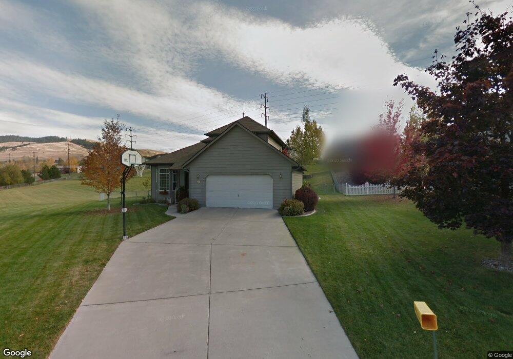
4890 Scott Allen Dr Missoula, MT 59803
Miller Creek NeighborhoodEstimated Value: $679,000 - $788,000
5
Beds
4
Baths
778
Sq Ft
$941/Sq Ft
Est. Value
About This Home
This home is located at 4890 Scott Allen Dr, Missoula, MT 59803 and is currently estimated at $732,193, approximately $941 per square foot. 4890 Scott Allen Dr is a home located in Missoula County with nearby schools including Jeannette Rankin Elementary School, Porter Middle School, and Sentinel High School.
Ownership History
Date
Name
Owned For
Owner Type
Purchase Details
Closed on
Jun 27, 2003
Sold by
Evans Richard D and Evans Diane C
Bought by
Woodward Mark and Woodward Cindi
Current Estimated Value
Home Financials for this Owner
Home Financials are based on the most recent Mortgage that was taken out on this home.
Original Mortgage
$90,000
Outstanding Balance
$38,148
Interest Rate
5.22%
Mortgage Type
Purchase Money Mortgage
Estimated Equity
$694,045
Create a Home Valuation Report for This Property
The Home Valuation Report is an in-depth analysis detailing your home's value as well as a comparison with similar homes in the area
Home Values in the Area
Average Home Value in this Area
Purchase History
| Date | Buyer | Sale Price | Title Company |
|---|---|---|---|
| Woodward Mark | -- | -- |
Source: Public Records
Mortgage History
| Date | Status | Borrower | Loan Amount |
|---|---|---|---|
| Open | Woodward Mark | $90,000 |
Source: Public Records
Tax History Compared to Growth
Tax History
| Year | Tax Paid | Tax Assessment Tax Assessment Total Assessment is a certain percentage of the fair market value that is determined by local assessors to be the total taxable value of land and additions on the property. | Land | Improvement |
|---|---|---|---|---|
| 2025 | $6,890 | $690,700 | $107,904 | $582,796 |
| 2024 | $6,526 | $572,900 | $89,940 | $482,960 |
| 2023 | $6,351 | $572,900 | $89,940 | $482,960 |
| 2022 | $5,445 | $423,400 | $0 | $0 |
| 2021 | $4,923 | $423,400 | $0 | $0 |
| 2020 | $4,951 | $390,000 | $0 | $0 |
| 2019 | $4,937 | $390,000 | $0 | $0 |
| 2018 | $4,693 | $359,600 | $0 | $0 |
| 2017 | $4,113 | $359,600 | $0 | $0 |
| 2016 | $4,008 | $327,938 | $0 | $0 |
| 2015 | $3,698 | $327,958 | $0 | $0 |
| 2014 | $3,505 | $173,840 | $0 | $0 |
Source: Public Records
Map
Nearby Homes
- 4060 Jamie Ann Ln
- 6610 Justin Ct
- 6650 Linda Vista Blvd
- 7206 Shaver Dr
- 5065 Jeff Dr
- 6994 Shaver Dr
- 7083 Shaver Dr
- 6915 Shaver Dr
- Nhn Avery Ln
- 7006 Max Dr
- 7032 Jenaya Ct
- Linda Vista Blvd Linda Vista Blvd
- 7123 Shaver Dr
- 7022 Max Dr
- 7037 Max Dr
- 7070 Max Dr
- 7055 Guinevere Dr
- 7044 Guinevere Dr
- 6250 Timothy Ct
- 4800 Jaiden Ln
- 4882 Scott Allen Dr
- 4887 Scott Allen Dr
- 4932 Christian Dr
- 4920 Christian Dr
- 4908 Christian Dr
- 4874 Scott Allen Dr
- 4879 Scott Allen Dr
- 4944 Christian Dr
- 6851 Linda Vista Blvd
- 4896 Christian Dr
- 4871 Scott Allen Dr
- 6859 Linda Vista Blvd
- 4866 Scott Allen Dr
- 6841 Linda Vista Blvd
- 4956 Christian Dr
- 6869 Linda Vista Blvd
- 4927 Christian Dr
- 7014 Alisha Dr
- 4863 Scott Allen Dr
- 4884 Christian Dr