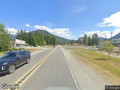
48902 State Route 530 NE Darrington, WA 98241
Estimated Value: $194,000 - $392,000
1
Bed
1
Bath
864
Sq Ft
$359/Sq Ft
Est. Value
About This Home
This home is located at 48902 State Route 530 NE, Darrington, WA 98241 and is currently estimated at $310,000, approximately $358 per square foot. 48902 State Route 530 NE is a home located in Snohomish County with nearby schools including Darrington Elementary School and Darrington High School.
Ownership History
Date
Name
Owned For
Owner Type
Purchase Details
Closed on
Mar 29, 2007
Sold by
Mcmahan Delios D and Mcmahan Loreen I
Bought by
Wright Lena Louise and Nations Rosetta Deleen
Current Estimated Value
Purchase Details
Closed on
Jan 12, 2007
Sold by
Mcmahan Delios D and Mcmahan Loreen I
Bought by
Wright Lena Louise and Nations Rosetta Deleen
Purchase Details
Closed on
Jan 27, 2006
Sold by
Mcmahan Delios D and Mcmahan Loreen I
Bought by
Wright Lena Louise and Nations Rosetta Deleen
Purchase Details
Closed on
Jan 5, 2005
Sold by
Mcmahan Delios D and Mcmahan Loreen I
Bought by
Wright Lena Louise and Nations Rosetta Deleen
Purchase Details
Closed on
Dec 17, 2004
Sold by
Mcmahan Delios D and Mcmahan Loreen I
Bought by
Wright Lena Louise and Nations Rosetta Deleen
Create a Home Valuation Report for This Property
The Home Valuation Report is an in-depth analysis detailing your home's value as well as a comparison with similar homes in the area
Home Values in the Area
Average Home Value in this Area
Purchase History
| Date | Buyer | Sale Price | Title Company |
|---|---|---|---|
| Wright Lena Louise | -- | None Available | |
| Wright Lena Louise | -- | None Available | |
| Wright Lena Louise | -- | None Available | |
| Wright Lena Louise | -- | -- | |
| Wright Lena Louise | -- | -- |
Source: Public Records
Tax History Compared to Growth
Tax History
| Year | Tax Paid | Tax Assessment Tax Assessment Total Assessment is a certain percentage of the fair market value that is determined by local assessors to be the total taxable value of land and additions on the property. | Land | Improvement |
|---|---|---|---|---|
| 2025 | $1,876 | $289,000 | $253,000 | $36,000 |
| 2024 | $1,876 | $239,000 | $203,000 | $36,000 |
| 2023 | $1,844 | $237,400 | $200,000 | $37,400 |
| 2022 | $1,585 | $175,300 | $140,000 | $35,300 |
| 2020 | $1,572 | $154,800 | $117,500 | $37,300 |
| 2019 | $1,434 | $139,400 | $102,500 | $36,900 |
| 2018 | $1,538 | $118,300 | $81,800 | $36,500 |
| 2017 | $1,402 | $109,100 | $65,000 | $44,100 |
| 2016 | $1,337 | $95,200 | $51,500 | $43,700 |
| 2015 | $1,437 | $101,500 | $50,000 | $51,500 |
| 2013 | $663 | $46,700 | $15,000 | $31,700 |
Source: Public Records
Map
Nearby Homes
- 49729 Sauk Prairie Rd
- 55109 E Sauk Ln
- 462 Xx Giles Rd
- 46529 Giles Rd
- 46228 Giles Rd
- 22750 Washington 530
- 925 Montague Ave
- 930 Sauk Ave
- 730 S Emens Ave
- 609 Clear Creek Rd
- 720 Givens Ave
- 0 XXX S Emens Ave
- 1185 Riddle St
- 1095 Darrington St
- 0 Darrington St
- 6 Stillaguamish
- 1035 Darrington St
- 1025 Darrington St
- 1170 Darrington St
- 665 Commercial Ave
- 48902 State Route 530 NE
- 48902 State Route 530 NE
- 48902 State Route 530 NE
- 49120 State Route 530 NE
- 49124 State Route 530 NE
- 48516 State Route 530 NE
- 49610 Estes Rd
- 32121 49th Dr NE
- 32327 494th Dr NE
- 32409 494th Dr NE
- 32800 State Route 530 NE
- 32819 State Route 530 NE
- 49516 State Route 530 NE
- 49430 State Route 530 NE
- 49526 State Route 530 NE
- 30726 Sauk Prairie Rd
- 49525 State Route 530 NE
- 49525 State Route 530 NE
- 49121 Sauk Prairie Rd
- 54230 Fortner Rd
