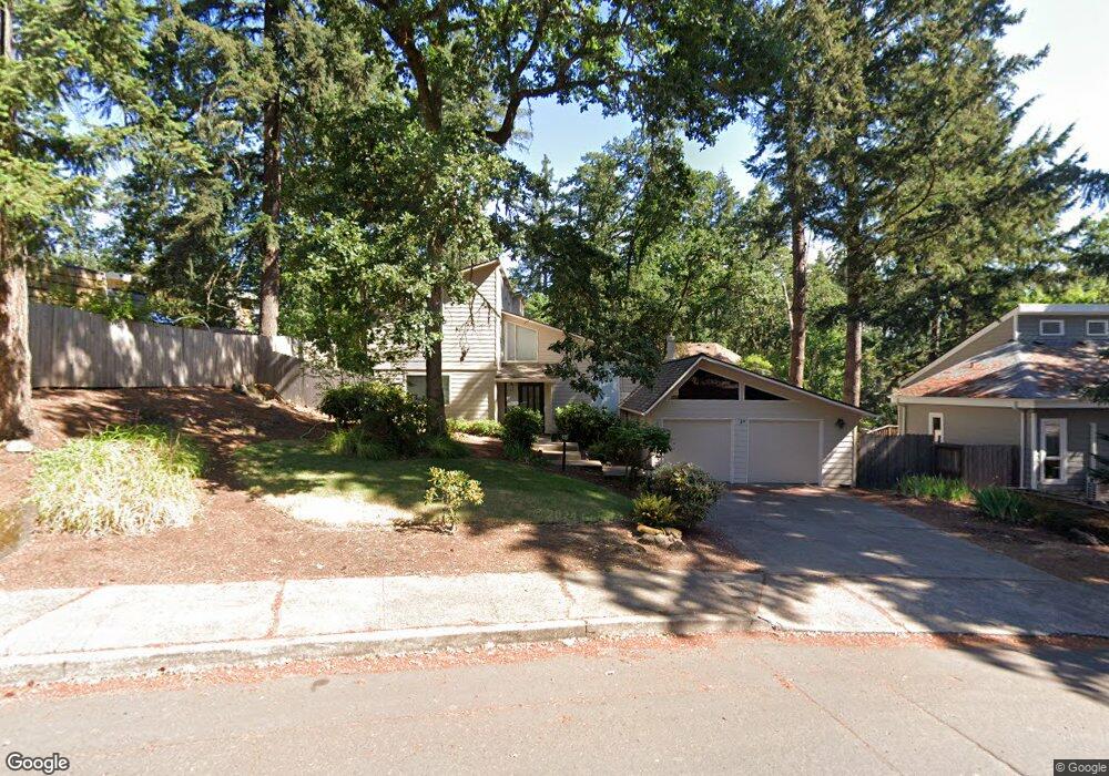
4895 Mahalo Dr Eugene, OR 97405
Southeast Eugene NeighborhoodEstimated Value: $590,907 - $636,000
4
Beds
3
Baths
2,043
Sq Ft
$298/Sq Ft
Est. Value
About This Home
This home is located at 4895 Mahalo Dr, Eugene, OR 97405 and is currently estimated at $608,227, approximately $297 per square foot. 4895 Mahalo Dr is a home located in Lane County with nearby schools including Edgewood Community Elementary School, Spencer Butte Middle School, and South Eugene High School.
Ownership History
Date
Name
Owned For
Owner Type
Purchase Details
Closed on
Jul 2, 2024
Sold by
Hall Gordon C N and Hall Jeanne M
Bought by
Gordon And Jeanne Hall Living Trust and Hall
Current Estimated Value
Purchase Details
Closed on
Sep 16, 2009
Sold by
Rawles Robert N and Rawles Laura C
Bought by
Hall Gordon C N and Hall Jeanne M N
Home Financials for this Owner
Home Financials are based on the most recent Mortgage that was taken out on this home.
Original Mortgage
$165,000
Interest Rate
5.18%
Mortgage Type
New Conventional
Purchase Details
Closed on
Oct 17, 2001
Sold by
Boutin K James and Boutin Janice A
Bought by
Rawles Robert N and Bonini Laura C
Home Financials for this Owner
Home Financials are based on the most recent Mortgage that was taken out on this home.
Original Mortgage
$159,200
Interest Rate
6.88%
Create a Home Valuation Report for This Property
The Home Valuation Report is an in-depth analysis detailing your home's value as well as a comparison with similar homes in the area
Home Values in the Area
Average Home Value in this Area
Purchase History
| Date | Buyer | Sale Price | Title Company |
|---|---|---|---|
| Gordon And Jeanne Hall Living Trust | -- | None Listed On Document | |
| Hall Gordon C N | $310,000 | First American Title | |
| Rawles Robert N | $199,000 | Western Pioneer Title Co |
Source: Public Records
Mortgage History
| Date | Status | Borrower | Loan Amount |
|---|---|---|---|
| Previous Owner | Hall Gordon C N | $165,000 | |
| Previous Owner | Rawles Robert N | $159,200 |
Source: Public Records
Tax History Compared to Growth
Tax History
| Year | Tax Paid | Tax Assessment Tax Assessment Total Assessment is a certain percentage of the fair market value that is determined by local assessors to be the total taxable value of land and additions on the property. | Land | Improvement |
|---|---|---|---|---|
| 2025 | $6,205 | $318,445 | -- | -- |
| 2024 | $6,127 | $309,170 | -- | -- |
| 2023 | $6,127 | $300,166 | $0 | $0 |
| 2022 | $5,740 | $291,424 | $0 | $0 |
| 2021 | $5,392 | $282,936 | $0 | $0 |
| 2020 | $5,411 | $274,696 | $0 | $0 |
| 2019 | $5,222 | $266,696 | $0 | $0 |
| 2018 | $4,901 | $251,387 | $0 | $0 |
| 2017 | $4,595 | $251,387 | $0 | $0 |
| 2016 | $4,414 | $244,065 | $0 | $0 |
| 2015 | $4,297 | $236,956 | $0 | $0 |
| 2014 | $4,231 | $230,054 | $0 | $0 |
Source: Public Records
Map
Nearby Homes
- 4856 Mahalo Dr
- 4695 Fox Hollow Rd
- 4574 Manzanita St
- 645 Kingswood Ave
- 4845 Brookwood St
- 830 Larch St
- 4815 Brookwood St
- 5120 Talisman St
- 4495 Pinecrest Dr
- 5075 Saratoga St
- 4441 Fox Hollow Rd Unit 4
- 5115 Nectar Way
- 5369 Donald St
- 895 Pine Forest Dr
- 4273 E Amazon Dr
- 4364 Fox Hollow Rd
- 947 Hiwan Ct
- 910 E 43rd Ave
- 296 Woodridge Dr
- 4117 E Amazon Dr
- 4918 Mahalo Dr
- 4910 Mahalo Dr
- 4881 Mahalo Dr
- 4762 Manzanita St
- 710 Foothill Dr
- 4890 Mahalo Dr
- 4752 Manzanita St
- 4865 Mahalo Dr
- 4878 Mahalo Dr
- 4924 Mahalo Dr
- 714 Foothill Dr
- 4960 Mahalo Dr
- 4868 Mahalo Dr
- 708 Foothill Dr
- 4748 Manzanita St
- 4936 Mahalo Dr
- 4845 Mahalo Dr
- 716 Foothill Dr
- 4948 Mahalo Dr
- 706 Foothill Dr