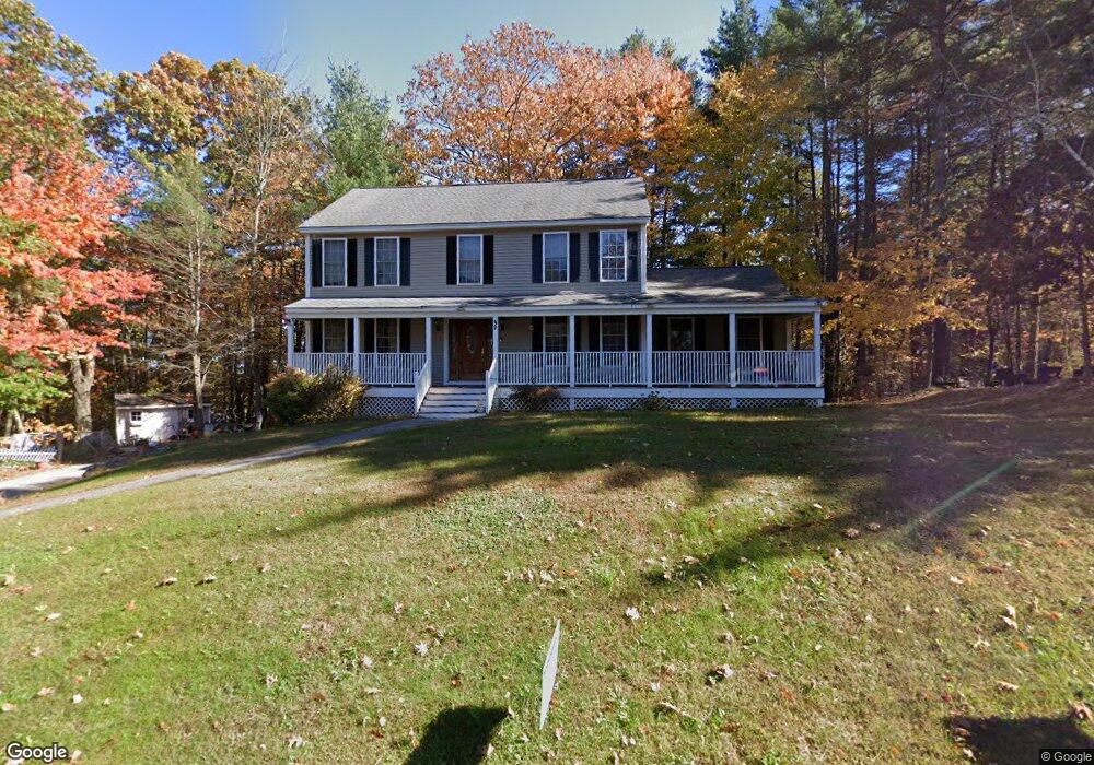
49 Autumn Run Hooksett, NH 03106
Estimated Value: $693,000 - $726,000
4
Beds
3
Baths
2,805
Sq Ft
$252/Sq Ft
Est. Value
About This Home
This home is located at 49 Autumn Run, Hooksett, NH 03106 and is currently estimated at $707,795, approximately $252 per square foot. 49 Autumn Run is a home located in Merrimack County with nearby schools including Fred C. Underhill School, Hooksett Memorial School, and David R. Cawley Middle School.
Ownership History
Date
Name
Owned For
Owner Type
Purchase Details
Closed on
Aug 23, 2007
Sold by
Wright Lonnie G and Wright Patti L
Bought by
Tahoun Ahmed and Tahoun Magda
Current Estimated Value
Home Financials for this Owner
Home Financials are based on the most recent Mortgage that was taken out on this home.
Original Mortgage
$323,000
Interest Rate
6.78%
Mortgage Type
Purchase Money Mortgage
Purchase Details
Closed on
Jun 18, 2001
Sold by
Barrington John R and Barrington Nicole A
Bought by
Wright Lonnie G and Wright Patti L
Home Financials for this Owner
Home Financials are based on the most recent Mortgage that was taken out on this home.
Original Mortgage
$239,400
Interest Rate
7.15%
Mortgage Type
Purchase Money Mortgage
Purchase Details
Closed on
Nov 1, 1999
Sold by
Advanced Contr Corp
Bought by
Barrington John R and Barrington Nicole A
Create a Home Valuation Report for This Property
The Home Valuation Report is an in-depth analysis detailing your home's value as well as a comparison with similar homes in the area
Home Values in the Area
Average Home Value in this Area
Purchase History
| Date | Buyer | Sale Price | Title Company |
|---|---|---|---|
| Tahoun Ahmed | $340,000 | -- | |
| Wright Lonnie G | $252,000 | -- | |
| Barrington John R | $65,000 | -- |
Source: Public Records
Mortgage History
| Date | Status | Borrower | Loan Amount |
|---|---|---|---|
| Open | Barrington John R | $323,000 | |
| Closed | Barrington John R | $323,000 | |
| Previous Owner | Barrington John R | $239,400 |
Source: Public Records
Tax History
| Year | Tax Paid | Tax Assessment Tax Assessment Total Assessment is a certain percentage of the fair market value that is determined by local assessors to be the total taxable value of land and additions on the property. | Land | Improvement |
|---|---|---|---|---|
| 2024 | $10,600 | $625,000 | $160,800 | $464,200 |
| 2023 | $9,988 | $625,000 | $160,800 | $464,200 |
| 2022 | $8,442 | $351,000 | $104,100 | $246,900 |
| 2021 | $7,799 | $351,000 | $104,100 | $246,900 |
| 2020 | $7,901 | $351,000 | $104,100 | $246,900 |
| 2019 | $7,564 | $351,000 | $104,100 | $246,900 |
| 2018 | $7,764 | $351,000 | $104,100 | $246,900 |
| 2017 | $7,645 | $285,900 | $101,400 | $184,500 |
| 2016 | $7,545 | $285,900 | $101,400 | $184,500 |
| 2015 | $4,749 | $285,900 | $101,400 | $184,500 |
Source: Public Records
Map
Nearby Homes
- 192 Londonderry Turnpike
- 36 Prescott Heights Rd
- 15 Joanne Dr
- 13 Johns Dr
- 267 Londonderry Turnpike
- 41 Golden Gate Dr
- 1095 1097 1099 Hooksett Rd Unit 73, 74, 75
- 1099 Hooksett Rd Unit 73
- 286 Londonderry Turnpike Unit A
- 1097 Hooksett Rd Unit 74
- 1095 Hooksett Rd
- 286B Londonderry Turnpike Unit A
- 191 Brookview Dr
- 6 Golden Gate Dr
- 14 Overlook Cir
- 146 Brookview Dr
- 10 Harvard Ave
- 9 Lancelot Dr
- 9 Berry Hill Rd
- 135 Brookview Dr
Your Personal Tour Guide
Ask me questions while you tour the home.